Pricing Guides & Dictionary of Makers Marks for Antiques & Collectibles
Appraise and find values for
3 early maps, Plan of the City of...
From
marks4antiques.com
- The most updated price guide and makers' marks research online
As a member, you have access to a team of experts
and assistance is always available to you for free
An example from the millions of items in our Price Guide:
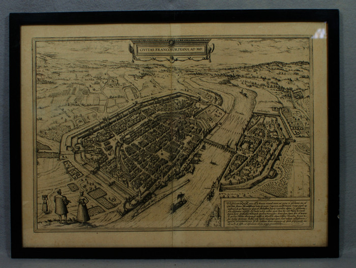
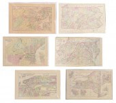
3 early maps, Plan of the City of Copenhagen, Plan of the Canal of Kiel, T Cadell, London, 1784, Braun & Hogenberg, Civitas Francofordiana Ad Mo, Cologne...
This is an example from our
values4antiques price guide
We do not buy or sell any items
See more price guides
Check our other research services:
IDENTIFY WORLDWIDE MAKERS' MARKS & HALLMARKS
marks4ceramics:
Porcelain, Pottery, Chinaware, Figurines, Dolls, Vases...
marks4silver
:
Silver, Jewelry, Pewter, Silverplate, Copper & Bronze...
Explore other items from our
Antiques & Collectibles Price Guide
-
 A Very Large Collection of Maps, 19th/e
[more like this]
A Very Large Collection of Maps, 19th/e
[more like this]
-
 Jacques Tanesse (New Orleans) "Plan of t
[more like this]
Jacques Tanesse (New Orleans) "Plan of t
[more like this]
-
 8 TENNESSEE MILITARY & SURVEY MAPSAssort
[more like this]
8 TENNESSEE MILITARY & SURVEY MAPSAssort
[more like this]
-
 MAPS: JOHN SPEED (ENGLAND, 1552-1629), T
[more like this]
MAPS: JOHN SPEED (ENGLAND, 1552-1629), T
[more like this]
-
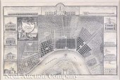
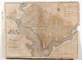 Rare early maps: Washington D.C. PLAN OF
[more like this]
Rare early maps: Washington D.C. PLAN OF
[more like this]
-
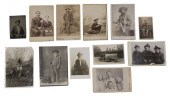 Photographic Archive of Miles City Monta
[more like this]
Photographic Archive of Miles City Monta
[more like this]
-
 (6) MITCHELL & BRADLEY ATLAS MAPS NEW YO
[more like this]
(6) MITCHELL & BRADLEY ATLAS MAPS NEW YO
[more like this]
-
 MAP: "GETTYSBURG BATTLE-FIELD", BY JOHN
[more like this]
MAP: "GETTYSBURG BATTLE-FIELD", BY JOHN
[more like this]
-
 HENRY MOUZON - MAP OF NORTH AND SOUTH CA
[more like this]
HENRY MOUZON - MAP OF NORTH AND SOUTH CA
[more like this]
-
 A LATE MEXICAN-AMERICAN WAR ERA MAP, "MA
[more like this]
A LATE MEXICAN-AMERICAN WAR ERA MAP, "MA
[more like this]
-
 1 vol. (Philadelphia Atlas.) Smedley, S
[more like this]
1 vol. (Philadelphia Atlas.) Smedley, S
[more like this]
-
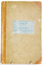 Rare Book: Atlas to Marshall's Life of W
[more like this]
Rare Book: Atlas to Marshall's Life of W
[more like this]
-
 2 FRAMED 18TH C. FADEN MAPS - GREECE & D
[more like this]
2 FRAMED 18TH C. FADEN MAPS - GREECE & D
[more like this]
-
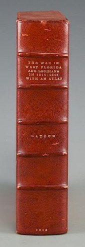 LATOUR WAR IN WEST FLORIDA LA 1814-1815,
[more like this]
LATOUR WAR IN WEST FLORIDA LA 1814-1815,
[more like this]
-
 4 vols. (Pennsylvania Property Atlases
[more like this]
4 vols. (Pennsylvania Property Atlases
[more like this]
-
 DU HALDE, Jean-Baptiste, (French, 1674-1
[more like this]
DU HALDE, Jean-Baptiste, (French, 1674-1
[more like this]
-
 MITCHELL. A NEW UNIVERSAL ATLAS CONTAINI
[more like this]
MITCHELL. A NEW UNIVERSAL ATLAS CONTAINI
[more like this]
-
 AN ANTIQUE MAP, "CARTE DES VARIATIONS DE
[more like this]
AN ANTIQUE MAP, "CARTE DES VARIATIONS DE
[more like this]
-
 2 vols. (Philadelphia Property Atlases.
[more like this]
2 vols. (Philadelphia Property Atlases.
[more like this]
-
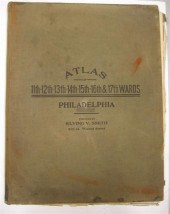
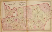
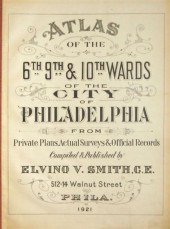 4 vols. Philadelphia Ward Atlases. Elvi
[more like this]
4 vols. Philadelphia Ward Atlases. Elvi
[more like this]
-
 Historic Guthrie Oklahoma/Chickamauga Pr
[more like this]
Historic Guthrie Oklahoma/Chickamauga Pr
[more like this]
-
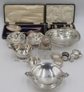 SILVER. ASSORTED GROUPING OF ENGLISH SIL
[more like this]
SILVER. ASSORTED GROUPING OF ENGLISH SIL
[more like this]
-
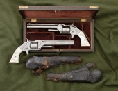 Pair of Nimschke-Style Engraved Smith &
[more like this]
Pair of Nimschke-Style Engraved Smith &
[more like this]
-
 A Large Collection of Maps of America,
[more like this]
A Large Collection of Maps of America,
[more like this]
-
 6 MISSISSIPPI AND TENNESSEE RIVER MAPSSi
[more like this]
6 MISSISSIPPI AND TENNESSEE RIVER MAPSSi
[more like this]
-
 (5) TEXAS MAPS, 1850'S<br>(lot of 5
[more like this]
(5) TEXAS MAPS, 1850'S<br>(lot of 5
[more like this]
-
 4 vols. (Philadelphia Property Atlases)
[more like this]
4 vols. (Philadelphia Property Atlases)
[more like this]
-
 3 vols. Philadelphia Atlases. Germanto
[more like this]
3 vols. Philadelphia Atlases. Germanto
[more like this]
-
 7 vols. Cartography - American Subjects
[more like this]
7 vols. Cartography - American Subjects
[more like this]
-
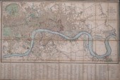 WYLD'S NEW PLAN OF LONDON AND WESTMINSTE
[more like this]
WYLD'S NEW PLAN OF LONDON AND WESTMINSTE
[more like this]
-
 Charles Hook Armco Steel Company Lot of
[more like this]
Charles Hook Armco Steel Company Lot of
[more like this]
-
 WILLIAM WINTERBOTHAM. AN HISTORICAL, GEO
[more like this]
WILLIAM WINTERBOTHAM. AN HISTORICAL, GEO
[more like this]
-
 7 vols. Cartography: Brown, Lloyd A. Th
[more like this]
7 vols. Cartography: Brown, Lloyd A. Th
[more like this]
-
 1782 Thomas Kitchen atlas, A General Atl
[more like this]
1782 Thomas Kitchen atlas, A General Atl
[more like this]
-
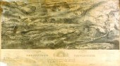
 Military Maps Illustrating the Operation
[more like this]
Military Maps Illustrating the Operation
[more like this]
-
 THE LIFE OF GEORGE WASHINGTON, BY JOHN M
[more like this]
THE LIFE OF GEORGE WASHINGTON, BY JOHN M
[more like this]
This list is limited to only a few results.
Many more items are available to our members in our
Price Guide!
Ideal research tools for Collectors, Personal Property Appraisers, Antiques & Collectibles
Dealers, Auction Houses, Museums, eBayers or
other online
sellers (Rubylane, Etsy etc) and curious minds interested in appraising & identifying collectibles

EASY. FAST. ACCURATE.
Research at its best

Our research tools include:


