Pricing Guides & Dictionary of Makers Marks for Antiques & Collectibles
Appraise and find values for
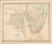
MAPS OF SAVANNAH/CHARLESTON &...
From
marks4antiques.com
- The most updated price guide and makers' marks research online
As a member, you have access to a team of experts
and assistance is always available to you for free
An example from the millions of items in our Price Guide:
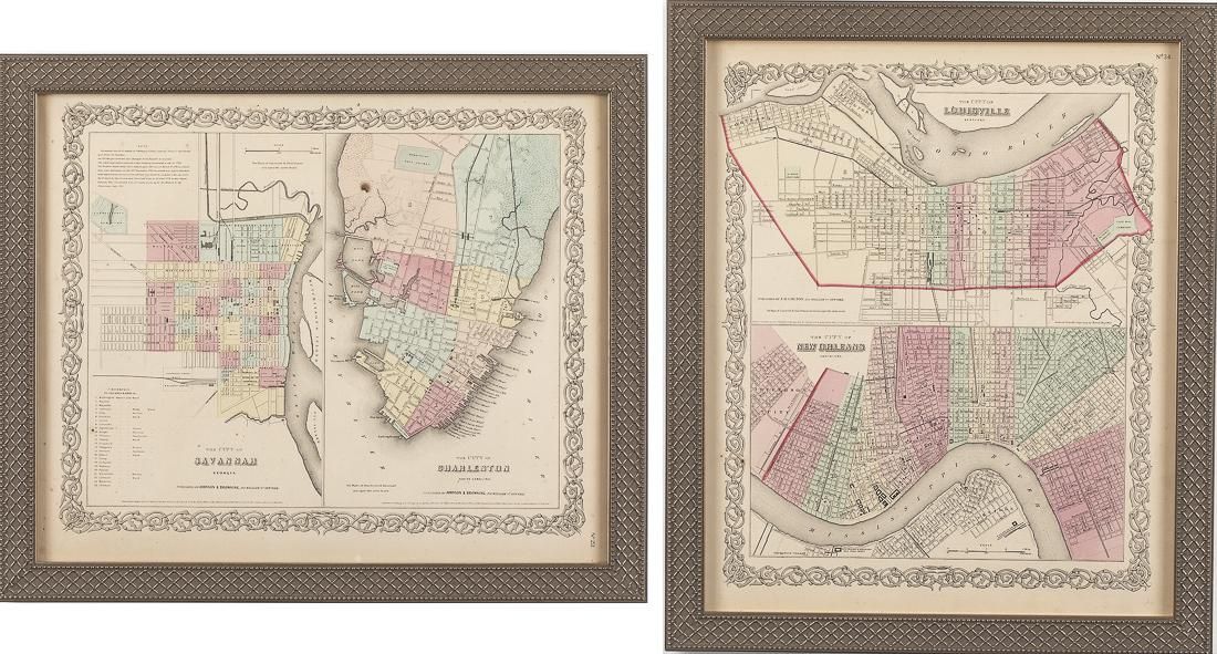
MAPS OF SAVANNAH/CHARLESTON & LOUISVILLE/NEW ORLEANSProperty of a Private Collector 2 Maps, One Savannah/Charleston, the Other Louisville/New Orleans, 19th...
This is an example from our
values4antiques price guide
We do not buy or sell any items
See more price guides
Check our other research services:
IDENTIFY WORLDWIDE MAKERS' MARKS & HALLMARKS
marks4ceramics:
Porcelain, Pottery, Chinaware, Figurines, Dolls, Vases...
marks4silver
:
Silver, Jewelry, Pewter, Silverplate, Copper & Bronze...
Explore other items from our
Antiques & Collectibles Price Guide
-
 Maps and Views: Civil War Charleston Sou
[more like this]
Maps and Views: Civil War Charleston Sou
[more like this]
-
 Rare early maps of Charleston South Caro
[more like this]
Rare early maps of Charleston South Caro
[more like this]
-
 A Very Large Collection of Maps, 19th/e
[more like this]
A Very Large Collection of Maps, 19th/e
[more like this]
-
 Books on the Battle of Fort Pulaski and
[more like this]
Books on the Battle of Fort Pulaski and
[more like this]
-
 COLTON'S MAPS OF SAVANNAH AND CHARL
[more like this]
COLTON'S MAPS OF SAVANNAH AND CHARL
[more like this]
-
 John James Trumbull Arnold Pennsylvania
[more like this]
John James Trumbull Arnold Pennsylvania
[more like this]
-
 New York Classical mahogany secretary bo
[more like this]
New York Classical mahogany secretary bo
[more like this]
-
 EDWIN AUGUSTUS HARLESTON(American/South
[more like this]
EDWIN AUGUSTUS HARLESTON(American/South
[more like this]
-
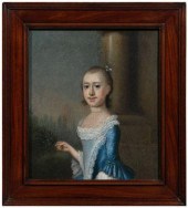
 Charles Fraser South Carolina (1782-1860
[more like this]
Charles Fraser South Carolina (1782-1860
[more like this]
-
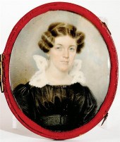
 Important Jeremiah Theus portrait (Swiss
[more like this]
Important Jeremiah Theus portrait (Swiss
[more like this]
-
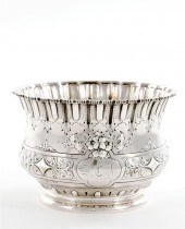 Southern sterling bowl W. G. Whilden & C
[more like this]
Southern sterling bowl W. G. Whilden & C
[more like this]
-
 HENRY MOUZON - MAP OF NORTH AND SOUTH CA
[more like this]
HENRY MOUZON - MAP OF NORTH AND SOUTH CA
[more like this]
-
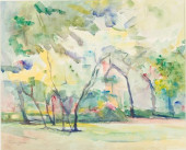 MYRTLE JONES (SAVANNAH, 1913-2005), TREE
[more like this]
MYRTLE JONES (SAVANNAH, 1913-2005), TREE
[more like this]
-
 4 vols. (Pennsylvania Property Atlases
[more like this]
4 vols. (Pennsylvania Property Atlases
[more like this]
-
 1 vol. (Philadelphia Atlas.) Smedley, S
[more like this]
1 vol. (Philadelphia Atlas.) Smedley, S
[more like this]
-
 DU HALDE, Jean-Baptiste, (French, 1674-1
[more like this]
DU HALDE, Jean-Baptiste, (French, 1674-1
[more like this]
-
 MITCHELL. A NEW UNIVERSAL ATLAS CONTAINI
[more like this]
MITCHELL. A NEW UNIVERSAL ATLAS CONTAINI
[more like this]
-
 2 FRAMED 18TH C. FADEN MAPS - GREECE & D
[more like this]
2 FRAMED 18TH C. FADEN MAPS - GREECE & D
[more like this]
-
 AN ANTIQUE MAP, "CARTE DES VARIATIONS DE
[more like this]
AN ANTIQUE MAP, "CARTE DES VARIATIONS DE
[more like this]
-
 Ten pieces Charleston coin silver: two J
[more like this]
Ten pieces Charleston coin silver: two J
[more like this]
-
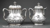 A Charleston Coin Silver Presentation Cr
[more like this]
A Charleston Coin Silver Presentation Cr
[more like this]
-
![[Civil War - Manuscripts] Civi](/images/civil-war-manuscripts-civil--15efed-medium.jpg) [Civil War - Manuscripts] Civil War Sold
[more like this]
[Civil War - Manuscripts] Civil War Sold
[more like this]
-
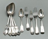
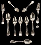 29 PCS. SAVANNAH, GEORGIA SILVER FLATWAR
[more like this]
29 PCS. SAVANNAH, GEORGIA SILVER FLATWAR
[more like this]
-
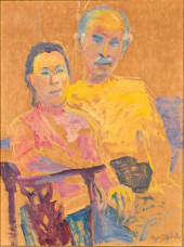 MYRTLE JONES, SELF-PORTRAIT W/ HUSBAND,
[more like this]
MYRTLE JONES, SELF-PORTRAIT W/ HUSBAND,
[more like this]
-
 CHRISTOPHER MURPHY JR, HERMITAGE PLANTAT
[more like this]
CHRISTOPHER MURPHY JR, HERMITAGE PLANTAT
[more like this]
-
 Augusta Denk Oelschig (Petressen) (Ameri
[more like this]
Augusta Denk Oelschig (Petressen) (Ameri
[more like this]
-
 A Large Collection of Maps of America,
[more like this]
A Large Collection of Maps of America,
[more like this]
-
 2 vols. (Philadelphia Property Atlases.
[more like this]
2 vols. (Philadelphia Property Atlases.
[more like this]
-
 7 vols. Cartography: Brown, Lloyd A. Th
[more like this]
7 vols. Cartography: Brown, Lloyd A. Th
[more like this]
-
 7 vols. Cartography - American Subjects
[more like this]
7 vols. Cartography - American Subjects
[more like this]
-
 1782 Thomas Kitchen atlas, A General Atl
[more like this]
1782 Thomas Kitchen atlas, A General Atl
[more like this]
-
 Military Maps Illustrating the Operation
[more like this]
Military Maps Illustrating the Operation
[more like this]
-
 THE LIFE OF GEORGE WASHINGTON, BY JOHN M
[more like this]
THE LIFE OF GEORGE WASHINGTON, BY JOHN M
[more like this]
-
 MAPS: JOHN SPEED (ENGLAND, 1552-1629), T
[more like this]
MAPS: JOHN SPEED (ENGLAND, 1552-1629), T
[more like this]
-
 6 MISSISSIPPI AND TENNESSEE RIVER MAPSSi
[more like this]
6 MISSISSIPPI AND TENNESSEE RIVER MAPSSi
[more like this]
-
 8 TENNESSEE MILITARY & SURVEY MAPSAssort
[more like this]
8 TENNESSEE MILITARY & SURVEY MAPSAssort
[more like this]
This list is limited to only a few results.
Many more items are available to our members in our
Price Guide!
Ideal research tools for Collectors, Personal Property Appraisers, Antiques & Collectibles
Dealers, Auction Houses, Museums, eBayers or
other online
sellers (Rubylane, Etsy etc) and curious minds interested in appraising & identifying collectibles

EASY. FAST. ACCURATE.
Research at its best

Our research tools include:


