Pricing Guides & Dictionary of Makers Marks for Antiques & Collectibles
Appraise and find values for
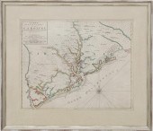
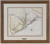
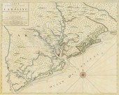
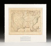
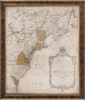
MORTIER - CARTE PARTICULIERE DE...
From
marks4antiques.com
- The most updated price guide and makers' marks research online
As a member, you have access to a team of experts
and assistance is always available to you for free
An example from the millions of items in our Price Guide:
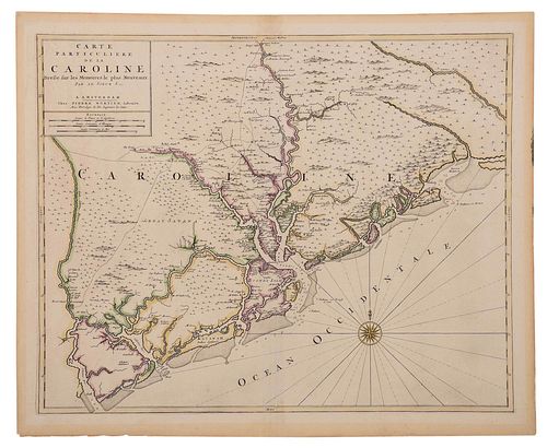
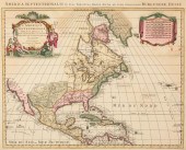
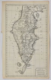
MORTIER - CARTE PARTICULIERE DE LA CAROLINEPierre Mortier (Dutch, 1661-1711), Carte Particuliere de la Caroline: dresse sur les memoires le plus nouveaux...
This is an example from our
values4antiques price guide
We do not buy or sell any items
See more price guides
Check our other research services:
IDENTIFY WORLDWIDE MAKERS' MARKS & HALLMARKS
marks4ceramics:
Porcelain, Pottery, Chinaware, Figurines, Dolls, Vases...
marks4silver
:
Silver, Jewelry, Pewter, Silverplate, Copper & Bronze...
Explore other items from our
Antiques & Collectibles Price Guide
-
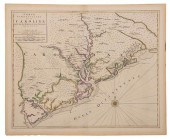 MORTIER - CARTE PARTICULIERE DE LA CAROL
[more like this]
MORTIER - CARTE PARTICULIERE DE LA CAROL
[more like this]
-
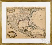
 AN ANTIQUE MAP, "CARTE PARTICULIèRE DE I
[more like this]
AN ANTIQUE MAP, "CARTE PARTICULIèRE DE I
[more like this]
-
 AN ANTIQUE MAP, "CARTE PARTICULIèRE DE I
[more like this]
AN ANTIQUE MAP, "CARTE PARTICULIèRE DE I
[more like this]
-
 [Political Americana - Lincolniana] Abra
[more like this]
[Political Americana - Lincolniana] Abra
[more like this]
-
 Rare early map of South Carolina by Pier
[more like this]
Rare early map of South Carolina by Pier
[more like this]
-
 PIERRE MORTIER - MAP OF SOUTH CAROLINAPi
[more like this]
PIERRE MORTIER - MAP OF SOUTH CAROLINAPi
[more like this]
-
 JOHANNES L. VAN LUCHTENBURG (1685-1711)
[more like this]
JOHANNES L. VAN LUCHTENBURG (1685-1711)
[more like this]
-
 COVENS AND MORTIER, CARTE DES INDES ET D
[more like this]
COVENS AND MORTIER, CARTE DES INDES ET D
[more like this]
-
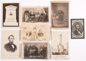
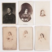
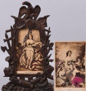
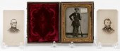 CASED TIN TYPE AND TWO CARTE DE VISITES
[more like this]
CASED TIN TYPE AND TWO CARTE DE VISITES
[more like this]
-
 BLAEU, MORTIER, VISSCHER - THREE MAPS OF
[more like this]
BLAEU, MORTIER, VISSCHER - THREE MAPS OF
[more like this]
-
 IMPORTANT EARLY SOUTH CAROLINA MAP 1696P
[more like this]
IMPORTANT EARLY SOUTH CAROLINA MAP 1696P
[more like this]
-
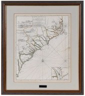 PIERRE MORTIER - MAP OF THE CAROLINAS, 1
[more like this]
PIERRE MORTIER - MAP OF THE CAROLINAS, 1
[more like this]
-
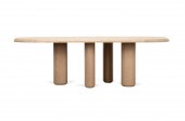 COLLECTION PARTICULIERE LARGE OAK DINING
[more like this]
COLLECTION PARTICULIERE LARGE OAK DINING
[more like this]
-
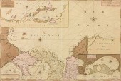
 AN ANTIQUE MAP, "CARTE DE LA LOUISIANE E
[more like this]
AN ANTIQUE MAP, "CARTE DE LA LOUISIANE E
[more like this]
-
 PIETER MORTIER (AFTER), PAIR LARGE ENGRA
[more like this]
PIETER MORTIER (AFTER), PAIR LARGE ENGRA
[more like this]
-
 COVENS & MORTIER COLOR ENGRAVED MAPCoven
[more like this]
COVENS & MORTIER COLOR ENGRAVED MAPCoven
[more like this]
-
 PIETER COVENS AND CORNELIU MORTIER, C. 1
[more like this]
PIETER COVENS AND CORNELIU MORTIER, C. 1
[more like this]
-
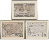
 MAPS OF THE OTTOMAN EMPIRE BY DE WITT AN
[more like this]
MAPS OF THE OTTOMAN EMPIRE BY DE WITT AN
[more like this]
-
 PIERRE MORTIER, CARTOGRAPHER, AVENIO VUL
[more like this]
PIERRE MORTIER, CARTOGRAPHER, AVENIO VUL
[more like this]
-
 DRESDEN CARL THIEME, EDOUARD MORTIER (NA
[more like this]
DRESDEN CARL THIEME, EDOUARD MORTIER (NA
[more like this]
-
 SIXTEEN ANTIQUE MAPSSixteen Antique Maps
[more like this]
SIXTEEN ANTIQUE MAPSSixteen Antique Maps
[more like this]
-
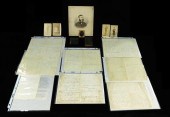
 Five Richard Kidder Meade, Jr. Confedera
[more like this]
Five Richard Kidder Meade, Jr. Confedera
[more like this]
-
 [Political Americana - Lincolniana] Mary
[more like this]
[Political Americana - Lincolniana] Mary
[more like this]
-
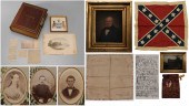
 CIVIL WAR: MANUSCRIPTS, PHOTOGRAPHS, AND
[more like this]
CIVIL WAR: MANUSCRIPTS, PHOTOGRAPHS, AND
[more like this]
-
 EMANCIPATION AND PEACE CARTE-DE-VISITE,
[more like this]
EMANCIPATION AND PEACE CARTE-DE-VISITE,
[more like this]
-
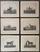 CARLE VERNET AND CHARLES LEVACHEX (FRENC
[more like this]
CARLE VERNET AND CHARLES LEVACHEX (FRENC
[more like this]
-
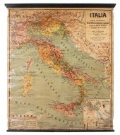
 HAND-COLORED MAP OF NORTH AMERICA "CARTE
[more like this]
HAND-COLORED MAP OF NORTH AMERICA "CARTE
[more like this]
-
 FOUR GUILLAUME DELISLE ENGRAVED MAPS 18T
[more like this]
FOUR GUILLAUME DELISLE ENGRAVED MAPS 18T
[more like this]
-
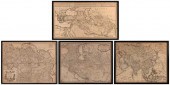
 GRP: 7 MAPS OF RUSSIA AND EUROPEGroup of
[more like this]
GRP: 7 MAPS OF RUSSIA AND EUROPEGroup of
[more like this]
-
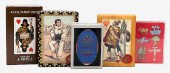 FIVE PACKS OF PLAYING CARDS.Five Packs o
[more like this]
FIVE PACKS OF PLAYING CARDS.Five Packs o
[more like this]
-
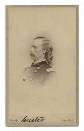 AUTOGRAPHED CARTE-DE-VISITE OF GEORGE AR
[more like this]
AUTOGRAPHED CARTE-DE-VISITE OF GEORGE AR
[more like this]
-
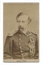 CARTE DE VISITE OF GEORGE ARMSTRONG CUST
[more like this]
CARTE DE VISITE OF GEORGE ARMSTRONG CUST
[more like this]
-
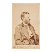 SIGNED ULYSSES S. GRANT CARTE DE VISITE<
[more like this]
SIGNED ULYSSES S. GRANT CARTE DE VISITE<
[more like this]
-
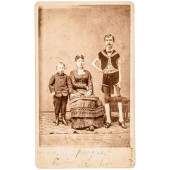 C 1878 CARTE DE VISITE WITH P.T. BARNUMS
[more like this]
C 1878 CARTE DE VISITE WITH P.T. BARNUMS
[more like this]
-
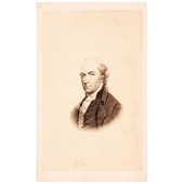 C. 1850 ALEXANDER HAMILTON PORTRAIT ENGR
[more like this]
C. 1850 ALEXANDER HAMILTON PORTRAIT ENGR
[more like this]
-
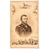 C. 1863 PATRIOTIC CIVIL WAR CARTE DE VIS
[more like this]
C. 1863 PATRIOTIC CIVIL WAR CARTE DE VIS
[more like this]
This list is limited to only a few results.
Many more items are available to our members in our
Price Guide!
Ideal research tools for Collectors, Personal Property Appraisers, Antiques & Collectibles
Dealers, Auction Houses, Museums, eBayers or
other online
sellers (Rubylane, Etsy etc) and curious minds interested in appraising & identifying collectibles

EASY. FAST. ACCURATE.
Research at its best

Our research tools include:


