Pricing Guides & Dictionary of Makers Marks for Antiques & Collectibles
Appraise and find values for
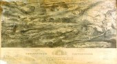
Book "Battle Maps & Charts of the...
From
marks4antiques.com
- The most updated price guide and makers' marks research online
As a member, you have access to a team of experts
and assistance is always available to you for free
An example from the millions of items in our Price Guide:
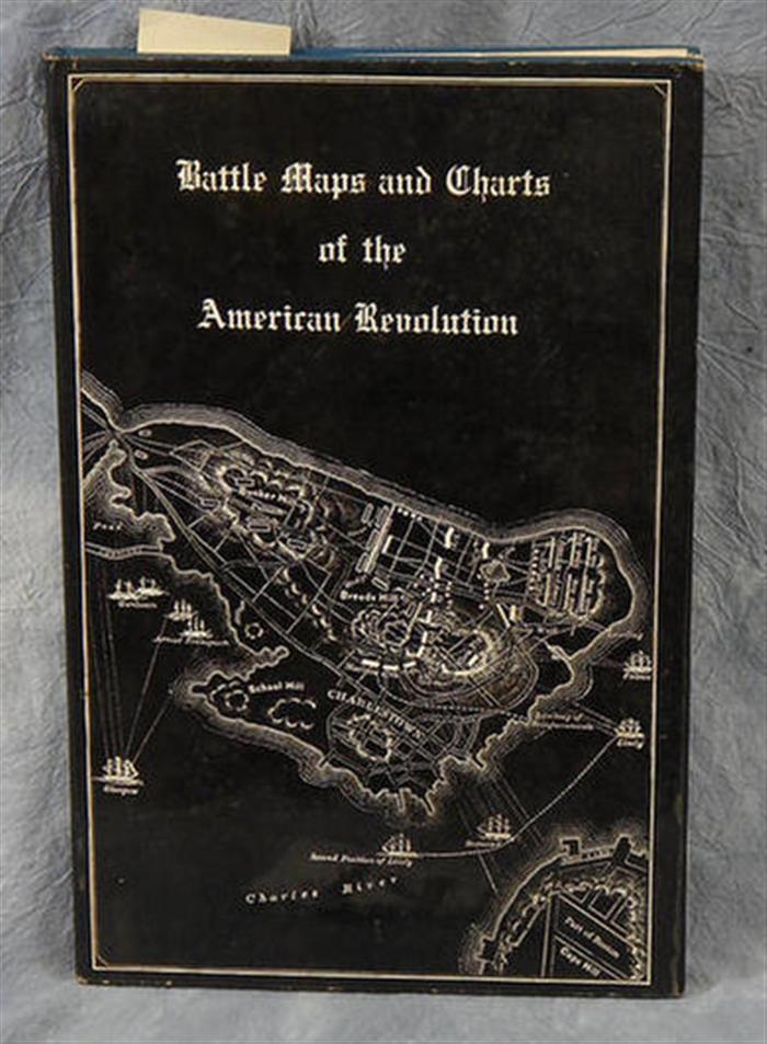
Book "Battle Maps & Charts of the American Revolution" by Henry B. Carrington, N.Y., 1974, Arno Press. Estimate $40-50...
This is an example from our
values4antiques price guide
We do not buy or sell any items
See more price guides
Check our other research services:
IDENTIFY WORLDWIDE MAKERS' MARKS & HALLMARKS
marks4ceramics:
Porcelain, Pottery, Chinaware, Figurines, Dolls, Vases...
marks4silver
:
Silver, Jewelry, Pewter, Silverplate, Copper & Bronze...
Explore other items from our
Antiques & Collectibles Price Guide
-
 Joseph F. Wallet Des Barres (English 172
[more like this]
Joseph F. Wallet Des Barres (English 172
[more like this]
-
 A Very Large Collection of Maps, 19th/e
[more like this]
A Very Large Collection of Maps, 19th/e
[more like this]
-
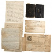
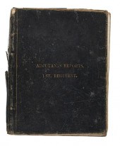 Confederate Order Book 1st Virginia Regi
[more like this]
Confederate Order Book 1st Virginia Regi
[more like this]
-
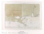
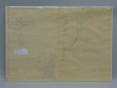 2 ON-BOARD KEPT WHALING CHARTS. THESE AR
[more like this]
2 ON-BOARD KEPT WHALING CHARTS. THESE AR
[more like this]
-
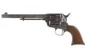 BOSTON CUSTER'S COLT CARRIED AT LITTLE B
[more like this]
BOSTON CUSTER'S COLT CARRIED AT LITTLE B
[more like this]
-
 2 FRAMED 18TH C. FADEN MAPS - GREECE & D
[more like this]
2 FRAMED 18TH C. FADEN MAPS - GREECE & D
[more like this]
-
 AN ANTIQUE MAP, "CARTE DES VARIATIONS DE
[more like this]
AN ANTIQUE MAP, "CARTE DES VARIATIONS DE
[more like this]
-
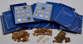 LARGE GROUPING OF US COIN COLLECTION SET
[more like this]
LARGE GROUPING OF US COIN COLLECTION SET
[more like this]
-
 A LATE MEXICAN-AMERICAN WAR ERA MAP, "MA
[more like this]
A LATE MEXICAN-AMERICAN WAR ERA MAP, "MA
[more like this]
-
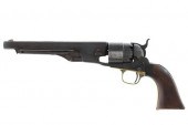 OGLALA SIOUX CRAZY HORSE OWNED COLT 1860
[more like this]
OGLALA SIOUX CRAZY HORSE OWNED COLT 1860
[more like this]
-
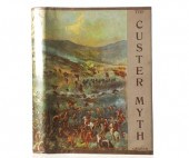 "THE CUSTER MYTH", COL. W.A. GRAHAM, 1ST
[more like this]
"THE CUSTER MYTH", COL. W.A. GRAHAM, 1ST
[more like this]
-
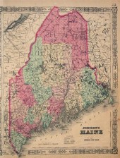 1 vol. Johnson's New Illustrated Family
[more like this]
1 vol. Johnson's New Illustrated Family
[more like this]
-
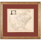 C 1776 NORTH AMERICA AGREEABLE TO THE MO
[more like this]
C 1776 NORTH AMERICA AGREEABLE TO THE MO
[more like this]
-
 8 TENNESSEE MILITARY & SURVEY MAPSAssort
[more like this]
8 TENNESSEE MILITARY & SURVEY MAPSAssort
[more like this]
-
 CIVIL WAR ARCHIVE, INCL. GEN. BATE ON DE
[more like this]
CIVIL WAR ARCHIVE, INCL. GEN. BATE ON DE
[more like this]
-
 4 vols. (Pennsylvania Property Atlases
[more like this]
4 vols. (Pennsylvania Property Atlases
[more like this]
-
 1 vol. (Philadelphia Atlas.) Smedley, S
[more like this]
1 vol. (Philadelphia Atlas.) Smedley, S
[more like this]
-
 DU HALDE, Jean-Baptiste, (French, 1674-1
[more like this]
DU HALDE, Jean-Baptiste, (French, 1674-1
[more like this]
-
 MITCHELL. A NEW UNIVERSAL ATLAS CONTAINI
[more like this]
MITCHELL. A NEW UNIVERSAL ATLAS CONTAINI
[more like this]
-
 HENRY MOUZON - MAP OF NORTH AND SOUTH CA
[more like this]
HENRY MOUZON - MAP OF NORTH AND SOUTH CA
[more like this]
-
 6 MISSISSIPPI AND TENNESSEE RIVER MAPSSi
[more like this]
6 MISSISSIPPI AND TENNESSEE RIVER MAPSSi
[more like this]
-
 5 CIVIL WAR RELATED BOOKS1st item: Hopki
[more like this]
5 CIVIL WAR RELATED BOOKS1st item: Hopki
[more like this]
-
 7 EARLY TENNESSEE GEOLOGICAL REPORTS, IN
[more like this]
7 EARLY TENNESSEE GEOLOGICAL REPORTS, IN
[more like this]
-
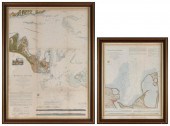 TWO MARTHA'S VINEYARD MAPS/CHARTS 19TH C
[more like this]
TWO MARTHA'S VINEYARD MAPS/CHARTS 19TH C
[more like this]
-
 Military Maps Illustrating the Operation
[more like this]
Military Maps Illustrating the Operation
[more like this]
-
 5 CIVIL WAR MAPSLot of five Civil War ma
[more like this]
5 CIVIL WAR MAPSLot of five Civil War ma
[more like this]
-
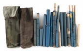
 FIVE BLUEBACK CHARTS OF NAVIGATIONAL ARE
[more like this]
FIVE BLUEBACK CHARTS OF NAVIGATIONAL ARE
[more like this]
-
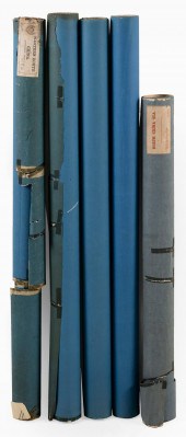
 APPROX. THIRTEEN CHARTS AND TWO GREEN CA
[more like this]
APPROX. THIRTEEN CHARTS AND TWO GREEN CA
[more like this]
-
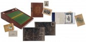 CAPTAIN MOSES RICH COLMAN LAP DESK AND A
[more like this]
CAPTAIN MOSES RICH COLMAN LAP DESK AND A
[more like this]
-
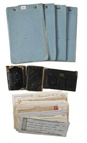 Private Dexter Butterfield 2nd Massachus
[more like this]
Private Dexter Butterfield 2nd Massachus
[more like this]
-
 MAP: "GETTYSBURG BATTLE-FIELD", BY JOHN
[more like this]
MAP: "GETTYSBURG BATTLE-FIELD", BY JOHN
[more like this]
-
 POTTERY: AMERICAN BENNINGTON-TYPE POTTER
[more like this]
POTTERY: AMERICAN BENNINGTON-TYPE POTTER
[more like this]
-
 (5) TEXAS MAPS, 1850'S<br>(lot of 5
[more like this]
(5) TEXAS MAPS, 1850'S<br>(lot of 5
[more like this]
-
 Brevet Brigadier General James M. Ruggle
[more like this]
Brevet Brigadier General James M. Ruggle
[more like this]
-
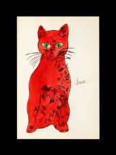 ANDY WARHOL (american 1928-1987) '25 C
[more like this]
ANDY WARHOL (american 1928-1987) '25 C
[more like this]
-
 CHARLES RENNIE MACKINTOSH AND MARGARET M
[more like this]
CHARLES RENNIE MACKINTOSH AND MARGARET M
[more like this]
This list is limited to only a few results.
Many more items are available to our members in our
Price Guide!
Ideal research tools for Collectors, Personal Property Appraisers, Antiques & Collectibles
Dealers, Auction Houses, Museums, eBayers or
other online
sellers (Rubylane, Etsy etc) and curious minds interested in appraising & identifying collectibles

EASY. FAST. ACCURATE.
Research at its best

Our research tools include:


