Pricing Guides & Dictionary of Makers Marks for Antiques & Collectibles
Appraise and find values for
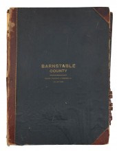
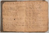
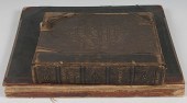
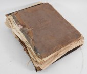
BOUND ATLAS OF BARNSTABLE COUNTY BY...
From
marks4antiques.com
- The most updated price guide and makers' marks research online
As a member, you have access to a team of experts
and assistance is always available to you for free
An example from the millions of items in our Price Guide:

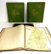
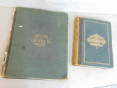
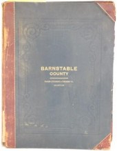
BOUND ATLAS OF BARNSTABLE COUNTY BY WALKER LITHO.AND PUBLISHING CO., BOSTON, CA 1910 (UNDATED). EMBOSSED CLOTH BOARDS. LEATHER SPINE IS SPLIT. HAS TOWNS...
This is an example from our
values4antiques price guide
We do not buy or sell any items
See more price guides
Check our other research services:
IDENTIFY WORLDWIDE MAKERS' MARKS & HALLMARKS
marks4ceramics:
Porcelain, Pottery, Chinaware, Figurines, Dolls, Vases...
marks4silver
:
Silver, Jewelry, Pewter, Silverplate, Copper & Bronze...
Explore other items from our
Antiques & Collectibles Price Guide
-
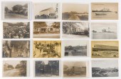 (VIEW) CAPE COD - BARNSTABLE: 16 REAL PH
[more like this]
(VIEW) CAPE COD - BARNSTABLE: 16 REAL PH
[more like this]
-
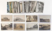 (VIEW) CAPE COD - BARNSTABLE: 33 POSTCAR
[more like this]
(VIEW) CAPE COD - BARNSTABLE: 33 POSTCAR
[more like this]
-
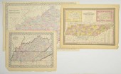
 5 KENTUCKY AND TENNESSEE MAPS1st item: "
[more like this]
5 KENTUCKY AND TENNESSEE MAPS1st item: "
[more like this]
-
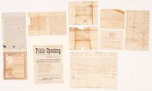 10 PCS 19TH C. TN EPHEMERA, INCL. GOVERN
[more like this]
10 PCS 19TH C. TN EPHEMERA, INCL. GOVERN
[more like this]
-
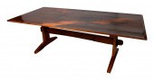 WEST BARNSTABLE TABLES TRESTLE TABLE WES
[more like this]
WEST BARNSTABLE TABLES TRESTLE TABLE WES
[more like this]
-
 DICK KIUSALAS WEST BARNSTABLE TABLES COF
[more like this]
DICK KIUSALAS WEST BARNSTABLE TABLES COF
[more like this]
-
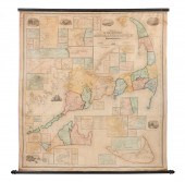 MONUMENTAL MAP OF CAPE COD 1858 LITHOGRA
[more like this]
MONUMENTAL MAP OF CAPE COD 1858 LITHOGRA
[more like this]
-
 GROUP OF MIDDLE TN EPHEMERA INC. SLAVE S
[more like this]
GROUP OF MIDDLE TN EPHEMERA INC. SLAVE S
[more like this]
-
 WALKER LITHOGRAPH & PUBLISHING CO. ATLAS
[more like this]
WALKER LITHOGRAPH & PUBLISHING CO. ATLAS
[more like this]
-
 VA BIRTH/SLAVE RECORD INC. JOHN OVERTONC
[more like this]
VA BIRTH/SLAVE RECORD INC. JOHN OVERTONC
[more like this]
-
 Atlas and Cyclopedia of Butler County Oh
[more like this]
Atlas and Cyclopedia of Butler County Oh
[more like this]
-
 6PC ASSORTED ANTIQUE 1870'S ATLASES Unit
[more like this]
6PC ASSORTED ANTIQUE 1870'S ATLASES Unit
[more like this]
-
 A THREE-PIECE LOT OF ITEMS RELATED TO A
[more like this]
A THREE-PIECE LOT OF ITEMS RELATED TO A
[more like this]
-
 ''Atlas of Hampden County Massachusetts
[more like this]
''Atlas of Hampden County Massachusetts
[more like this]
-
 2 BOOKS. ATLAS OF COLUMBIA COUNTY & HIST
[more like this]
2 BOOKS. ATLAS OF COLUMBIA COUNTY & HIST
[more like this]
-
 BOUND ATLAS OF BARNSTABLE COUNTY BY WALK
[more like this]
BOUND ATLAS OF BARNSTABLE COUNTY BY WALK
[more like this]
-
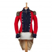 RARE IRISH MILITIA FIELD OFFICER'S RED C
[more like this]
RARE IRISH MILITIA FIELD OFFICER'S RED C
[more like this]
-
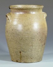 19TH C. NC STONEWARE JAR, SIGNED G. WOLF
[more like this]
19TH C. NC STONEWARE JAR, SIGNED G. WOLF
[more like this]
-
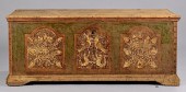 WYTHE COUNTY, VA PAINT DECORATED BLANKET
[more like this]
WYTHE COUNTY, VA PAINT DECORATED BLANKET
[more like this]
-
 4 vols. (Pennsylvania Property Atlases
[more like this]
4 vols. (Pennsylvania Property Atlases
[more like this]
-
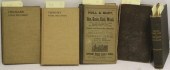 5 BOUND BOOKS RELATED TO CAPE COD TO INC
[more like this]
5 BOUND BOOKS RELATED TO CAPE COD TO INC
[more like this]
-
 MAP AND ATLAS LOT, 3 PCS INCL. MELISH DI
[more like this]
MAP AND ATLAS LOT, 3 PCS INCL. MELISH DI
[more like this]
-
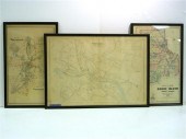
 4 TN & KY MAPS, 3 FRAMED1st item: "Tenne
[more like this]
4 TN & KY MAPS, 3 FRAMED1st item: "Tenne
[more like this]
-
 Three atlas maps featuring Rhode Island:
[more like this]
Three atlas maps featuring Rhode Island:
[more like this]
-
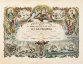 (ATLAS FRONTISPIECES) A group of four ti
[more like this]
(ATLAS FRONTISPIECES) A group of four ti
[more like this]
-
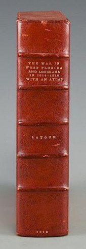 LATOUR WAR IN WEST FLORIDA LA 1814-1815,
[more like this]
LATOUR WAR IN WEST FLORIDA LA 1814-1815,
[more like this]
-
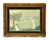 AMERICAN NEEDLEWORK PICTURE. Probably M
[more like this]
AMERICAN NEEDLEWORK PICTURE. Probably M
[more like this]
-
 HISTORY OF BARNSTABLE COUNTY, MASSACHUSE
[more like this]
HISTORY OF BARNSTABLE COUNTY, MASSACHUSE
[more like this]
-
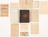
 Archive of Documents Associated with the
[more like this]
Archive of Documents Associated with the
[more like this]
-
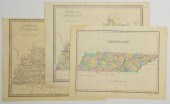
 3 MAPS TOTAL , 1 OF TENNESSEE, 2 OF KENT
[more like this]
3 MAPS TOTAL , 1 OF TENNESSEE, 2 OF KENT
[more like this]
-
 3 KY & TN MAPS: VANCE, TANNER, JOHNSON1s
[more like this]
3 KY & TN MAPS: VANCE, TANNER, JOHNSON1s
[more like this]
-
 3 TN AND KY MAPS INC. FINLEY AND 2 GREEN
[more like this]
3 TN AND KY MAPS INC. FINLEY AND 2 GREEN
[more like this]
-
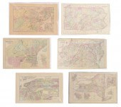 (6) MITCHELL & BRADLEY ATLAS MAPS NEW YO
[more like this]
(6) MITCHELL & BRADLEY ATLAS MAPS NEW YO
[more like this]
-
 (11) FRENCH BOOKS, WITH DATES RANGING FR
[more like this]
(11) FRENCH BOOKS, WITH DATES RANGING FR
[more like this]
-
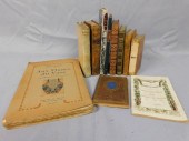
 TWENTY-SEVEN 18TH-20TH CENTURY BOOKS, VA
[more like this]
TWENTY-SEVEN 18TH-20TH CENTURY BOOKS, VA
[more like this]
-
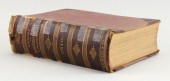
 3VOL CHARLES DICKENS FINELY BOUND 1ST ED
[more like this]
3VOL CHARLES DICKENS FINELY BOUND 1ST ED
[more like this]
This list is limited to only a few results.
Many more items are available to our members in our
Price Guide!
Ideal research tools for Collectors, Personal Property Appraisers, Antiques & Collectibles
Dealers, Auction Houses, Museums, eBayers or
other online
sellers (Rubylane, Etsy etc) and curious minds interested in appraising & identifying collectibles

EASY. FAST. ACCURATE.
Research at its best

Our research tools include:


