Pricing Guides & Dictionary of Makers Marks for Antiques & Collectibles
Appraise and find values for
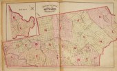
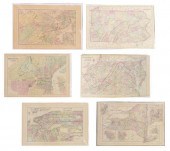
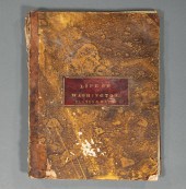
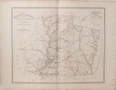
Three atlas maps featuring Rhode...
From
marks4antiques.com
- The most updated price guide and makers' marks research online
As a member, you have access to a team of experts
and assistance is always available to you for free
An example from the millions of items in our Price Guide:
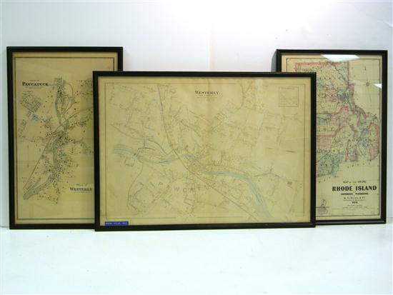
Three atlas maps featuring Rhode Island: Plan of Pawcatuck and Westerly 24 rods to the inch scale with Westerly Business Directory of Churches Banks ...
This is an example from our
values4antiques price guide
We do not buy or sell any items
See more price guides
Check our other research services:
IDENTIFY WORLDWIDE MAKERS' MARKS & HALLMARKS
marks4ceramics:
Porcelain, Pottery, Chinaware, Figurines, Dolls, Vases...
marks4silver
:
Silver, Jewelry, Pewter, Silverplate, Copper & Bronze...
Explore other items from our
Antiques & Collectibles Price Guide
-
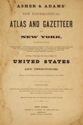
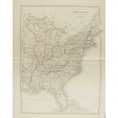
 A Very Large Collection of Maps, 19th/e
[more like this]
A Very Large Collection of Maps, 19th/e
[more like this]
-
 4 vols. (Pennsylvania Property Atlases
[more like this]
4 vols. (Pennsylvania Property Atlases
[more like this]
-
 MITCHELL. A NEW UNIVERSAL ATLAS CONTAINI
[more like this]
MITCHELL. A NEW UNIVERSAL ATLAS CONTAINI
[more like this]
-
 1 vol. (Philadelphia Atlas.) Smedley, S
[more like this]
1 vol. (Philadelphia Atlas.) Smedley, S
[more like this]
-
 AN ANTIQUE MAP, "CARTE DES VARIATIONS DE
[more like this]
AN ANTIQUE MAP, "CARTE DES VARIATIONS DE
[more like this]
-
 EXTENSIVE AND UNIQUE COLLECTION OF MEMOR
[more like this]
EXTENSIVE AND UNIQUE COLLECTION OF MEMOR
[more like this]
-
 4 vols. (Philadelphia Property Atlases)
[more like this]
4 vols. (Philadelphia Property Atlases)
[more like this]
-
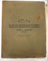
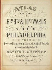 4 vols. Philadelphia Ward Atlases. Elvi
[more like this]
4 vols. Philadelphia Ward Atlases. Elvi
[more like this]
-
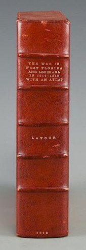 LATOUR WAR IN WEST FLORIDA LA 1814-1815,
[more like this]
LATOUR WAR IN WEST FLORIDA LA 1814-1815,
[more like this]
-
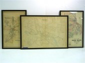 Three atlas maps featuring Rhode Island:
[more like this]
Three atlas maps featuring Rhode Island:
[more like this]
-
 6PC ASSORTED ANTIQUE 1870'S ATLASES Unit
[more like this]
6PC ASSORTED ANTIQUE 1870'S ATLASES Unit
[more like this]
-
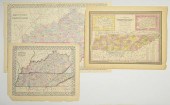
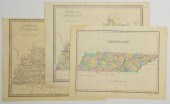 3 TN AND KY MAPS INC. FINLEY AND 2 GREEN
[more like this]
3 TN AND KY MAPS INC. FINLEY AND 2 GREEN
[more like this]
-
 3 vols. Philadelphia Atlases. Germanto
[more like this]
3 vols. Philadelphia Atlases. Germanto
[more like this]
-
 RARE 18TH CENTURY CHINESE ATLASA rare 18
[more like this]
RARE 18TH CENTURY CHINESE ATLASA rare 18
[more like this]
-
 (6) MITCHELL & BRADLEY ATLAS MAPS NEW YO
[more like this]
(6) MITCHELL & BRADLEY ATLAS MAPS NEW YO
[more like this]
-
 2 vols. (Philadelphia Property Atlases.
[more like this]
2 vols. (Philadelphia Property Atlases.
[more like this]
-
 1782 Thomas Kitchen atlas, A General Atl
[more like this]
1782 Thomas Kitchen atlas, A General Atl
[more like this]
-
 A Large Collection of Maps from Around t
[more like this]
A Large Collection of Maps from Around t
[more like this]
-
 3 MAPS TOTAL , 1 OF TENNESSEE, 2 OF KENT
[more like this]
3 MAPS TOTAL , 1 OF TENNESSEE, 2 OF KENT
[more like this]
-
 5 KENTUCKY AND TENNESSEE MAPS1st item: "
[more like this]
5 KENTUCKY AND TENNESSEE MAPS1st item: "
[more like this]
-
 Military Maps Illustrating the Operation
[more like this]
Military Maps Illustrating the Operation
[more like this]
-
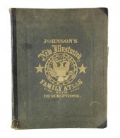 BOOK: JOHNSON'S NEW ILLUSTRATED FAMILY A
[more like this]
BOOK: JOHNSON'S NEW ILLUSTRATED FAMILY A
[more like this]
-
 IMPORTANT ANTIQUE ATLAS DU VOYAGE DE LA
[more like this]
IMPORTANT ANTIQUE ATLAS DU VOYAGE DE LA
[more like this]
-
 REVOLUTIONARY WAR ATLAS, 1807[Revolution
[more like this]
REVOLUTIONARY WAR ATLAS, 1807[Revolution
[more like this]
-
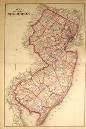 1 vol. (New Jersey County Atlas.) Beers
[more like this]
1 vol. (New Jersey County Atlas.) Beers
[more like this]
-
 2 vols. American 19th-Century State Atl
[more like this]
2 vols. American 19th-Century State Atl
[more like this]
-
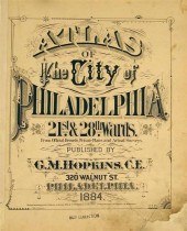 1 vol. (Philadelphia Property Atlas.) A
[more like this]
1 vol. (Philadelphia Property Atlas.) A
[more like this]
-
 Maps from Robert Mills' 1825 Atlas of So
[more like this]
Maps from Robert Mills' 1825 Atlas of So
[more like this]
-
 ATLASES - BLACK, A. & C.: PUBLISHER
BLAC
[more like this]
ATLASES - BLACK, A. & C.: PUBLISHER
BLAC
[more like this]
-
 IMPORTANT RHODE ISLAND DYER FAMILY COAT
[more like this]
IMPORTANT RHODE ISLAND DYER FAMILY COAT
[more like this]
-
 8 TENNESSEE MILITARY & SURVEY MAPSAssort
[more like this]
8 TENNESSEE MILITARY & SURVEY MAPSAssort
[more like this]
-
 5 CIVIL WAR MAPSLot of five Civil War ma
[more like this]
5 CIVIL WAR MAPSLot of five Civil War ma
[more like this]
-
 DU HALDE, Jean-Baptiste, (French, 1674-1
[more like this]
DU HALDE, Jean-Baptiste, (French, 1674-1
[more like this]
-
 2 FRAMED 18TH C. FADEN MAPS - GREECE & D
[more like this]
2 FRAMED 18TH C. FADEN MAPS - GREECE & D
[more like this]
-
 HENRY MOUZON - MAP OF NORTH AND SOUTH CA
[more like this]
HENRY MOUZON - MAP OF NORTH AND SOUTH CA
[more like this]
-
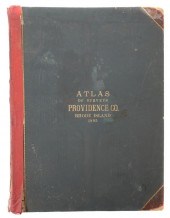 MASSIVE RHODE ISLAND ATLAS 1895The last
[more like this]
MASSIVE RHODE ISLAND ATLAS 1895The last
[more like this]
This list is limited to only a few results.
Many more items are available to our members in our
Price Guide!
Ideal research tools for Collectors, Personal Property Appraisers, Antiques & Collectibles
Dealers, Auction Houses, Museums, eBayers or
other online
sellers (Rubylane, Etsy etc) and curious minds interested in appraising & identifying collectibles

EASY. FAST. ACCURATE.
Research at its best

Our research tools include:


