Pricing Guides & Dictionary of Makers Marks for Antiques & Collectibles
Appraise and find values for
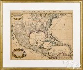
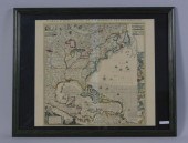
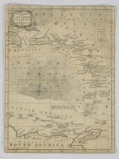
COVENS & MORTIER COLOR ENGRAVED...
From
marks4antiques.com
- The most updated price guide and makers' marks research online
As a member, you have access to a team of experts
and assistance is always available to you for free
An example from the millions of items in our Price Guide:
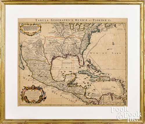
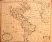
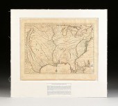
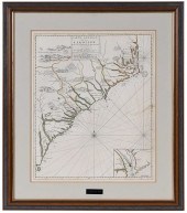
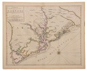
COVENS & MORTIER COLOR ENGRAVED MAPCovens & Mortier colored engraved map of Mexico and Florida Tabula Geographica Mexicae et Floridae , ca. 1722 , 19...
This is an example from our
values4antiques price guide
We do not buy or sell any items
See more price guides
Check our other research services:
IDENTIFY WORLDWIDE MAKERS' MARKS & HALLMARKS
marks4ceramics:
Porcelain, Pottery, Chinaware, Figurines, Dolls, Vases...
marks4silver
:
Silver, Jewelry, Pewter, Silverplate, Copper & Bronze...
Explore other items from our
Antiques & Collectibles Price Guide
-
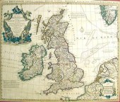
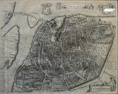
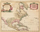 PIETER COVENS AND CORNELIU MORTIER, C. 1
[more like this]
PIETER COVENS AND CORNELIU MORTIER, C. 1
[more like this]
-
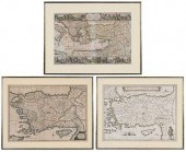
 MAPS OF THE OTTOMAN EMPIRE BY DE WITT AN
[more like this]
MAPS OF THE OTTOMAN EMPIRE BY DE WITT AN
[more like this]
-
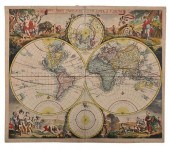
 SIXTEEN ANTIQUE MAPSSixteen Antique Maps
[more like this]
SIXTEEN ANTIQUE MAPSSixteen Antique Maps
[more like this]
-
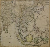 COVENS AND MORTIER, CARTE DES INDES ET D
[more like this]
COVENS AND MORTIER, CARTE DES INDES ET D
[more like this]
-
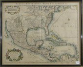
 COVENS & MORTIER COLOR ENGRAVED MAPCoven
[more like this]
COVENS & MORTIER COLOR ENGRAVED MAPCoven
[more like this]
-
 JOHANNES L. VAN LUCHTENBURG (1685-1711)
[more like this]
JOHANNES L. VAN LUCHTENBURG (1685-1711)
[more like this]
-
 BLAEU, MORTIER, VISSCHER - THREE MAPS OF
[more like this]
BLAEU, MORTIER, VISSCHER - THREE MAPS OF
[more like this]
-
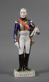
 A GROUP OF GOLDEN SILVER AGE DELL FOUR C
[more like this]
A GROUP OF GOLDEN SILVER AGE DELL FOUR C
[more like this]
-
 2 pieces. Partly Hand-Colored Engraved
[more like this]
2 pieces. Partly Hand-Colored Engraved
[more like this]
-
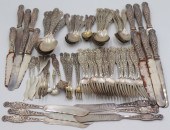
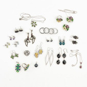 (25) GROUPING OF STERLING AND SILVER PLA
[more like this]
(25) GROUPING OF STERLING AND SILVER PLA
[more like this]
-
 1 piece. Engraved Map With Outline Colo
[more like this]
1 piece. Engraved Map With Outline Colo
[more like this]
-
 MAPS: TWO MAPS: GUILLAUME DELISLE (FRENC
[more like this]
MAPS: TWO MAPS: GUILLAUME DELISLE (FRENC
[more like this]
-
 AN ANTIQUE MAP, "CARTE DE LA LOUISIANE E
[more like this]
AN ANTIQUE MAP, "CARTE DE LA LOUISIANE E
[more like this]
-
 STERLING. WHITING HERALDIC THEODORE B. S
[more like this]
STERLING. WHITING HERALDIC THEODORE B. S
[more like this]
-
 1 piece. Hand-Colored Engraving. Covens
[more like this]
1 piece. Hand-Colored Engraving. Covens
[more like this]
-
 Eugene Henri Fricx (fl. 1706 - circa 174
[more like this]
Eugene Henri Fricx (fl. 1706 - circa 174
[more like this]
-
 HENRY POPPLE (B. MID-17TH C. DIED1743),M
[more like this]
HENRY POPPLE (B. MID-17TH C. DIED1743),M
[more like this]
-
 EARLY 18TH CENTURY MAP, HAND-COLORED ENG
[more like this]
EARLY 18TH CENTURY MAP, HAND-COLORED ENG
[more like this]
-
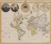
 DE WIT - NOVA ORBIS TABULA IN LUCEM EDIT
[more like this]
DE WIT - NOVA ORBIS TABULA IN LUCEM EDIT
[more like this]
-
 AFTER NICOLAS SANSON (1600-1667) A COLON
[more like this]
AFTER NICOLAS SANSON (1600-1667) A COLON
[more like this]
-
 GUILLAUME DE LISLE (1675-1726), AN 18TH
[more like this]
GUILLAUME DE LISLE (1675-1726), AN 18TH
[more like this]
-
 GRP: 5 MAPS OF BRAZIL BLAEU BELLIN KITCH
[more like this]
GRP: 5 MAPS OF BRAZIL BLAEU BELLIN KITCH
[more like this]
-
 AN ANTIQUE MAP, "CARTE PARTICULIèRE DE I
[more like this]
AN ANTIQUE MAP, "CARTE PARTICULIèRE DE I
[more like this]
-
 AN ANTIQUE MAP, "CARTE PARTICULIèRE DE I
[more like this]
AN ANTIQUE MAP, "CARTE PARTICULIèRE DE I
[more like this]
-
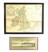
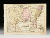
 Henry Popple. partial map of the British
[more like this]
Henry Popple. partial map of the British
[more like this]
-
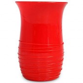 STEUBEN ROUGE FLAMBE TUMBLERDESCRIPTION:
[more like this]
STEUBEN ROUGE FLAMBE TUMBLERDESCRIPTION:
[more like this]
-
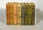 8 vols. Baum, L. Frank. Oz Titles: The
[more like this]
8 vols. Baum, L. Frank. Oz Titles: The
[more like this]
-
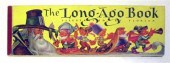 12 vols. Illustrated Children's Books:
[more like this]
12 vols. Illustrated Children's Books:
[more like this]
-
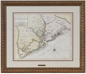
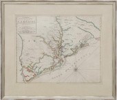 Rare early map of South Carolina by Pier
[more like this]
Rare early map of South Carolina by Pier
[more like this]
-
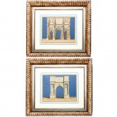 PIETER MORTIER (AFTER), PAIR LARGE ENGRA
[more like this]
PIETER MORTIER (AFTER), PAIR LARGE ENGRA
[more like this]
-
 PIERRE MORTIER, CARTOGRAPHER, AVENIO VUL
[more like this]
PIERRE MORTIER, CARTOGRAPHER, AVENIO VUL
[more like this]
-
 DRESDEN CARL THIEME, EDOUARD MORTIER (NA
[more like this]
DRESDEN CARL THIEME, EDOUARD MORTIER (NA
[more like this]
-
 PIERRE MORTIER - MAP OF THE CAROLINAS, 1
[more like this]
PIERRE MORTIER - MAP OF THE CAROLINAS, 1
[more like this]
-
 PIERRE MORTIER - MAP OF SOUTH CAROLINAPi
[more like this]
PIERRE MORTIER - MAP OF SOUTH CAROLINAPi
[more like this]
-
 MORTIER - CARTE PARTICULIERE DE LA CAROL
[more like this]
MORTIER - CARTE PARTICULIERE DE LA CAROL
[more like this]
-
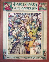 13 vols. (Rackham, Arthur, illustrator)
[more like this]
13 vols. (Rackham, Arthur, illustrator)
[more like this]
This list is limited to only a few results.
Many more items are available to our members in our
Price Guide!
Ideal research tools for Collectors, Personal Property Appraisers, Antiques & Collectibles
Dealers, Auction Houses, Museums, eBayers or
other online
sellers (Rubylane, Etsy etc) and curious minds interested in appraising & identifying collectibles

EASY. FAST. ACCURATE.
Research at its best

Our research tools include:


