Pricing Guides & Dictionary of Makers Marks for Antiques & Collectibles
Appraise and find values for
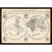
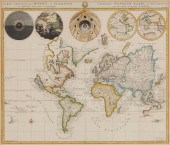
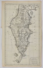
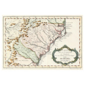
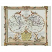
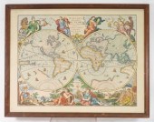
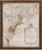
Mappe Monde Ou Carte Generale de la...
From
marks4antiques.com
- The most updated price guide and makers' marks research online
As a member, you have access to a team of experts
and assistance is always available to you for free
An example from the millions of items in our Price Guide:
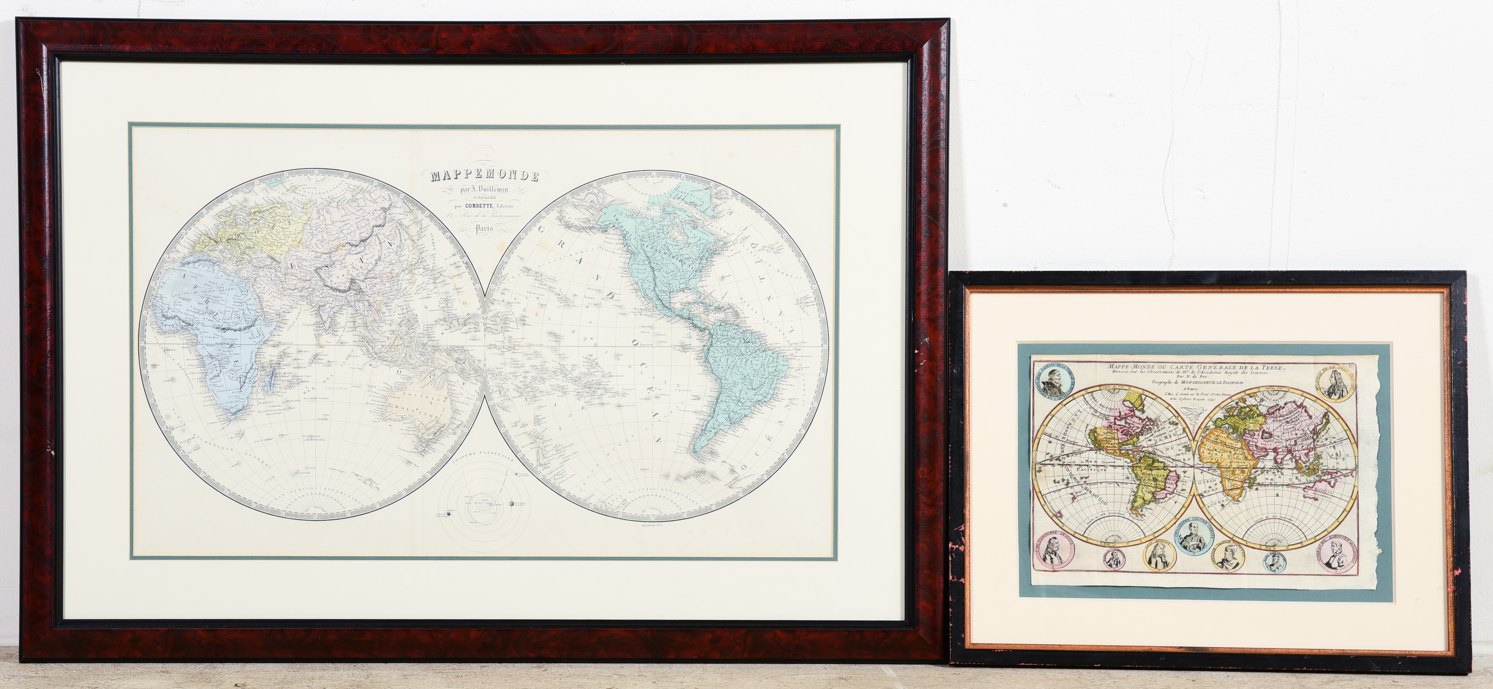
Mappe Monde Ou Carte Generale de la Terre, N De Fer, Pairs, 1754, hand colored about 9" x 13" left edge trimmed, with original Vuillemin Map -...
This is an example from our
values4antiques price guide
We do not buy or sell any items
See more price guides
Check our other research services:
IDENTIFY WORLDWIDE MAKERS' MARKS & HALLMARKS
marks4ceramics:
Porcelain, Pottery, Chinaware, Figurines, Dolls, Vases...
marks4silver
:
Silver, Jewelry, Pewter, Silverplate, Copper & Bronze...
Explore other items from our
Antiques & Collectibles Price Guide
-
 AN ANTIQUE MAP, "MAPPE MONDE OU CARTE Ré
[more like this]
AN ANTIQUE MAP, "MAPPE MONDE OU CARTE Ré
[more like this]
-
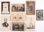 [Political Americana - Lincolniana] Abra
[more like this]
[Political Americana - Lincolniana] Abra
[more like this]
-
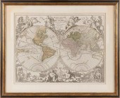 "MAPPE MONDE OU DESCRIPTION DU GLOBE TER
[more like this]
"MAPPE MONDE OU DESCRIPTION DU GLOBE TER
[more like this]
-
 C 1750 HANDCOLORED DOUBLE HEMISPHERE WOR
[more like this]
C 1750 HANDCOLORED DOUBLE HEMISPHERE WOR
[more like this]
-
 Mappe Monde Ou Carte Generale de la Terr
[more like this]
Mappe Monde Ou Carte Generale de la Terr
[more like this]
-
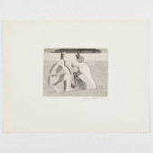 JACQUES VILLON (1875-1963): APRèS LE BAI
[more like this]
JACQUES VILLON (1875-1963): APRèS LE BAI
[more like this]
-
 HAND COLORED ENGRAVED MAPPE-MONDEHand co
[more like this]
HAND COLORED ENGRAVED MAPPE-MONDEHand co
[more like this]
-
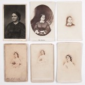
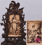
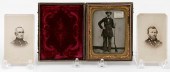 CASED TIN TYPE AND TWO CARTE DE VISITES
[more like this]
CASED TIN TYPE AND TWO CARTE DE VISITES
[more like this]
-
 JOHANNES L. VAN LUCHTENBURG (1685-1711)
[more like this]
JOHANNES L. VAN LUCHTENBURG (1685-1711)
[more like this]
-
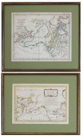
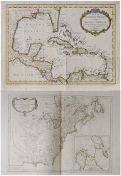 Two French Maps of the Americas 18th cen
[more like this]
Two French Maps of the Americas 18th cen
[more like this]
-
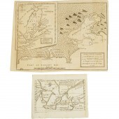 Two Small Maps of Canada, early-mid 18th
[more like this]
Two Small Maps of Canada, early-mid 18th
[more like this]
-
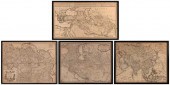
 GRP: 7 MAPS OF RUSSIA AND EUROPEGroup of
[more like this]
GRP: 7 MAPS OF RUSSIA AND EUROPEGroup of
[more like this]
-
 Rare New Orleans Double-Sided Commercial
[more like this]
Rare New Orleans Double-Sided Commercial
[more like this]
-
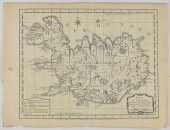 JACQUES-NICOLAS BELLIN MAP OF ICELAND CA
[more like this]
JACQUES-NICOLAS BELLIN MAP OF ICELAND CA
[more like this]
-
 TWO COLLECTIBLE MAPS: DISCOVERIES OF RUS
[more like this]
TWO COLLECTIBLE MAPS: DISCOVERIES OF RUS
[more like this]
-
 BELLIN, JACQUES-NICOLAS. CARTE DE LA CA
[more like this]
BELLIN, JACQUES-NICOLAS. CARTE DE LA CA
[more like this]
-
 Six-view world map after Homann Heirs 18
[more like this]
Six-view world map after Homann Heirs 18
[more like this]
-
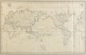
 Gerard Valck Double-Hemisphere World Map
[more like this]
Gerard Valck Double-Hemisphere World Map
[more like this]
-
 Unframed French map, "Mappe-Monde", Pier
[more like this]
Unframed French map, "Mappe-Monde", Pier
[more like this]
-
 BRION DE LA TOUR, LOUIS. MAPPE-MONDE (Pa
[more like this]
BRION DE LA TOUR, LOUIS. MAPPE-MONDE (Pa
[more like this]
-
 DE VAUGONDY, ROBERT. MAPPE MONDé (Paris,
[more like this]
DE VAUGONDY, ROBERT. MAPPE MONDé (Paris,
[more like this]
-
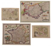 BLAEU, LE ROUGE - THREE MAPS OF FRANCE,
[more like this]
BLAEU, LE ROUGE - THREE MAPS OF FRANCE,
[more like this]
-
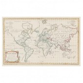
 World Map Paris, 18th century, Mappe mon
[more like this]
World Map Paris, 18th century, Mappe mon
[more like this]
-
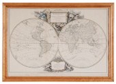
 DOUBLE HEMISPHERE WORLD MAPDouble Hemisp
[more like this]
DOUBLE HEMISPHERE WORLD MAPDouble Hemisp
[more like this]
-
 CHES. I.B. ELWE MAP OF THE WORLD France,
[more like this]
CHES. I.B. ELWE MAP OF THE WORLD France,
[more like this]
-
 IMPORTANT ANTIQUE ATLAS DU VOYAGE DE LA
[more like this]
IMPORTANT ANTIQUE ATLAS DU VOYAGE DE LA
[more like this]
-
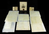
 Five Richard Kidder Meade, Jr. Confedera
[more like this]
Five Richard Kidder Meade, Jr. Confedera
[more like this]
-
 [Political Americana - Lincolniana] Mary
[more like this]
[Political Americana - Lincolniana] Mary
[more like this]
-
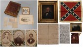
 CIVIL WAR: MANUSCRIPTS, PHOTOGRAPHS, AND
[more like this]
CIVIL WAR: MANUSCRIPTS, PHOTOGRAPHS, AND
[more like this]
-
 EMANCIPATION AND PEACE CARTE-DE-VISITE,
[more like this]
EMANCIPATION AND PEACE CARTE-DE-VISITE,
[more like this]
-
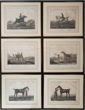 CARLE VERNET AND CHARLES LEVACHEX (FRENC
[more like this]
CARLE VERNET AND CHARLES LEVACHEX (FRENC
[more like this]
-
 HAND-COLORED MAP OF NORTH AMERICA "CARTE
[more like this]
HAND-COLORED MAP OF NORTH AMERICA "CARTE
[more like this]
-
 FOUR GUILLAUME DELISLE ENGRAVED MAPS 18T
[more like this]
FOUR GUILLAUME DELISLE ENGRAVED MAPS 18T
[more like this]
-
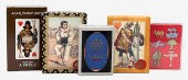 FIVE PACKS OF PLAYING CARDS.Five Packs o
[more like this]
FIVE PACKS OF PLAYING CARDS.Five Packs o
[more like this]
-
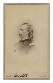 AUTOGRAPHED CARTE-DE-VISITE OF GEORGE AR
[more like this]
AUTOGRAPHED CARTE-DE-VISITE OF GEORGE AR
[more like this]
-
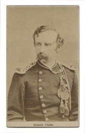 CARTE DE VISITE OF GEORGE ARMSTRONG CUST
[more like this]
CARTE DE VISITE OF GEORGE ARMSTRONG CUST
[more like this]
This list is limited to only a few results.
Many more items are available to our members in our
Price Guide!
Ideal research tools for Collectors, Personal Property Appraisers, Antiques & Collectibles
Dealers, Auction Houses, Museums, eBayers or
other online
sellers (Rubylane, Etsy etc) and curious minds interested in appraising & identifying collectibles

EASY. FAST. ACCURATE.
Research at its best

Our research tools include:


