Pricing Guides & Dictionary of Makers Marks for Antiques & Collectibles
Appraise and find values for
[Maps] Three plans of Baltimore and...
From
marks4antiques.com
- The most updated price guide and makers' marks research online
As a member, you have access to a team of experts
and assistance is always available to you for free
An example from the millions of items in our Price Guide:
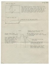
![[Maps] Three plans of Baltimore and](/images/maps-three-plans-of-baltimore--139629-full.jpg)
[Maps] Three plans of Baltimore and the harbor 1) U.S. Harbor Advisory Board ''Baltimore Harbor'' 1876 framed; 2) ''Map of the Property of the Canton...
This is an example from our
values4antiques price guide
We do not buy or sell any items
See more price guides
Check our other research services:
IDENTIFY WORLDWIDE MAKERS' MARKS & HALLMARKS
marks4ceramics:
Porcelain, Pottery, Chinaware, Figurines, Dolls, Vases...
marks4silver
:
Silver, Jewelry, Pewter, Silverplate, Copper & Bronze...
Explore other items from our
Antiques & Collectibles Price Guide
-
 25 vols. (20 wrappers.) Baltimore - Dir
[more like this]
25 vols. (20 wrappers.) Baltimore - Dir
[more like this]
-
 A Very Large Collection of Maps, 19th/e
[more like this]
A Very Large Collection of Maps, 19th/e
[more like this]
-
 DU HALDE, Jean-Baptiste, (French, 1674-1
[more like this]
DU HALDE, Jean-Baptiste, (French, 1674-1
[more like this]
-
 BOOK: "MAPS, PLANS, VIEWS AND COINS, THE
[more like this]
BOOK: "MAPS, PLANS, VIEWS AND COINS, THE
[more like this]
-
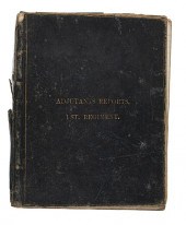 Confederate Order Book 1st Virginia Regi
[more like this]
Confederate Order Book 1st Virginia Regi
[more like this]
-
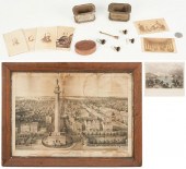 1876 CENTENNIAL SOUVENIRS, CDVS AND 2 BA
[more like this]
1876 CENTENNIAL SOUVENIRS, CDVS AND 2 BA
[more like this]
-
 MAPS: JOHN SPEED (ENGLAND, 1552-1629), T
[more like this]
MAPS: JOHN SPEED (ENGLAND, 1552-1629), T
[more like this]
-
 MAPS: JOHN MARSHALL "THE LIFE OF GEORGE
[more like this]
MAPS: JOHN MARSHALL "THE LIFE OF GEORGE
[more like this]
-
 ORIGINAL ILLUSION PLANS TO THE DISEMBODI
[more like this]
ORIGINAL ILLUSION PLANS TO THE DISEMBODI
[more like this]
-
 5 vols. Military History - The Franco-P
[more like this]
5 vols. Military History - The Franco-P
[more like this]
-
 MITCHELL. A NEW UNIVERSAL ATLAS CONTAINI
[more like this]
MITCHELL. A NEW UNIVERSAL ATLAS CONTAINI
[more like this]
-
 AN ANTIQUE MAP, "CARTE DES VARIATIONS DE
[more like this]
AN ANTIQUE MAP, "CARTE DES VARIATIONS DE
[more like this]
-
 4 vols. (Pennsylvania Property Atlases
[more like this]
4 vols. (Pennsylvania Property Atlases
[more like this]
-
 1 vol. (Philadelphia Atlas.) Smedley, S
[more like this]
1 vol. (Philadelphia Atlas.) Smedley, S
[more like this]
-
 2 FRAMED 18TH C. FADEN MAPS - GREECE & D
[more like this]
2 FRAMED 18TH C. FADEN MAPS - GREECE & D
[more like this]
-
 HENRY MOUZON - MAP OF NORTH AND SOUTH CA
[more like this]
HENRY MOUZON - MAP OF NORTH AND SOUTH CA
[more like this]
-
 5 CIVIL WAR RELATED BOOKS1st item: Hopki
[more like this]
5 CIVIL WAR RELATED BOOKS1st item: Hopki
[more like this]
-
 MAPS & DOCUMENTS: VICTORIAN VELLUM LEGAL
[more like this]
MAPS & DOCUMENTS: VICTORIAN VELLUM LEGAL
[more like this]
-
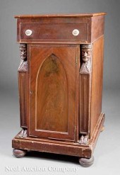 An American Classical Carved Mahogany Pe
[more like this]
An American Classical Carved Mahogany Pe
[more like this]
-
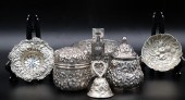 STERLING. GROUPING OF STERLING BALTIMORE
[more like this]
STERLING. GROUPING OF STERLING BALTIMORE
[more like this]
-
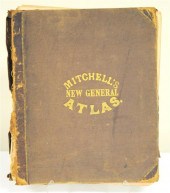 Mitchell's New General Atlas 1860 lack
[more like this]
Mitchell's New General Atlas 1860 lack
[more like this]
-
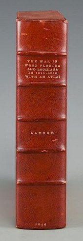 LATOUR WAR IN WEST FLORIDA LA 1814-1815,
[more like this]
LATOUR WAR IN WEST FLORIDA LA 1814-1815,
[more like this]
-
 Archaeology & Ancient History Books The
[more like this]
Archaeology & Ancient History Books The
[more like this]
-
 8 TENNESSEE MILITARY & SURVEY MAPSAssort
[more like this]
8 TENNESSEE MILITARY & SURVEY MAPSAssort
[more like this]
-
 6 MISSISSIPPI AND TENNESSEE RIVER MAPSSi
[more like this]
6 MISSISSIPPI AND TENNESSEE RIVER MAPSSi
[more like this]
-
 Military Maps Illustrating the Operation
[more like this]
Military Maps Illustrating the Operation
[more like this]
-
 A Large Collection of Maps of America,
[more like this]
A Large Collection of Maps of America,
[more like this]
-
 2 vols. (Philadelphia Property Atlases.
[more like this]
2 vols. (Philadelphia Property Atlases.
[more like this]
-
 7 vols. Cartography: Brown, Lloyd A. Th
[more like this]
7 vols. Cartography: Brown, Lloyd A. Th
[more like this]
-
 7 vols. Cartography - American Subjects
[more like this]
7 vols. Cartography - American Subjects
[more like this]
-
 1782 Thomas Kitchen atlas, A General Atl
[more like this]
1782 Thomas Kitchen atlas, A General Atl
[more like this]
-
 THE LIFE OF GEORGE WASHINGTON, BY JOHN M
[more like this]
THE LIFE OF GEORGE WASHINGTON, BY JOHN M
[more like this]
-
 5 CIVIL WAR MAPSLot of five Civil War ma
[more like this]
5 CIVIL WAR MAPSLot of five Civil War ma
[more like this]
-
 (5) TEXAS MAPS, 1850'S<br>(lot of 5
[more like this]
(5) TEXAS MAPS, 1850'S<br>(lot of 5
[more like this]
-
 MARK ALAN LEITHAUSER, AMERICAN, WASHINGT
[more like this]
MARK ALAN LEITHAUSER, AMERICAN, WASHINGT
[more like this]
-
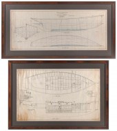 PAIR OF STERLING BURGESS SHIP PLANS EARL
[more like this]
PAIR OF STERLING BURGESS SHIP PLANS EARL
[more like this]
This list is limited to only a few results.
Many more items are available to our members in our
Price Guide!
Ideal research tools for Collectors, Personal Property Appraisers, Antiques & Collectibles
Dealers, Auction Houses, Museums, eBayers or
other online
sellers (Rubylane, Etsy etc) and curious minds interested in appraising & identifying collectibles

EASY. FAST. ACCURATE.
Research at its best

Our research tools include:


