Pricing Guides & Dictionary of Makers Marks for Antiques & Collectibles
Appraise and find values for
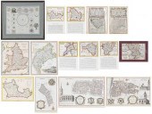
Set of Three Maps, depicting \"San...
From
marks4antiques.com
- The most updated price guide and makers' marks research online
As a member, you have access to a team of experts
and assistance is always available to you for free
An example from the millions of items in our Price Guide:
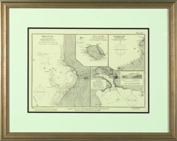
Set of Three Maps, depicting \"San Juan, Porto Rico\", sight 18\" x 28-1/4\"; Mayaguez Bay\", sight 13\" x 19\"; and \"Porto Rico\", sight 23-1/4\" x...
This is an example from our
values4antiques price guide
We do not buy or sell any items
See more price guides
Check our other research services:
IDENTIFY WORLDWIDE MAKERS' MARKS & HALLMARKS
marks4ceramics:
Porcelain, Pottery, Chinaware, Figurines, Dolls, Vases...
marks4silver
:
Silver, Jewelry, Pewter, Silverplate, Copper & Bronze...
Explore other items from our
Antiques & Collectibles Price Guide
-
 A Very Large Collection of Maps, 19th/e
[more like this]
A Very Large Collection of Maps, 19th/e
[more like this]
-
 111 WALKING LIBERTY HALF 1/2 DOLLARS111
[more like this]
111 WALKING LIBERTY HALF 1/2 DOLLARS111
[more like this]
-
 104 MERCURY AND ROOSEVELT DIMESMercury D
[more like this]
104 MERCURY AND ROOSEVELT DIMESMercury D
[more like this]
-
 A LATE MEXICAN-AMERICAN WAR ERA MAP, "MA
[more like this]
A LATE MEXICAN-AMERICAN WAR ERA MAP, "MA
[more like this]
-
 EMILY DE CANTEBRANA EDWARDS (TEXAS, 1888
[more like this]
EMILY DE CANTEBRANA EDWARDS (TEXAS, 1888
[more like this]
-
 2 FRAMED 18TH C. FADEN MAPS - GREECE & D
[more like this]
2 FRAMED 18TH C. FADEN MAPS - GREECE & D
[more like this]
-
 MITCHELL. A NEW UNIVERSAL ATLAS CONTAINI
[more like this]
MITCHELL. A NEW UNIVERSAL ATLAS CONTAINI
[more like this]
-
 4 vols. (Pennsylvania Property Atlases
[more like this]
4 vols. (Pennsylvania Property Atlases
[more like this]
-
 1 vol. (Philadelphia Atlas.) Smedley, S
[more like this]
1 vol. (Philadelphia Atlas.) Smedley, S
[more like this]
-
 DU HALDE, Jean-Baptiste, (French, 1674-1
[more like this]
DU HALDE, Jean-Baptiste, (French, 1674-1
[more like this]
-
 HENRY MOUZON - MAP OF NORTH AND SOUTH CA
[more like this]
HENRY MOUZON - MAP OF NORTH AND SOUTH CA
[more like this]
-
 AN ANTIQUE MAP, "CARTE DES VARIATIONS DE
[more like this]
AN ANTIQUE MAP, "CARTE DES VARIATIONS DE
[more like this]
-
 8 TENNESSEE MILITARY & SURVEY MAPSAssort
[more like this]
8 TENNESSEE MILITARY & SURVEY MAPSAssort
[more like this]
-
 GRP: MODERN AND CONTEMPORARY ART BOOKSLa
[more like this]
GRP: MODERN AND CONTEMPORARY ART BOOKSLa
[more like this]
-
 MAPS: JOHN SPEED (ENGLAND, 1552-1629), T
[more like this]
MAPS: JOHN SPEED (ENGLAND, 1552-1629), T
[more like this]
-
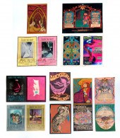 10 PIECE COLLECTION OF VINTAGE CONCERT F
[more like this]
10 PIECE COLLECTION OF VINTAGE CONCERT F
[more like this]
-
 A Large Collection of Maps of America,
[more like this]
A Large Collection of Maps of America,
[more like this]
-
 5 CIVIL WAR RELATED BOOKS1st item: Hopki
[more like this]
5 CIVIL WAR RELATED BOOKS1st item: Hopki
[more like this]
-
 2 vols. (Philadelphia Property Atlases.
[more like this]
2 vols. (Philadelphia Property Atlases.
[more like this]
-
 7 vols. Cartography: Brown, Lloyd A. Th
[more like this]
7 vols. Cartography: Brown, Lloyd A. Th
[more like this]
-
 7 vols. Cartography - American Subjects
[more like this]
7 vols. Cartography - American Subjects
[more like this]
-
 1782 Thomas Kitchen atlas, A General Atl
[more like this]
1782 Thomas Kitchen atlas, A General Atl
[more like this]
-
 Military Maps Illustrating the Operation
[more like this]
Military Maps Illustrating the Operation
[more like this]
-
 THE LIFE OF GEORGE WASHINGTON, BY JOHN M
[more like this]
THE LIFE OF GEORGE WASHINGTON, BY JOHN M
[more like this]
-
 6 MISSISSIPPI AND TENNESSEE RIVER MAPSSi
[more like this]
6 MISSISSIPPI AND TENNESSEE RIVER MAPSSi
[more like this]
-
 5 CIVIL WAR MAPSLot of five Civil War ma
[more like this]
5 CIVIL WAR MAPSLot of five Civil War ma
[more like this]
-
 MAPS: JOHN MARSHALL "THE LIFE OF GEORGE
[more like this]
MAPS: JOHN MARSHALL "THE LIFE OF GEORGE
[more like this]
-
 (5) TEXAS MAPS, 1850'S<br>(lot of 5
[more like this]
(5) TEXAS MAPS, 1850'S<br>(lot of 5
[more like this]
-
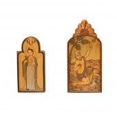 CATHERINE ROBLES-SHAW, PAIR OF RETABLOS:
[more like this]
CATHERINE ROBLES-SHAW, PAIR OF RETABLOS:
[more like this]
-
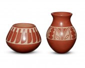 TWO SAN ILDEFONSO PUEBLO POTTERY VESSELS
[more like this]
TWO SAN ILDEFONSO PUEBLO POTTERY VESSELS
[more like this]
-
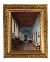 Sunlit Corridor Guanajuato by Eugenio La
[more like this]
Sunlit Corridor Guanajuato by Eugenio La
[more like this]
-
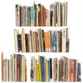
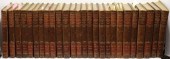 26 LEATHER BOUND VOLUME SET, QUARTO, TIT
[more like this]
26 LEATHER BOUND VOLUME SET, QUARTO, TIT
[more like this]
-
 7 EARLY TENNESSEE GEOLOGICAL REPORTS, IN
[more like this]
7 EARLY TENNESSEE GEOLOGICAL REPORTS, IN
[more like this]
-
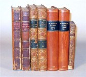 7 vols. French & British Travelers in A
[more like this]
7 vols. French & British Travelers in A
[more like this]
-
 GROUP OF 14 MAPS OF GREAT BRITAIN, FRAME
[more like this]
GROUP OF 14 MAPS OF GREAT BRITAIN, FRAME
[more like this]
-
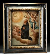 FRAMED SPANISH COLONIAL PAINTING SAN FRA
[more like this]
FRAMED SPANISH COLONIAL PAINTING SAN FRA
[more like this]
This list is limited to only a few results.
Many more items are available to our members in our
Price Guide!
Ideal research tools for Collectors, Personal Property Appraisers, Antiques & Collectibles
Dealers, Auction Houses, Museums, eBayers or
other online
sellers (Rubylane, Etsy etc) and curious minds interested in appraising & identifying collectibles

EASY. FAST. ACCURATE.
Research at its best

Our research tools include:


