Pricing Guides & Dictionary of Makers Marks for Antiques & Collectibles
Appraise and find values for
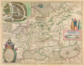
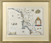
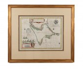
WILLEM BLAEU - MAP OF VIRGINIA...
From
marks4antiques.com
- The most updated price guide and makers' marks research online
As a member, you have access to a team of experts
and assistance is always available to you for free
An example from the millions of items in our Price Guide:
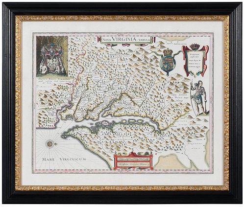
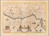
WILLEM BLAEU - MAP OF VIRGINIA AND CHESAPEAKE REGIONWillem Janszoon Blaeu, Nova Virginiae Tabula , Amsterdam, circa 1642, original engraving by Jodocus...
This is an example from our
values4antiques price guide
We do not buy or sell any items
See more price guides
Check our other research services:
IDENTIFY WORLDWIDE MAKERS' MARKS & HALLMARKS
marks4ceramics:
Porcelain, Pottery, Chinaware, Figurines, Dolls, Vases...
marks4silver
:
Silver, Jewelry, Pewter, Silverplate, Copper & Bronze...
Explore other items from our
Antiques & Collectibles Price Guide
-
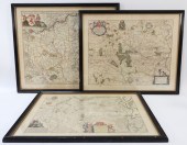
 BRITANNIA, VOL. I & II CAMDEN 1722Camden
[more like this]
BRITANNIA, VOL. I & II CAMDEN 1722Camden
[more like this]
-
 A COMPLETE SYSTEM OF GEOGRAPHY, VOL. I B
[more like this]
A COMPLETE SYSTEM OF GEOGRAPHY, VOL. I B
[more like this]
-
 IMPORTANT ANTIQUE ATLAS DU VOYAGE DE LA
[more like this]
IMPORTANT ANTIQUE ATLAS DU VOYAGE DE LA
[more like this]
-
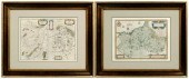
 5 KENTUCKY AND TENNESSEE MAPS1st item: "
[more like this]
5 KENTUCKY AND TENNESSEE MAPS1st item: "
[more like this]
-
 17TH C. DUTCH MAP - REGNO DI NAPOLI - BY
[more like this]
17TH C. DUTCH MAP - REGNO DI NAPOLI - BY
[more like this]
-
 A RARE ANTIQUE CIVIL WAR ERA MAP, "PRESS
[more like this]
A RARE ANTIQUE CIVIL WAR ERA MAP, "PRESS
[more like this]
-
 3 KY & TN MAPS: VANCE, TANNER, JOHNSON1s
[more like this]
3 KY & TN MAPS: VANCE, TANNER, JOHNSON1s
[more like this]
-
 GRP: 5 MAPS OF BRAZIL BLAEU BELLIN KITCH
[more like this]
GRP: 5 MAPS OF BRAZIL BLAEU BELLIN KITCH
[more like this]
-
 4 TN & KY MAPS, 3 FRAMED1st item: "Tenne
[more like this]
4 TN & KY MAPS, 3 FRAMED1st item: "Tenne
[more like this]
-
 Joseph Hubert Diss Debar Sketchbook Jose
[more like this]
Joseph Hubert Diss Debar Sketchbook Jose
[more like this]
-
 8 TENNESSEE MILITARY & SURVEY MAPSAssort
[more like this]
8 TENNESSEE MILITARY & SURVEY MAPSAssort
[more like this]
-
 MAP: BLAEU, WILLEM & JOAN. "TABULA RUSSI
[more like this]
MAP: BLAEU, WILLEM & JOAN. "TABULA RUSSI
[more like this]
-
 A Very Large Collection of Maps, 19th/e
[more like this]
A Very Large Collection of Maps, 19th/e
[more like this]
-
 3PC ANTIQUE MAPS OF GERMANY Netherlands,
[more like this]
3PC ANTIQUE MAPS OF GERMANY Netherlands,
[more like this]
-
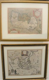 WILLEM BLAEU "INDIA QUAE ORIENTALIS DICT
[more like this]
WILLEM BLAEU "INDIA QUAE ORIENTALIS DICT
[more like this]
-
 A TOPOGRAPHICAL MAP OF THE ENVIRONS OF L
[more like this]
A TOPOGRAPHICAL MAP OF THE ENVIRONS OF L
[more like this]
-
 11 PC. MAP COLLECTION: Comprising; 1- La
[more like this]
11 PC. MAP COLLECTION: Comprising; 1- La
[more like this]
-
 16TH / 18TH C. EUROPEAN MAPS OF NEW SPAI
[more like this]
16TH / 18TH C. EUROPEAN MAPS OF NEW SPAI
[more like this]
-
 BLAEU, MORTIER, VISSCHER - THREE MAPS OF
[more like this]
BLAEU, MORTIER, VISSCHER - THREE MAPS OF
[more like this]
-
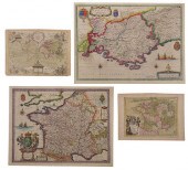 BLAEU, LE ROUGE - THREE MAPS OF FRANCE,
[more like this]
BLAEU, LE ROUGE - THREE MAPS OF FRANCE,
[more like this]
-
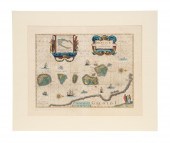 WILLEM BLAEU HAND COLORED MAP "SPICE ISL
[more like this]
WILLEM BLAEU HAND COLORED MAP "SPICE ISL
[more like this]
-
 MAP: "TERRITORIO DI VERONA", 1640, BY WI
[more like this]
MAP: "TERRITORIO DI VERONA", 1640, BY WI
[more like this]
-
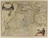
 WILLEM BLAEU, DUTCH 1571-1638, MAP OF GU
[more like this]
WILLEM BLAEU, DUTCH 1571-1638, MAP OF GU
[more like this]
-
 EARLY MAP, NOVA BELGICA ET ANGLIA NOVA,
[more like this]
EARLY MAP, NOVA BELGICA ET ANGLIA NOVA,
[more like this]
-
 A LATE MEXICAN-AMERICAN WAR ERA MAP, "MA
[more like this]
A LATE MEXICAN-AMERICAN WAR ERA MAP, "MA
[more like this]
-
 AN IMPORTANT REPUBLIC OF TEXAS MAP, "MAP
[more like this]
AN IMPORTANT REPUBLIC OF TEXAS MAP, "MAP
[more like this]
-
 AN ANTIQUE RECONSTRUCTION ERA MAP, "KOSS
[more like this]
AN ANTIQUE RECONSTRUCTION ERA MAP, "KOSS
[more like this]
-
 3 19TH CENT. AL, KY, & TN MAPS1st item:
[more like this]
3 19TH CENT. AL, KY, & TN MAPS1st item:
[more like this]
-
 MAP AND ATLAS LOT, 3 PCS INCL. MELISH DI
[more like this]
MAP AND ATLAS LOT, 3 PCS INCL. MELISH DI
[more like this]
-
 5 CIVIL WAR MAPSLot of five Civil War ma
[more like this]
5 CIVIL WAR MAPSLot of five Civil War ma
[more like this]
-
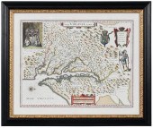 WILLEM BLAEU - MAP OF VIRGINIA AND CHESA
[more like this]
WILLEM BLAEU - MAP OF VIRGINIA AND CHESA
[more like this]
-
 Confederate Order Book 1st Virginia Regi
[more like this]
Confederate Order Book 1st Virginia Regi
[more like this]
-
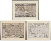
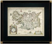 17th century map of Iceland, "Tabul
[more like this]
17th century map of Iceland, "Tabul
[more like this]
-
 Three 17th century European maps: two Fr
[more like this]
Three 17th century European maps: two Fr
[more like this]
-
 AFTER WILLEM BLAEU STRAITS OF MAGELLAN E
[more like this]
AFTER WILLEM BLAEU STRAITS OF MAGELLAN E
[more like this]
-
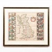 WILLEM BLAEU, MAP OF GREAT BRITAIN, FRAM
[more like this]
WILLEM BLAEU, MAP OF GREAT BRITAIN, FRAM
[more like this]
This list is limited to only a few results.
Many more items are available to our members in our
Price Guide!
Ideal research tools for Collectors, Personal Property Appraisers, Antiques & Collectibles
Dealers, Auction Houses, Museums, eBayers or
other online
sellers (Rubylane, Etsy etc) and curious minds interested in appraising & identifying collectibles

EASY. FAST. ACCURATE.
Research at its best

Our research tools include:


