Pricing Guides & Dictionary of Makers Marks for Antiques & Collectibles

A few examples of appraisal values for
SOUTH SEA
Search our price guide for your own treasures
-
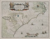 17th Century Map of the Southeast
 "Virginiae partis australis, et Floridae partis orientalis...," by Willem Blaeu, after Mercator and Hondius, from Blaeu's Theatre du Monde ou Nouvel Atlas, Amsterdam, 1640, showing the coastline and interior from Chesapeake Bay to Northern Florida with coats-of-arms in interior representing English and French regional claims, elaborate hand-colored title cartouche with six Native Americans, scale vignette with two cherubs, Latin text verso, hand colored, on laid paper, 15-1/4 x 19-1/2 in.; in modern painted wood frame,
17th Century Map of the Southeast
17th Century Map of the Southeast "Virginiae partis australis, et Floridae partis orientalis...," by Willem Blaeu, after Mercator and Hondius, from Blaeu's Theatre du Monde ou Nouvel Atlas, Amsterdam, 1640, showing the coastline and interior from Chesapeake Bay to Northern Florida with coats-of-arms in interior representing English and French regional claims, elaborate hand-colored title cartouche with six Native Americans, scale vignette with two cherubs, Latin text verso, hand colored, on laid paper, 15-1/4 x 19-1/2 in.; in modern painted wood frame, -
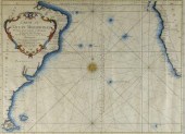 SEA FARING MAP, ATLANTIC OCEAN,
 1746A map (folds), "Carte De L’Océan Méridional", by M. Bellin, Marine Engineer. A very interesting sea faring map delineating the major navigational routes between southern Africa and South America. Hand coloured with a decorative central compass rose and dated 1746. Framed. 13 3/8" x 17 3/4".
SEA FARING MAP, ATLANTIC OCEAN,
SEA FARING MAP, ATLANTIC OCEAN, 1746A map (folds), "Carte De L’Océan Méridional", by M. Bellin, Marine Engineer. A very interesting sea faring map delineating the major navigational routes between southern Africa and South America. Hand coloured with a decorative central compass rose and dated 1746. Framed. 13 3/8" x 17 3/4". -
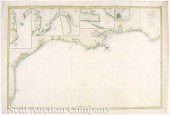 [Spanish Sea Chart of Coasts of
 Texas and Louisiana] "Seno Mejicano Hoja II. Parte Setentrional..." 1867 hand-colored engraving by T. Bryant Direccion de Hidrografia Madrid (with their embossed stamp) showing the coasts of Texas Louisiana Mississippi Alabama and Western Florida; with inset maps of Matagorda Bay Galveston Bay the mouth of the Sabine River Biloxi Bay and San Luis Pass; with lighthouses highlighted sheet 26 1/4 in. x 40 1/4 in.
[Spanish Sea Chart of Coasts of
[Spanish Sea Chart of Coasts of Texas and Louisiana] "Seno Mejicano Hoja II. Parte Setentrional..." 1867 hand-colored engraving by T. Bryant Direccion de Hidrografia Madrid (with their embossed stamp) showing the coasts of Texas Louisiana Mississippi Alabama and Western Florida; with inset maps of Matagorda Bay Galveston Bay the mouth of the Sabine River Biloxi Bay and San Luis Pass; with lighthouses highlighted sheet 26 1/4 in. x 40 1/4 in. -
 South Sea Island carving
 possibly functions as a giant ladle multi figural handle carved cup with face broken piece at top (detached but included) 41'' l. cup 6 3/4'' dia.
South Sea Island carving
South Sea Island carving possibly functions as a giant ladle multi figural handle carved cup with face broken piece at top (detached but included) 41'' l. cup 6 3/4'' dia. -
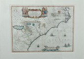 Rare early map: Southeastern United
 States coast by Willem Blaeu Amsterdam circa 1641 to 1676 VIRGINIAE PARTIS AUSTRALIS ET FLORIDAE PARTIS ORIENTALIS INTERJACENTIUMQUS REGIONUM NOVA DESCRIPTIO. Matted framed and handcolored. plate size: H15 1/4'' W20'' overall: H25 3/4'' W30'' Provenance: South Carolina private collection. With center crease; appears to be in very good original condition; not examined out of frame. Back   Inquiry    Previous Item  Next Item © Charlton Hall Auctions. Images descriptions and condition reports used on this site are original copyright material and are not to be reproduced without permission. For further information telephone 803.779.5678   © 2012 CHARLTON HALL GALLERIES INC.
Rare early map: Southeastern United
Rare early map: Southeastern United States coast by Willem Blaeu Amsterdam circa 1641 to 1676 VIRGINIAE PARTIS AUSTRALIS ET FLORIDAE PARTIS ORIENTALIS INTERJACENTIUMQUS REGIONUM NOVA DESCRIPTIO. Matted framed and handcolored. plate size: H15 1/4'' W20'' overall: H25 3/4'' W30'' Provenance: South Carolina private collection. With center crease; appears to be in very good original condition; not examined out of frame. Back   Inquiry    Previous Item  Next Item © Charlton Hall Auctions. Images descriptions and condition reports used on this site are original copyright material and are not to be reproduced without permission. For further information telephone 803.779.5678   © 2012 CHARLTON HALL GALLERIES INC. -
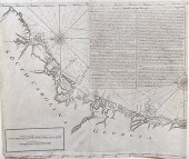 Early Sea Islands map South
 Carolina and Georgia coast London 18th century INSTRUCTIONS FOR THE COAST OF SOUTH CAROLINA GEORGIA AND THE COAST OF ST. AUGUSTIN unframed. H18 5/8'' W21 1/2'' Provenance: South Carolina private collection. Lower section rebuilt; two leaves have been joined at center; tab at top edge with tear extending into margin; some discoloration consistent with age. Back   Inquiry    Previous Item  Next Item © Charlton Hall Auctions. Images descriptions and condition reports used on this site are original copyright material and are not to be reproduced without permission. For further information telephone 803.779.5678   © 2012 CHARLTON HALL GALLERIES INC.
Early Sea Islands map South
Early Sea Islands map South Carolina and Georgia coast London 18th century INSTRUCTIONS FOR THE COAST OF SOUTH CAROLINA GEORGIA AND THE COAST OF ST. AUGUSTIN unframed. H18 5/8'' W21 1/2'' Provenance: South Carolina private collection. Lower section rebuilt; two leaves have been joined at center; tab at top edge with tear extending into margin; some discoloration consistent with age. Back   Inquiry    Previous Item  Next Item © Charlton Hall Auctions. Images descriptions and condition reports used on this site are original copyright material and are not to be reproduced without permission. For further information telephone 803.779.5678   © 2012 CHARLTON HALL GALLERIES INC. -
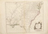 Southeastern United States map by
 D'Anville D'Anville Jean Baptiste Bourguignon. PARTIE MERIDIONALE DE LA LOUISIANE AVEC LA FLORIDE LA CAROLINE ET LA VIRGINIE. Santini and Remondini. Venice: n.d. circa 1784. With coloring. plate size: H19 3/8'' W23'' Staining along center crease; foxing to margins and verso; 1/4'' tear along center crease at top; abrasion at upper right of cartouche.
Southeastern United States map by
Southeastern United States map by D'Anville D'Anville Jean Baptiste Bourguignon. PARTIE MERIDIONALE DE LA LOUISIANE AVEC LA FLORIDE LA CAROLINE ET LA VIRGINIE. Santini and Remondini. Venice: n.d. circa 1784. With coloring. plate size: H19 3/8'' W23'' Staining along center crease; foxing to margins and verso; 1/4'' tear along center crease at top; abrasion at upper right of cartouche. -
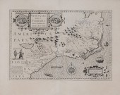 Map of the Southeast After John
 White 17th century, "Viriginiae Item et Floridae Americae Provinciarum, Nove Descriptio," by Jodocus Hondius, after maps by John White and Jacques Le Moyne, published in Mercator's Atlas Novus, Sive Descriptio Geographic..., Amsterdam, circa 1630, showing the southeastern United States to northern Florida, elaborate title cartouche depicting Native American villages, other representations of Native Americans, wildlife, sea monsters and sailing ships, Latin text verso, strong dark impression, on laid paper, 13-1/2 x 19-1/4 in. (plate),
Map of the Southeast After John
Map of the Southeast After John White 17th century, "Viriginiae Item et Floridae Americae Provinciarum, Nove Descriptio," by Jodocus Hondius, after maps by John White and Jacques Le Moyne, published in Mercator's Atlas Novus, Sive Descriptio Geographic..., Amsterdam, circa 1630, showing the southeastern United States to northern Florida, elaborate title cartouche depicting Native American villages, other representations of Native Americans, wildlife, sea monsters and sailing ships, Latin text verso, strong dark impression, on laid paper, 13-1/2 x 19-1/4 in. (plate), -
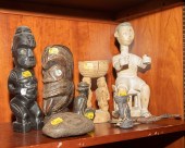 SELECTION OF SOUTH SEAS & NEW
 GUINEA WOOD CARVINGS 20th century, including two Polynesian style tiki figures; two small bowls with bird-like figures, Sepik River Valley, New Guinea; and a Javanese figure of a seated man; Together with a carved stone bearing a stylized face, 4 earthenware pipe bowls from Cameroon and a pair of Dan style ceremonial spoons, from Cote d'Ivoire.
SELECTION OF SOUTH SEAS & NEW
SELECTION OF SOUTH SEAS & NEW GUINEA WOOD CARVINGS 20th century, including two Polynesian style tiki figures; two small bowls with bird-like figures, Sepik River Valley, New Guinea; and a Javanese figure of a seated man; Together with a carved stone bearing a stylized face, 4 earthenware pipe bowls from Cameroon and a pair of Dan style ceremonial spoons, from Cote d'Ivoire. -
 SOUTH SEAS CARVED FIGURE Carved
 wood on wooden base, 35 1/2 in. H., original price tag still affixed.
SOUTH SEAS CARVED FIGURE Carved
SOUTH SEAS CARVED FIGURE Carved wood on wooden base, 35 1/2 in. H., original price tag still affixed. -
 Southeast Asia marble Guanyin,
 standing on a rocky precipice, right hand in an abhaya mudra, left hand holding a vessel, early to mid 20th century, 25 in. Minor wear, pigment and tape residue. The Estate of the Late Bobby W. Alford
Southeast Asia marble Guanyin,
Southeast Asia marble Guanyin, standing on a rocky precipice, right hand in an abhaya mudra, left hand holding a vessel, early to mid 20th century, 25 in. Minor wear, pigment and tape residue. The Estate of the Late Bobby W. Alford -
 Arnoldus Montanus Map of
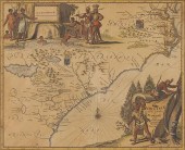
 Southeastern Coast''Virginiae partis australis et Floridae partis orientalis...Nova Descriptio '' Amsterdam 1671 a hand-colored double-page copperplate engraving showing Virginia as an English possession and South Carolina as belonging to France. Sheet: 12 3/8 x 14 9/16 in.; Plate 11 3/8'' x 14 '' in. Presented behind mat in wooden frame.Sheet 12 3/8 xLightstruck showing mat's outline; even browning; colors vibrant; a few small marginal splits.
Arnoldus Montanus Map of
Arnoldus Montanus Map of Southeastern Coast''Virginiae partis australis et Floridae partis orientalis...Nova Descriptio '' Amsterdam 1671 a hand-colored double-page copperplate engraving showing Virginia as an English possession and South Carolina as belonging to France. Sheet: 12 3/8 x 14 9/16 in.; Plate 11 3/8'' x 14 '' in. Presented behind mat in wooden frame.Sheet 12 3/8 xLightstruck showing mat's outline; even browning; colors vibrant; a few small marginal splits. -
 SHELVOCKE GEORGE A Voyage Round the
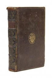
 World By Way of the Great South Sea. London: J. Senex 1726. 8vo contemporary calf with gilt-stamped dice to upper cover gilt-decorated and lettered spine red leather spine label. With five plates three fold-out. Rubbing to boards; hinges cracked; ownership stamp to title page; scattered brownspotting.
SHELVOCKE GEORGE A Voyage Round the
SHELVOCKE GEORGE A Voyage Round the World By Way of the Great South Sea. London: J. Senex 1726. 8vo contemporary calf with gilt-stamped dice to upper cover gilt-decorated and lettered spine red leather spine label. With five plates three fold-out. Rubbing to boards; hinges cracked; ownership stamp to title page; scattered brownspotting. -
 SEA COAST BY RAY ELLIS (SOUTH
 CAROLINA/MASSACHUSETTS B. 1921). Watercolor on paper signed and dated 1988 lower right. Woman gathering flowers on Monhegan Island Maine. Framed 29.5''h. 40.5''w.
SEA COAST BY RAY ELLIS (SOUTH
SEA COAST BY RAY ELLIS (SOUTH CAROLINA/MASSACHUSETTS B. 1921). Watercolor on paper signed and dated 1988 lower right. Woman gathering flowers on Monhegan Island Maine. Framed 29.5''h. 40.5''w. -
 18TH CENTURY COLORED MAP OF THE
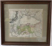
 BLACK SEA (PONTUSEUXINUS TUREIS MARE NEGRUM) IN ASIA MINOR. DATED 1743, BY JOHN MATTHEW HASIO. SHOWS SOME CREASING FROM FOLDS AND A MINOR REPAIR TO BOTTOM EDGE. NICELY FRAMED AND MATTED. SIGHT SIZE 19 1/2" X 23", OVERALL 29 3/4" X 33 1/4".
18TH CENTURY COLORED MAP OF THE
18TH CENTURY COLORED MAP OF THE BLACK SEA (PONTUSEUXINUS TUREIS MARE NEGRUM) IN ASIA MINOR. DATED 1743, BY JOHN MATTHEW HASIO. SHOWS SOME CREASING FROM FOLDS AND A MINOR REPAIR TO BOTTOM EDGE. NICELY FRAMED AND MATTED. SIGHT SIZE 19 1/2" X 23", OVERALL 29 3/4" X 33 1/4". -
 Coastal map of the Carolinas by
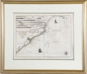
 George Louis Le Rouge Paris circa 1777 NOUVELLE CARTE DES COTES DES CAROLINES SEPTENTRIONALES ET MERIDIONALES DU CAP FEAR A SUD EDISTO as published in ATLAS AMERIQUAIN SEPTENTRIONALE. Matted framed and uncolored. plate size: H16 1/2'' W21 1/2'' Provenance: Columbia South Carolina private collection. Good overall condition; hinged at top with tape; light matteburning; few small and light spots of discoloration; center crease.
Coastal map of the Carolinas by
Coastal map of the Carolinas by George Louis Le Rouge Paris circa 1777 NOUVELLE CARTE DES COTES DES CAROLINES SEPTENTRIONALES ET MERIDIONALES DU CAP FEAR A SUD EDISTO as published in ATLAS AMERIQUAIN SEPTENTRIONALE. Matted framed and uncolored. plate size: H16 1/2'' W21 1/2'' Provenance: Columbia South Carolina private collection. Good overall condition; hinged at top with tape; light matteburning; few small and light spots of discoloration; center crease. -
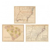 THREE EARLY MAPS OF SOUTHEASTERN
 INTEREST To include: Moll, Herman. Carolina n.p., n.d. (1729) copperplate engraving with sparse outline color, depicts North America's southeastern coast from the mouth of the Chesapeake Bay to north Florida; plus...Baldwin, Robert. A Map of Virginia, North and South Carolina, Georgia, Maryland with part of New Jersey &c.London, R. Baldwin, 1755), copperplate engraving with outline color, European expansion is clearly shown as this small map extends west of the Mississippi River; plus...Finley, Anthony. South Carolina (Philadelphia: A. Finley, n.d., circa 1820s with 20th century inscribed 1826 date), engraving with color; all maps in matching wooden frames, the verso of each affixed with a gold seal reading "Riddle's Greenville, S.C., Our 44th Year, 1910-1954."
THREE EARLY MAPS OF SOUTHEASTERN
THREE EARLY MAPS OF SOUTHEASTERN INTEREST To include: Moll, Herman. Carolina n.p., n.d. (1729) copperplate engraving with sparse outline color, depicts North America's southeastern coast from the mouth of the Chesapeake Bay to north Florida; plus...Baldwin, Robert. A Map of Virginia, North and South Carolina, Georgia, Maryland with part of New Jersey &c.London, R. Baldwin, 1755), copperplate engraving with outline color, European expansion is clearly shown as this small map extends west of the Mississippi River; plus...Finley, Anthony. South Carolina (Philadelphia: A. Finley, n.d., circa 1820s with 20th century inscribed 1826 date), engraving with color; all maps in matching wooden frames, the verso of each affixed with a gold seal reading "Riddle's Greenville, S.C., Our 44th Year, 1910-1954." -
 DE BRAHM - MAP OF SOUTH CAROLINA,
 1780William Gerard De Brahm (1718-1799), A Map of South Carolina And a Part of Georgia. Containing the Whole Sea Coast; all the Islands, Inlets, Rivers, Creeks, Parishes, Townships, Boroughs, Roads, and Bridges... , London, published by William Faden (1749-1836), with additions and revisions by John Stuart (1718-1779), second edition, in two sheets (lower half of total four sheet map), engraving on laid paper, sheet 27 x 48-1/2 in.; carved and gilt wood frame, 29-3/4 x 51-1/4 in. Provenance: Private Collection, Georgia Condition: tacked in at edges, slightly misaligned along center join line, trimmed to plate line, area of spotting/mold at left side, some areas of light foxing throughout, some very light toning and staining, handling creases; frame with light wear and abrasions
DE BRAHM - MAP OF SOUTH CAROLINA,
DE BRAHM - MAP OF SOUTH CAROLINA, 1780William Gerard De Brahm (1718-1799), A Map of South Carolina And a Part of Georgia. Containing the Whole Sea Coast; all the Islands, Inlets, Rivers, Creeks, Parishes, Townships, Boroughs, Roads, and Bridges... , London, published by William Faden (1749-1836), with additions and revisions by John Stuart (1718-1779), second edition, in two sheets (lower half of total four sheet map), engraving on laid paper, sheet 27 x 48-1/2 in.; carved and gilt wood frame, 29-3/4 x 51-1/4 in. Provenance: Private Collection, Georgia Condition: tacked in at edges, slightly misaligned along center join line, trimmed to plate line, area of spotting/mold at left side, some areas of light foxing throughout, some very light toning and staining, handling creases; frame with light wear and abrasions -
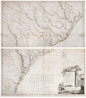 DE BRAHM/FADEN - MAP OF SOUTH
 CAROLINA, 1780A Map of South Carolina And a Part of Georgia. Containing the Whole Sea Coast; all the Islands, Inlets, Rivers, Creeks, Parishes, Townships, Boroughs, Roads, and Bridges... , London, published by William Faden (1749-1836), 1780, second edition of De Brahm's 1757 map with additions and revisions by John Stuart (1718-1779), in four sheets, engraving on laid paper with minimal hand colored highlights, sheets 28-1/8 x 49 in. and 27-7/8 x 50-3/8 in. Condition: laid down on two separate sheets of wove paper backing, some staining and losses to paper throughout (especially along fold lines), light wear to edges
DE BRAHM/FADEN - MAP OF SOUTH
DE BRAHM/FADEN - MAP OF SOUTH CAROLINA, 1780A Map of South Carolina And a Part of Georgia. Containing the Whole Sea Coast; all the Islands, Inlets, Rivers, Creeks, Parishes, Townships, Boroughs, Roads, and Bridges... , London, published by William Faden (1749-1836), 1780, second edition of De Brahm's 1757 map with additions and revisions by John Stuart (1718-1779), in four sheets, engraving on laid paper with minimal hand colored highlights, sheets 28-1/8 x 49 in. and 27-7/8 x 50-3/8 in. Condition: laid down on two separate sheets of wove paper backing, some staining and losses to paper throughout (especially along fold lines), light wear to edges -
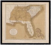 19th century map of the
 southeast, "A New Map of Part of the United States of North America, containing the Carolinas and Georgia. Also the Floridas and part of the Bahama islands, &c.", by John Cary, published in Cary's New Universal Atlas…, London, 1808, showing the southeastern United States with Florida divided into "East Florida" and "West Florida", hand-colored engraving on wove paper, 20-1/2 x 23-1/2 in.; modern wood frame. Probably laid down on acidic card, toning, light foxing, stains, fading, possible repaired tear along entire bottom margin (partially affecting plate mark), not examined out of frame; frame with abrasions. Estate of the Late Nathan and Mary Anne McCarley, Asheville, North Carolina.
19th century map of the
19th century map of the southeast, "A New Map of Part of the United States of North America, containing the Carolinas and Georgia. Also the Floridas and part of the Bahama islands, &c.", by John Cary, published in Cary's New Universal Atlas…, London, 1808, showing the southeastern United States with Florida divided into "East Florida" and "West Florida", hand-colored engraving on wove paper, 20-1/2 x 23-1/2 in.; modern wood frame. Probably laid down on acidic card, toning, light foxing, stains, fading, possible repaired tear along entire bottom margin (partially affecting plate mark), not examined out of frame; frame with abrasions. Estate of the Late Nathan and Mary Anne McCarley, Asheville, North Carolina. -
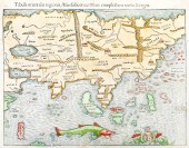 Sebastian Munster, 'India Extrema'.
 1550. Hand-colored early Ptolomaeic style map of Asia. Image measures 10x13.25'' with overall page measurement of 11.75 x 14.5''. Adhered to backing paper at top left corner. Some stains and discoloration throughout and several worm holes in upper left corner, small tear in margin above word 'regionis' at top.
Sebastian Munster, 'India Extrema'.
Sebastian Munster, 'India Extrema'. 1550. Hand-colored early Ptolomaeic style map of Asia. Image measures 10x13.25'' with overall page measurement of 11.75 x 14.5''. Adhered to backing paper at top left corner. Some stains and discoloration throughout and several worm holes in upper left corner, small tear in margin above word 'regionis' at top. -
 Beyond the Java Sea: Art of
 Indonesia's Outer Islands. Taylor, Paul Michael and Lorraine V. Aragon. Beyond the Java Sea, art of Indonesia's outer islands. Published by National Museum of Natural History / Abrams, New York, 1991. Approx L30 x 23cm. PROVENANCE Ex Eric Coote Collection, New South Wales. (1)
Beyond the Java Sea: Art of
Beyond the Java Sea: Art of Indonesia's Outer Islands. Taylor, Paul Michael and Lorraine V. Aragon. Beyond the Java Sea, art of Indonesia's outer islands. Published by National Museum of Natural History / Abrams, New York, 1991. Approx L30 x 23cm. PROVENANCE Ex Eric Coote Collection, New South Wales. (1) -
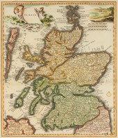 SEALIAN MAP OF "SCOZIA"
 Hand-colored engraving with mermaids, sea birds, shells and coral in upper left.
SEALIAN MAP OF "SCOZIA"
SEALIAN MAP OF "SCOZIA" Hand-colored engraving with mermaids, sea birds, shells and coral in upper left. -
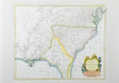 Rare early map: Southeastern United
 States Pietro Santini Venice circa 1776 PARTIE MERIDIONALE DE LA LOUISIANE AVEC LA FLORIDAE LA CAROLINE ET LA VIRGINIE PAR LE S. D ANVILLE as published in ATLAS UNIVERSEL DRESSÉ SUR LES MEILLEURS CARTES MODERNES 1784 edition. Handcolored matted and framed. plate size: H19 1/4'' W23'' overall: H29 1/4'' W33'' Provenance: South Carolina private collection. Vertical crease at center; small tear at top; light discoloration throughout; light stain at top left; not examined out of frame. Back   Inquiry    Previous Item  Next Item © Charlton Hall Auctions. Images descriptions and condition reports used on this site are original copyright material and are not to be reproduced without permission. For further information telephone 803.779.5678   © 2012 CHARLTON HALL GALLERIES INC.
Rare early map: Southeastern United
Rare early map: Southeastern United States Pietro Santini Venice circa 1776 PARTIE MERIDIONALE DE LA LOUISIANE AVEC LA FLORIDAE LA CAROLINE ET LA VIRGINIE PAR LE S. D ANVILLE as published in ATLAS UNIVERSEL DRESSÉ SUR LES MEILLEURS CARTES MODERNES 1784 edition. Handcolored matted and framed. plate size: H19 1/4'' W23'' overall: H29 1/4'' W33'' Provenance: South Carolina private collection. Vertical crease at center; small tear at top; light discoloration throughout; light stain at top left; not examined out of frame. Back   Inquiry    Previous Item  Next Item © Charlton Hall Auctions. Images descriptions and condition reports used on this site are original copyright material and are not to be reproduced without permission. For further information telephone 803.779.5678   © 2012 CHARLTON HALL GALLERIES INC. -
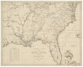 19th century map of the
 Southeast, "Southern Section of the United States including Florida & C.", based on 1816 map by John Melish, showing from the eastern seaboard into Missouri Territory, from Atlas til Friherre Klinckowstromo Bref om de Forente Staterne, by A.L. Klinckowstrom, Sweden, 1824, copper engraving on laid paper with watermarks, 17 x 20-1/2 in. (page). Loose, trimmed including some plate marks, toning, soiling, stains, creases, minor tears and losses at margins, pencil inscriptions lower left, cellophane tape verso.
19th century map of the
19th century map of the Southeast, "Southern Section of the United States including Florida & C.", based on 1816 map by John Melish, showing from the eastern seaboard into Missouri Territory, from Atlas til Friherre Klinckowstromo Bref om de Forente Staterne, by A.L. Klinckowstrom, Sweden, 1824, copper engraving on laid paper with watermarks, 17 x 20-1/2 in. (page). Loose, trimmed including some plate marks, toning, soiling, stains, creases, minor tears and losses at margins, pencil inscriptions lower left, cellophane tape verso. -
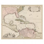 NICHOLAS VISSCHER, INSULAE
 AMERICANAE IN OCEANO SEPTENTRIONALI... ...ac Regiones Adjacentes, late 17th century, copperplate engraving with hand color, depicting the Caribbean and adjacent lands in North, South, and Central America; presented behind glass in mat within black wooden frame having a gilt liner.
NICHOLAS VISSCHER, INSULAE
NICHOLAS VISSCHER, INSULAE AMERICANAE IN OCEANO SEPTENTRIONALI... ...ac Regiones Adjacentes, late 17th century, copperplate engraving with hand color, depicting the Caribbean and adjacent lands in North, South, and Central America; presented behind glass in mat within black wooden frame having a gilt liner. -
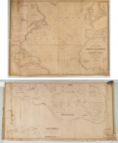 TWO SEA CHARTS Comprising: 1)
 "GENERAL CHART OF THE NORTH ATLANTIC, OR WESTERN OCEAN" (London: Imray, 1855) With an old linen repair on verso; and 2) "A CHART OF THE COAST OF BRAZIL, ETC & SEA FROM THE RIVER PARA TO BUENOS AYRES" (London: Wilson, 1861). Both are laid on cartridge paper at the time of manufacture.
TWO SEA CHARTS Comprising: 1)
TWO SEA CHARTS Comprising: 1) "GENERAL CHART OF THE NORTH ATLANTIC, OR WESTERN OCEAN" (London: Imray, 1855) With an old linen repair on verso; and 2) "A CHART OF THE COAST OF BRAZIL, ETC & SEA FROM THE RIVER PARA TO BUENOS AYRES" (London: Wilson, 1861). Both are laid on cartridge paper at the time of manufacture. -
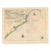 LE ROUGE SEA CHART OF THE
 CAROLINA COAST FROM CAPE FEAR TO SOUTH EDISTO Pocock, Nicholas. Nouvelle Carte Des Cotes Des Caroline (Paris: Chez Le Rouge, 1777), copperplate engraving with outline color, the map as published by George Le Rouge in his celebrated Atlas Amériquain Septentrionale.
LE ROUGE SEA CHART OF THE
LE ROUGE SEA CHART OF THE CAROLINA COAST FROM CAPE FEAR TO SOUTH EDISTO Pocock, Nicholas. Nouvelle Carte Des Cotes Des Caroline (Paris: Chez Le Rouge, 1777), copperplate engraving with outline color, the map as published by George Le Rouge in his celebrated Atlas Amériquain Septentrionale. -
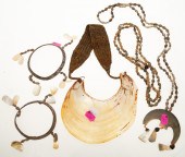 COLLECTION OF SOUTH SEA SHELLS &
 SEED JEWELRY Including three necklaces and two bracelets.
COLLECTION OF SOUTH SEA SHELLS &
COLLECTION OF SOUTH SEA SHELLS & SEED JEWELRY Including three necklaces and two bracelets. -
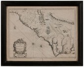 17th Century Map of the Carolinas
 "A New Description of Carolina", by John Speed, London, 1676, published by Basset and Chiswell, showing the coastline and interior with towns, waterways, and natural landmarks, including several nonexistent geographical features, on laid paper with English text verso, 15 x 20 in. (plate), modern wood frame,
17th Century Map of the Carolinas
17th Century Map of the Carolinas "A New Description of Carolina", by John Speed, London, 1676, published by Basset and Chiswell, showing the coastline and interior with towns, waterways, and natural landmarks, including several nonexistent geographical features, on laid paper with English text verso, 15 x 20 in. (plate), modern wood frame, -
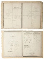 GROUP OF MAPS OF PARTS OF
 SUMATRA[Maps] Dalrymple, Alexander. Group of Maps of Parts of Sumatra. London, 1774. Five panels, bearing copper engravings, including plans of Lampoon Bay, Mew Bay, Billimbing Bay, Harbour of Se Laubo Laubo, and Three Bays on the Island Good-Fortune. Each 8 _ x 11 _”. Generally fine condition with a few light scuffs.
GROUP OF MAPS OF PARTS OF
GROUP OF MAPS OF PARTS OF SUMATRA[Maps] Dalrymple, Alexander. Group of Maps of Parts of Sumatra. London, 1774. Five panels, bearing copper engravings, including plans of Lampoon Bay, Mew Bay, Billimbing Bay, Harbour of Se Laubo Laubo, and Three Bays on the Island Good-Fortune. Each 8 _ x 11 _”. Generally fine condition with a few light scuffs. -
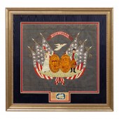 JAPANESE SILK EMBROIDERY SOUTH
 CAROLINA STATE SEAL American, early 20th century. Embroidered state seal and motto of South Carolina with figural supporters and patriotic motifs. The piece was likely with commissioned by a sailor stationed in Japan in memory of his home state. Marked below silk panel, having label inscribed "Nagasaki, Japan, H. Imamura, Embroiderer". Provenance: From the Lifetime Collection of Billy S. Arant, Jr., Chattanooga, TN. Approx. 31.25" x 32.25" (frame).
JAPANESE SILK EMBROIDERY SOUTH
JAPANESE SILK EMBROIDERY SOUTH CAROLINA STATE SEAL American, early 20th century. Embroidered state seal and motto of South Carolina with figural supporters and patriotic motifs. The piece was likely with commissioned by a sailor stationed in Japan in memory of his home state. Marked below silk panel, having label inscribed "Nagasaki, Japan, H. Imamura, Embroiderer". Provenance: From the Lifetime Collection of Billy S. Arant, Jr., Chattanooga, TN. Approx. 31.25" x 32.25" (frame). -
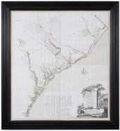 LARGE REPRODUCTION OF DEBRAHM MAP
 OF CAROLINAafter William Gerard De Brahm (German, 1717-1799), A Map of South Carolina and A Part of Georgia, Containing the Whole Sea Coast... engraver and publisher Thomas Jefferys (English, 1719-1771), decorative cartouche of scene from the indigo dye process, digital print with color, in four sheets, sight 53-3/4 x 48-1/2 in.; frame, 63-1/2 x 58-1/4 in.ÿ Provenance: Private Bluffton, South Carolina Collection Condition: light wear, creases and repairs appear to be printed, not examined out of frame; frame with light wear
LARGE REPRODUCTION OF DEBRAHM MAP
LARGE REPRODUCTION OF DEBRAHM MAP OF CAROLINAafter William Gerard De Brahm (German, 1717-1799), A Map of South Carolina and A Part of Georgia, Containing the Whole Sea Coast... engraver and publisher Thomas Jefferys (English, 1719-1771), decorative cartouche of scene from the indigo dye process, digital print with color, in four sheets, sight 53-3/4 x 48-1/2 in.; frame, 63-1/2 x 58-1/4 in.ÿ Provenance: Private Bluffton, South Carolina Collection Condition: light wear, creases and repairs appear to be printed, not examined out of frame; frame with light wear -
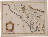 17th Century Map of the Carolinas
 "A New Description of Carolina", by John Speed, published by Basset and Chiswell, London, 1676, showing the coastline and interior with towns, waterways and other natural landmarks, including several nonexistent geographical features, hand-colored engraving on laid paper with fleur de lis watermark, English text verso, 14-13/16 x 19-13/16 in. (plate),
17th Century Map of the Carolinas
17th Century Map of the Carolinas "A New Description of Carolina", by John Speed, published by Basset and Chiswell, London, 1676, showing the coastline and interior with towns, waterways and other natural landmarks, including several nonexistent geographical features, hand-colored engraving on laid paper with fleur de lis watermark, English text verso, 14-13/16 x 19-13/16 in. (plate), -
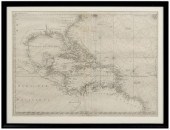 18th century map of the Americas,
 Plate 3 of "Ocean Atlantique et Mers Adjacentes en Quatre Feuilles…" by Robert Sayer, showing southeastern North America, the Gulf of Mexico, the Caribbean Islands, and northern South America, published in Pilote Americain by George Louis Le Rouge, France, 1778, copper engraving on laid paper with watermarks, page 21 x 28-1/2 in.; modern wood frame. Archival tape, earlier paper hinges still attached, toning, foxing, fading, soiling, stains, pest damage, reinforced center crease, tears and losses in margins, numerous fills and repaired tears, "56" in ink verso (probably period); frame with abrasions. Deaccessioned from MESDA and Old Salem to benefit the Acquisition Fund.
18th century map of the Americas,
18th century map of the Americas, Plate 3 of "Ocean Atlantique et Mers Adjacentes en Quatre Feuilles…" by Robert Sayer, showing southeastern North America, the Gulf of Mexico, the Caribbean Islands, and northern South America, published in Pilote Americain by George Louis Le Rouge, France, 1778, copper engraving on laid paper with watermarks, page 21 x 28-1/2 in.; modern wood frame. Archival tape, earlier paper hinges still attached, toning, foxing, fading, soiling, stains, pest damage, reinforced center crease, tears and losses in margins, numerous fills and repaired tears, "56" in ink verso (probably period); frame with abrasions. Deaccessioned from MESDA and Old Salem to benefit the Acquisition Fund. -
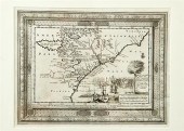 Rare early map: Southeastern United
 States coast by Pieter van der Aa circa 1714 ZEE EN LAND TOGTEN DER FRANSZEN GEDAAN NA EN IN'T AMERICAANS GEWEST VAN FLORIDA ALLER-EERST DOOR IOH. PONTIUS ONTDEKT. With second title printed below map: VOYAGES PAR MER ET PAR TERRE DES FRANCOIS DANS LA FLORIDE PREMIEREMENT DECOUVERTE PAR JEAN PONTIUS. Uncolored matted and framed. plate size: H8 3/4'' W11 1/2'' overall: H18'' W20 1/2'' Provenance: South Carolina private collection. Center vertical crease; three small creases in lower half (possible paper flaws); mended tear at lower right corner from edge running through the word ''plus.'' Not examined out of frame. Back   Inquiry    Previous Item  Next Item © Charlton Hall Auctions. Images descriptions and condition reports used on this site are original copyright material and are not to be reproduced without permission. For further information telephone 803.779.5678   © 2012 CHARLTON HALL GALLERIES INC.
Rare early map: Southeastern United
Rare early map: Southeastern United States coast by Pieter van der Aa circa 1714 ZEE EN LAND TOGTEN DER FRANSZEN GEDAAN NA EN IN'T AMERICAANS GEWEST VAN FLORIDA ALLER-EERST DOOR IOH. PONTIUS ONTDEKT. With second title printed below map: VOYAGES PAR MER ET PAR TERRE DES FRANCOIS DANS LA FLORIDE PREMIEREMENT DECOUVERTE PAR JEAN PONTIUS. Uncolored matted and framed. plate size: H8 3/4'' W11 1/2'' overall: H18'' W20 1/2'' Provenance: South Carolina private collection. Center vertical crease; three small creases in lower half (possible paper flaws); mended tear at lower right corner from edge running through the word ''plus.'' Not examined out of frame. Back   Inquiry    Previous Item  Next Item © Charlton Hall Auctions. Images descriptions and condition reports used on this site are original copyright material and are not to be reproduced without permission. For further information telephone 803.779.5678   © 2012 CHARLTON HALL GALLERIES INC.
...many more examples with full details are available to our members - Learn more


