Pricing Guides & Dictionary of Makers Marks for Antiques & Collectibles
Appraise and find values for
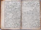
1850 BOOK OF THE WORLD W/ MAPS &...
From
marks4antiques.com
- The most updated price guide and makers' marks research online
As a member, you have access to a team of experts
and assistance is always available to you for free
An example from the millions of items in our Price Guide:
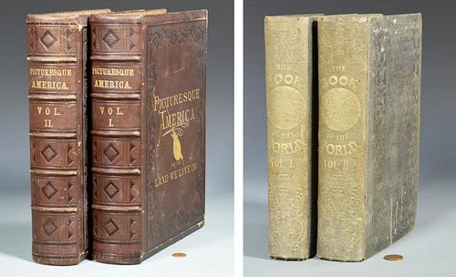
1850 BOOK OF THE WORLD W/ MAPS & SLAVE CENSUS PLUS PICT...1st item: FISHER, Richard S. The Book of the World; Being an Account of All Republics, Empires,...
This is an example from our
values4antiques price guide
We do not buy or sell any items
See more price guides
Check our other research services:
IDENTIFY WORLDWIDE MAKERS' MARKS & HALLMARKS
marks4ceramics:
Porcelain, Pottery, Chinaware, Figurines, Dolls, Vases...
marks4silver
:
Silver, Jewelry, Pewter, Silverplate, Copper & Bronze...
Explore other items from our
Antiques & Collectibles Price Guide
-
 TIME LIFE LIBRARY OF ART - 25 VOLUMES W/
[more like this]
TIME LIFE LIBRARY OF ART - 25 VOLUMES W/
[more like this]
-
 A Very Large Collection of Maps, 19th/e
[more like this]
A Very Large Collection of Maps, 19th/e
[more like this]
-
 MITCHELL. A NEW UNIVERSAL ATLAS CONTAINI
[more like this]
MITCHELL. A NEW UNIVERSAL ATLAS CONTAINI
[more like this]
-
 LARGE GROUPING OF US COIN COLLECTION SET
[more like this]
LARGE GROUPING OF US COIN COLLECTION SET
[more like this]
-
 7 EARLY TENNESSEE GEOLOGICAL REPORTS, IN
[more like this]
7 EARLY TENNESSEE GEOLOGICAL REPORTS, IN
[more like this]
-
 A RENAISSANCE MAP, "PTOLEMY MAP OF THE W
[more like this]
A RENAISSANCE MAP, "PTOLEMY MAP OF THE W
[more like this]
-
 1850 BOOK OF THE WORLD W/ MAPS & SLAVE C
[more like this]
1850 BOOK OF THE WORLD W/ MAPS & SLAVE C
[more like this]
-
 (5) TEXAS MAPS, 1850'S<br>(lot of 5
[more like this]
(5) TEXAS MAPS, 1850'S<br>(lot of 5
[more like this]
-
 4 vols. (Pennsylvania Property Atlases
[more like this]
4 vols. (Pennsylvania Property Atlases
[more like this]
-
 1 vol. (Philadelphia Atlas.) Smedley, S
[more like this]
1 vol. (Philadelphia Atlas.) Smedley, S
[more like this]
-
 DU HALDE, Jean-Baptiste, (French, 1674-1
[more like this]
DU HALDE, Jean-Baptiste, (French, 1674-1
[more like this]
-
 2 FRAMED 18TH C. FADEN MAPS - GREECE & D
[more like this]
2 FRAMED 18TH C. FADEN MAPS - GREECE & D
[more like this]
-
 HENRY MOUZON - MAP OF NORTH AND SOUTH CA
[more like this]
HENRY MOUZON - MAP OF NORTH AND SOUTH CA
[more like this]
-
 AN ANTIQUE MAP, "CARTE DES VARIATIONS DE
[more like this]
AN ANTIQUE MAP, "CARTE DES VARIATIONS DE
[more like this]
-
 6 MISSISSIPPI AND TENNESSEE RIVER MAPSSi
[more like this]
6 MISSISSIPPI AND TENNESSEE RIVER MAPSSi
[more like this]
-
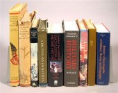
 5 CIVIL WAR RELATED BOOKS1st item: Hopki
[more like this]
5 CIVIL WAR RELATED BOOKS1st item: Hopki
[more like this]
-
 GROUP OF AFRICAN AMERICAN MILITARY HISTO
[more like this]
GROUP OF AFRICAN AMERICAN MILITARY HISTO
[more like this]
-
 A Large Collection of Maps from Around t
[more like this]
A Large Collection of Maps from Around t
[more like this]
-
 SEBASTIAN MUNSTER. COSMOGRAPHIAE UNIVERS
[more like this]
SEBASTIAN MUNSTER. COSMOGRAPHIAE UNIVERS
[more like this]
-
 8 TENNESSEE MILITARY & SURVEY MAPSAssort
[more like this]
8 TENNESSEE MILITARY & SURVEY MAPSAssort
[more like this]
-
 ANDY WARHOL (american 1928-1987) '25 C
[more like this]
ANDY WARHOL (american 1928-1987) '25 C
[more like this]
-
 CHARLES RENNIE MACKINTOSH AND MARGARET M
[more like this]
CHARLES RENNIE MACKINTOSH AND MARGARET M
[more like this]
-
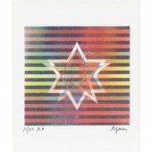 YAACOV AGAM, NEW YORK / ISRAEL / FRANCE
[more like this]
YAACOV AGAM, NEW YORK / ISRAEL / FRANCE
[more like this]
-
 A Large Collection of Maps of America,
[more like this]
A Large Collection of Maps of America,
[more like this]
-
 2 vols. (Philadelphia Property Atlases.
[more like this]
2 vols. (Philadelphia Property Atlases.
[more like this]
-
 7 vols. Cartography: Brown, Lloyd A. Th
[more like this]
7 vols. Cartography: Brown, Lloyd A. Th
[more like this]
-
 7 vols. Cartography - American Subjects
[more like this]
7 vols. Cartography - American Subjects
[more like this]
-
 1782 Thomas Kitchen atlas, A General Atl
[more like this]
1782 Thomas Kitchen atlas, A General Atl
[more like this]
-
 Military Maps Illustrating the Operation
[more like this]
Military Maps Illustrating the Operation
[more like this]
-
 THE LIFE OF GEORGE WASHINGTON, BY JOHN M
[more like this]
THE LIFE OF GEORGE WASHINGTON, BY JOHN M
[more like this]
-
 MAPS: JOHN SPEED (ENGLAND, 1552-1629), T
[more like this]
MAPS: JOHN SPEED (ENGLAND, 1552-1629), T
[more like this]
-
 5 CIVIL WAR MAPSLot of five Civil War ma
[more like this]
5 CIVIL WAR MAPSLot of five Civil War ma
[more like this]
-
 MAPS: JOHN MARSHALL "THE LIFE OF GEORGE
[more like this]
MAPS: JOHN MARSHALL "THE LIFE OF GEORGE
[more like this]
-
 MAP AND ATLAS LOT, 3 PCS INCL. MELISH DI
[more like this]
MAP AND ATLAS LOT, 3 PCS INCL. MELISH DI
[more like this]
-
 9 vols. Military History Reference & C.
[more like this]
9 vols. Military History Reference & C.
[more like this]
-
 BOOK: "MAPS, PLANS, VIEWS AND COINS, THE
[more like this]
BOOK: "MAPS, PLANS, VIEWS AND COINS, THE
[more like this]
This list is limited to only a few results.
Many more items are available to our members in our
Price Guide!
Ideal research tools for Collectors, Personal Property Appraisers, Antiques & Collectibles
Dealers, Auction Houses, Museums, eBayers or
other online
sellers (Rubylane, Etsy etc) and curious minds interested in appraising & identifying collectibles

EASY. FAST. ACCURATE.
Research at its best

Our research tools include:


