Pricing Guides & Dictionary of Makers Marks for Antiques & Collectibles
Appraise and find values for
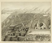
2 TOPOGRAPHICAL MAPS OF WARREN...
From
marks4antiques.com
- The most updated price guide and makers' marks research online
As a member, you have access to a team of experts
and assistance is always available to you for free
An example from the millions of items in our Price Guide:

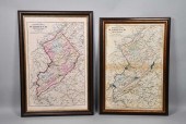
2 TOPOGRAPHICAL MAPS OF WARREN COUNTY, NEW JERSEY2 topographical maps of Warren County, New Jersey. Largest map: Sight: 23" x 15 1/4". Frame: 26 3/4" x...
This is an example from our
values4antiques price guide
We do not buy or sell any items
See more price guides
Check our other research services:
IDENTIFY WORLDWIDE MAKERS' MARKS & HALLMARKS
marks4ceramics:
Porcelain, Pottery, Chinaware, Figurines, Dolls, Vases...
marks4silver
:
Silver, Jewelry, Pewter, Silverplate, Copper & Bronze...
Explore other items from our
Antiques & Collectibles Price Guide
-
 A Very Large Collection of Maps, 19th/e
[more like this]
A Very Large Collection of Maps, 19th/e
[more like this]
-
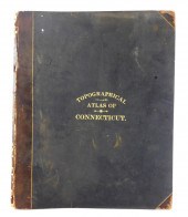 BOOK: TOPOGRAPHICAL ATLAS OF CONNECTICUT
[more like this]
BOOK: TOPOGRAPHICAL ATLAS OF CONNECTICUT
[more like this]
-
 2 TOPOGRAPHICAL MAPS OF WARREN COUNTY, N
[more like this]
2 TOPOGRAPHICAL MAPS OF WARREN COUNTY, N
[more like this]
-
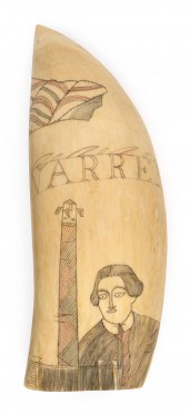 POLYCHROME SCRIMSHAW WHALE'S TOOTH PERTA
[more like this]
POLYCHROME SCRIMSHAW WHALE'S TOOTH PERTA
[more like this]
-
 2 vols. American 19th-Century State Atl
[more like this]
2 vols. American 19th-Century State Atl
[more like this]
-
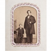 Tom Thumb's Personal Valet's CDV Album A
[more like this]
Tom Thumb's Personal Valet's CDV Album A
[more like this]
-
 8 TENNESSEE MILITARY & SURVEY MAPSAssort
[more like this]
8 TENNESSEE MILITARY & SURVEY MAPSAssort
[more like this]
-
 4 vols. (Pennsylvania Property Atlases
[more like this]
4 vols. (Pennsylvania Property Atlases
[more like this]
-
 1 vol. (Philadelphia Atlas.) Smedley, S
[more like this]
1 vol. (Philadelphia Atlas.) Smedley, S
[more like this]
-
 DU HALDE, Jean-Baptiste, (French, 1674-1
[more like this]
DU HALDE, Jean-Baptiste, (French, 1674-1
[more like this]
-
 MITCHELL. A NEW UNIVERSAL ATLAS CONTAINI
[more like this]
MITCHELL. A NEW UNIVERSAL ATLAS CONTAINI
[more like this]
-
 2 FRAMED 18TH C. FADEN MAPS - GREECE & D
[more like this]
2 FRAMED 18TH C. FADEN MAPS - GREECE & D
[more like this]
-
 HENRY MOUZON - MAP OF NORTH AND SOUTH CA
[more like this]
HENRY MOUZON - MAP OF NORTH AND SOUTH CA
[more like this]
-
 AN ANTIQUE MAP, "CARTE DES VARIATIONS DE
[more like this]
AN ANTIQUE MAP, "CARTE DES VARIATIONS DE
[more like this]
-
 A LATE MEXICAN-AMERICAN WAR ERA MAP, "MA
[more like this]
A LATE MEXICAN-AMERICAN WAR ERA MAP, "MA
[more like this]
-
 1 vol. The Official State Atlas of Kans
[more like this]
1 vol. The Official State Atlas of Kans
[more like this]
-
 TOPOGRAPHICAL AND OTHER VOLUMES
INCLUDIN
[more like this]
TOPOGRAPHICAL AND OTHER VOLUMES
INCLUDIN
[more like this]
-
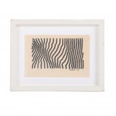 HENRY PEARSON, AMERICAN (1914-2006), UNS
[more like this]
HENRY PEARSON, AMERICAN (1914-2006), UNS
[more like this]
-
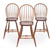
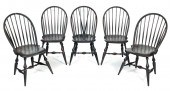 FIVE WARREN CHAIR WORKS WINDSOR CHAIRS W
[more like this]
FIVE WARREN CHAIR WORKS WINDSOR CHAIRS W
[more like this]
-
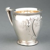 WARREN COUNTY, MISSISSIPPI COIN SILVER C
[more like this]
WARREN COUNTY, MISSISSIPPI COIN SILVER C
[more like this]
-
 THREE WARREN CHAIR WORKS WINDSOR CHAIRS
[more like this]
THREE WARREN CHAIR WORKS WINDSOR CHAIRS
[more like this]
-
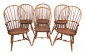
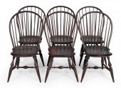 SET OF SIX WARREN CHAIR WORKS BOWBACK WI
[more like this]
SET OF SIX WARREN CHAIR WORKS BOWBACK WI
[more like this]
-
 SET OF SIX WARREN CHAIR WORKS BOW-BACK W
[more like this]
SET OF SIX WARREN CHAIR WORKS BOW-BACK W
[more like this]
-
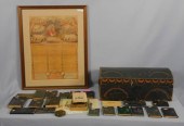 AMERICAN PINE PAINTED DOCUMENT BOX, EARL
[more like this]
AMERICAN PINE PAINTED DOCUMENT BOX, EARL
[more like this]
-
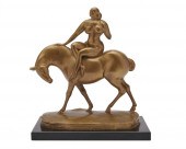 GASTON LACHAISE, (AMERICAN, 1882-1935),
[more like this]
GASTON LACHAISE, (AMERICAN, 1882-1935),
[more like this]
-
 SIX WARREN CHAIR WORKS WINDSOR CHAIRS WA
[more like this]
SIX WARREN CHAIR WORKS WINDSOR CHAIRS WA
[more like this]
-
 A Large Collection of Maps of America,
[more like this]
A Large Collection of Maps of America,
[more like this]
-
 2 vols. (Philadelphia Property Atlases.
[more like this]
2 vols. (Philadelphia Property Atlases.
[more like this]
-
 7 vols. Cartography: Brown, Lloyd A. Th
[more like this]
7 vols. Cartography: Brown, Lloyd A. Th
[more like this]
-
 7 vols. Cartography - American Subjects
[more like this]
7 vols. Cartography - American Subjects
[more like this]
-
 1782 Thomas Kitchen atlas, A General Atl
[more like this]
1782 Thomas Kitchen atlas, A General Atl
[more like this]
-
 Military Maps Illustrating the Operation
[more like this]
Military Maps Illustrating the Operation
[more like this]
-
 THE LIFE OF GEORGE WASHINGTON, BY JOHN M
[more like this]
THE LIFE OF GEORGE WASHINGTON, BY JOHN M
[more like this]
-
 MAPS: JOHN SPEED (ENGLAND, 1552-1629), T
[more like this]
MAPS: JOHN SPEED (ENGLAND, 1552-1629), T
[more like this]
-
 6 MISSISSIPPI AND TENNESSEE RIVER MAPSSi
[more like this]
6 MISSISSIPPI AND TENNESSEE RIVER MAPSSi
[more like this]
-
 5 CIVIL WAR RELATED BOOKS1st item: Hopki
[more like this]
5 CIVIL WAR RELATED BOOKS1st item: Hopki
[more like this]
This list is limited to only a few results.
Many more items are available to our members in our
Price Guide!
Ideal research tools for Collectors, Personal Property Appraisers, Antiques & Collectibles
Dealers, Auction Houses, Museums, eBayers or
other online
sellers (Rubylane, Etsy etc) and curious minds interested in appraising & identifying collectibles

EASY. FAST. ACCURATE.
Research at its best

Our research tools include:


