Pricing Guides & Dictionary of Makers Marks for Antiques & Collectibles
Appraise and find values for
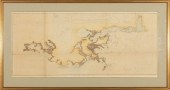
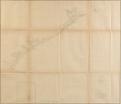
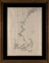
2 U.S. COAST SURVEY MAPS,...
From
marks4antiques.com
- The most updated price guide and makers' marks research online
As a member, you have access to a team of experts
and assistance is always available to you for free
An example from the millions of items in our Price Guide:
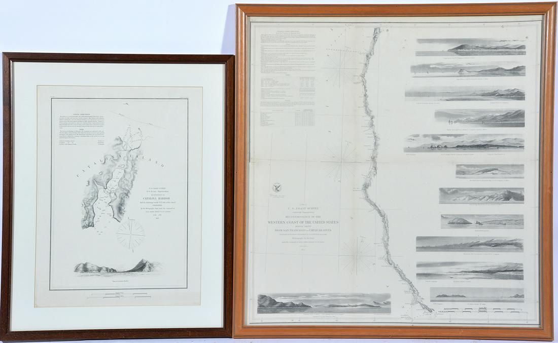
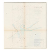
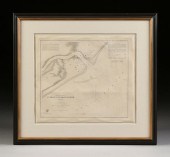
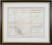
2 U.S. COAST SURVEY MAPS, CATALINA HARBOR & WEST COASTLot of two U.S. Coast Survey Maps to include: Catalina Harbor, "1852" and Reconnaissance of the...
This is an example from our
values4antiques price guide
We do not buy or sell any items
See more price guides
Check our other research services:
IDENTIFY WORLDWIDE MAKERS' MARKS & HALLMARKS
marks4ceramics:
Porcelain, Pottery, Chinaware, Figurines, Dolls, Vases...
marks4silver
:
Silver, Jewelry, Pewter, Silverplate, Copper & Bronze...
Explore other items from our
Antiques & Collectibles Price Guide
-
 8 TENNESSEE MILITARY & SURVEY MAPSAssort
[more like this]
8 TENNESSEE MILITARY & SURVEY MAPSAssort
[more like this]
-
 AN ANTIQUE SURVEY MAP, "PRELIMINARY CHAR
[more like this]
AN ANTIQUE SURVEY MAP, "PRELIMINARY CHAR
[more like this]
-
 A Very Large Collection of Maps, 19th/e
[more like this]
A Very Large Collection of Maps, 19th/e
[more like this]
-
 AN ANTIQUE SURVEY MAP, "U.S. COAST SURVE
[more like this]
AN ANTIQUE SURVEY MAP, "U.S. COAST SURVE
[more like this]
-
 AN ANTIQUE SURVEY MAP, "U.S. COAST SURVE
[more like this]
AN ANTIQUE SURVEY MAP, "U.S. COAST SURVE
[more like this]
-
 CIVIL WAR ERA U.S. COAST SURVEY CHART OF
[more like this]
CIVIL WAR ERA U.S. COAST SURVEY CHART OF
[more like this]
-
 AN ANTIQUE SURVEY MAP, "PRELIMINARY CHAR
[more like this]
AN ANTIQUE SURVEY MAP, "PRELIMINARY CHAR
[more like this]
-
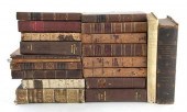
 TWO BOOKS: FIRST EDITION OF "TIME EXPOSU
[more like this]
TWO BOOKS: FIRST EDITION OF "TIME EXPOSU
[more like this]
-
 1853 MAP OF NANTUCKET HARBOR SURVEY OF T
[more like this]
1853 MAP OF NANTUCKET HARBOR SURVEY OF T
[more like this]
-
 Rare books: Ottoman Empire history and r
[more like this]
Rare books: Ottoman Empire history and r
[more like this]
-
 IMPORTANT ANTIQUE ATLAS DU VOYAGE DE LA
[more like this]
IMPORTANT ANTIQUE ATLAS DU VOYAGE DE LA
[more like this]
-
 US COAST SURVEY MAP OF THE LOUISIANA COA
[more like this]
US COAST SURVEY MAP OF THE LOUISIANA COA
[more like this]
-
 AN ANTIQUE RECONSTRUCTION ERA SURVEY MAP
[more like this]
AN ANTIQUE RECONSTRUCTION ERA SURVEY MAP
[more like this]
-
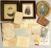 JOHN DAVIS AND FAMILY ARCHIVEArchive of
[more like this]
JOHN DAVIS AND FAMILY ARCHIVEArchive of
[more like this]
-
 4 vols. (Pennsylvania Property Atlases
[more like this]
4 vols. (Pennsylvania Property Atlases
[more like this]
-
 2 FRAMED 18TH C. FADEN MAPS - GREECE & D
[more like this]
2 FRAMED 18TH C. FADEN MAPS - GREECE & D
[more like this]
-
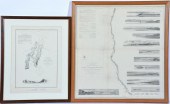 2 U.S. COAST SURVEY MAPS, CATALINA HARBO
[more like this]
2 U.S. COAST SURVEY MAPS, CATALINA HARBO
[more like this]
-
 ANTIQUE COAST SURVEY MAP OF COASTAL LOUI
[more like this]
ANTIQUE COAST SURVEY MAP OF COASTAL LOUI
[more like this]
-
 A Large Collection of Maps of America,
[more like this]
A Large Collection of Maps of America,
[more like this]
-
 US COAST SURVEY MAP CONNECTICUT & NEW YO
[more like this]
US COAST SURVEY MAP CONNECTICUT & NEW YO
[more like this]
-
 WILLIAM HENRY JACKSON ORIGINAL FRAMED AL
[more like this]
WILLIAM HENRY JACKSON ORIGINAL FRAMED AL
[more like this]
-
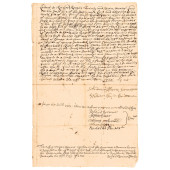 1720-DATED LAND SURVEY OF 27 ACRES IN PR
[more like this]
1720-DATED LAND SURVEY OF 27 ACRES IN PR
[more like this]
-
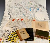 FLY FISHING ARCHIVE INCL. MAPS & BOOKSFl
[more like this]
FLY FISHING ARCHIVE INCL. MAPS & BOOKSFl
[more like this]
-
 1 vol. (Philadelphia Atlas.) Smedley, S
[more like this]
1 vol. (Philadelphia Atlas.) Smedley, S
[more like this]
-
 DU HALDE, Jean-Baptiste, (French, 1674-1
[more like this]
DU HALDE, Jean-Baptiste, (French, 1674-1
[more like this]
-
 MITCHELL. A NEW UNIVERSAL ATLAS CONTAINI
[more like this]
MITCHELL. A NEW UNIVERSAL ATLAS CONTAINI
[more like this]
-
 HENRY MOUZON - MAP OF NORTH AND SOUTH CA
[more like this]
HENRY MOUZON - MAP OF NORTH AND SOUTH CA
[more like this]
-
 AN ANTIQUE MAP, "CARTE DES VARIATIONS DE
[more like this]
AN ANTIQUE MAP, "CARTE DES VARIATIONS DE
[more like this]
-
 A LATE MEXICAN-AMERICAN WAR ERA MAP, "MA
[more like this]
A LATE MEXICAN-AMERICAN WAR ERA MAP, "MA
[more like this]
-
 7 EARLY TENNESSEE GEOLOGICAL REPORTS, IN
[more like this]
7 EARLY TENNESSEE GEOLOGICAL REPORTS, IN
[more like this]
-
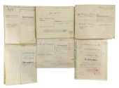 MAPS & DOCUMENTS: VICTORIAN VELLUM LEGAL
[more like this]
MAPS & DOCUMENTS: VICTORIAN VELLUM LEGAL
[more like this]
-
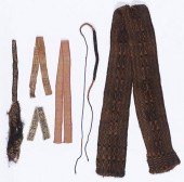 COLLECTION OF 6 PRE-COLUMBIAN TEXTILESCo
[more like this]
COLLECTION OF 6 PRE-COLUMBIAN TEXTILESCo
[more like this]
-
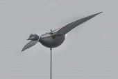 FLYING BRANTGeorge William McLellan (189
[more like this]
FLYING BRANTGeorge William McLellan (189
[more like this]
-
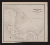
 U.S. COAST SURVEY SKETCH A, SECTION NO.
[more like this]
U.S. COAST SURVEY SKETCH A, SECTION NO.
[more like this]
-
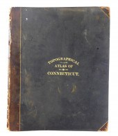 BOOK: TOPOGRAPHICAL ATLAS OF CONNECTICUT
[more like this]
BOOK: TOPOGRAPHICAL ATLAS OF CONNECTICUT
[more like this]
-
 SURVEY MAPS OF NORTH AND SOUTH AMERICAFi
[more like this]
SURVEY MAPS OF NORTH AND SOUTH AMERICAFi
[more like this]
This list is limited to only a few results.
Many more items are available to our members in our
Price Guide!
Ideal research tools for Collectors, Personal Property Appraisers, Antiques & Collectibles
Dealers, Auction Houses, Museums, eBayers or
other online
sellers (Rubylane, Etsy etc) and curious minds interested in appraising & identifying collectibles

EASY. FAST. ACCURATE.
Research at its best

Our research tools include:


