Pricing Guides & Dictionary of Makers Marks for Antiques & Collectibles
Appraise and find values for
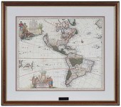
3 EUROPEAN MAPS, INCL. SCHENK,...
From
marks4antiques.com
- The most updated price guide and makers' marks research online
As a member, you have access to a team of experts
and assistance is always available to you for free
An example from the millions of items in our Price Guide:
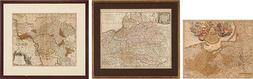
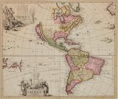
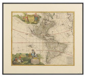
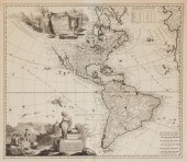
3 EUROPEAN MAPS, INCL. SCHENK, VALK, & HOMANN1st item: ESTATS DE POLOGNE SUBDIVISES SUIVANT LESTENDUE DES PALANTINATS map, published by Pieter Schenk,...
This is an example from our
values4antiques price guide
We do not buy or sell any items
See more price guides
Check our other research services:
IDENTIFY WORLDWIDE MAKERS' MARKS & HALLMARKS
marks4ceramics:
Porcelain, Pottery, Chinaware, Figurines, Dolls, Vases...
marks4silver
:
Silver, Jewelry, Pewter, Silverplate, Copper & Bronze...
Explore other items from our
Antiques & Collectibles Price Guide
-
 A Very Large Collection of Maps, 19th/e
[more like this]
A Very Large Collection of Maps, 19th/e
[more like this]
-
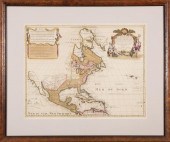 GUILLAUME DE L'ISLE AND PETER SCHENK MAP
[more like this]
GUILLAUME DE L'ISLE AND PETER SCHENK MAP
[more like this]
-
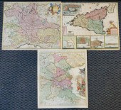 THREE SOUTHERN EUROPEAN COLORED MAPS, CO
[more like this]
THREE SOUTHERN EUROPEAN COLORED MAPS, CO
[more like this]
-
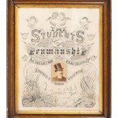 A Penmanship Advertisement by Students o
[more like this]
A Penmanship Advertisement by Students o
[more like this]
-
 PIETER SCHENK (1660-1711)Pieter Schenk (
[more like this]
PIETER SCHENK (1660-1711)Pieter Schenk (
[more like this]
-
 ANDREAS CELLARIUS; PETER SCHENK; GERARD
[more like this]
ANDREAS CELLARIUS; PETER SCHENK; GERARD
[more like this]
-
 3 EUROPEAN MAPS, INCL. SCHENK, VALK, & H
[more like this]
3 EUROPEAN MAPS, INCL. SCHENK, VALK, & H
[more like this]
-
 AN ANTIQUE MAP, "CARTE DES VARIATIONS DE
[more like this]
AN ANTIQUE MAP, "CARTE DES VARIATIONS DE
[more like this]
-
 4 vols. (Pennsylvania Property Atlases
[more like this]
4 vols. (Pennsylvania Property Atlases
[more like this]
-
 1 vol. (Philadelphia Atlas.) Smedley, S
[more like this]
1 vol. (Philadelphia Atlas.) Smedley, S
[more like this]
-
 DU HALDE, Jean-Baptiste, (French, 1674-1
[more like this]
DU HALDE, Jean-Baptiste, (French, 1674-1
[more like this]
-
 MITCHELL. A NEW UNIVERSAL ATLAS CONTAINI
[more like this]
MITCHELL. A NEW UNIVERSAL ATLAS CONTAINI
[more like this]
-
 2 FRAMED 18TH C. FADEN MAPS - GREECE & D
[more like this]
2 FRAMED 18TH C. FADEN MAPS - GREECE & D
[more like this]
-
 HENRY MOUZON - MAP OF NORTH AND SOUTH CA
[more like this]
HENRY MOUZON - MAP OF NORTH AND SOUTH CA
[more like this]
-
 1709 AMERICA MAP, CALIFORNIA ISLAND, ZUR
[more like this]
1709 AMERICA MAP, CALIFORNIA ISLAND, ZUR
[more like this]
-
 7 vols. French & British Travelers in A
[more like this]
7 vols. French & British Travelers in A
[more like this]
-
 Marie Pfeiffer Schenk painting (Florida,
[more like this]
Marie Pfeiffer Schenk painting (Florida,
[more like this]
-
 ADAM FRIEDRICH ZURNER (1679-1742) AND PI
[more like this]
ADAM FRIEDRICH ZURNER (1679-1742) AND PI
[more like this]
-
 OLIVER WENDELL "TOM" SCHENK (MAINE/OHIO,
[more like this]
OLIVER WENDELL "TOM" SCHENK (MAINE/OHIO,
[more like this]
-
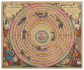 ANDREAS CELLARIUS; PETER SCHENK; GERARD
[more like this]
ANDREAS CELLARIUS; PETER SCHENK; GERARD
[more like this]
-
 PETER SCHENK - MAP OF NORTH AND SOUTH AM
[more like this]
PETER SCHENK - MAP OF NORTH AND SOUTH AM
[more like this]
-
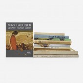 . Collection of Max Laeuger ephemera. re
[more like this]
. Collection of Max Laeuger ephemera. re
[more like this]
-
 AUGUST SCHENK (1828-1901): SHEEP AND RAM
[more like this]
AUGUST SCHENK (1828-1901): SHEEP AND RAM
[more like this]
-
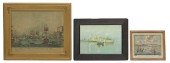 (3) FRAMED MARINE / MARITIME SUBJECT PRI
[more like this]
(3) FRAMED MARINE / MARITIME SUBJECT PRI
[more like this]
-
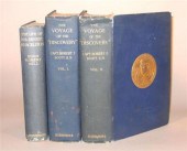 3 vols. Antarctic Travel & Exploration:
[more like this]
3 vols. Antarctic Travel & Exploration:
[more like this]
-
 A Large Collection of Maps of America,
[more like this]
A Large Collection of Maps of America,
[more like this]
-
 2 vols. (Philadelphia Property Atlases.
[more like this]
2 vols. (Philadelphia Property Atlases.
[more like this]
-
 7 vols. Cartography: Brown, Lloyd A. Th
[more like this]
7 vols. Cartography: Brown, Lloyd A. Th
[more like this]
-
 7 vols. Cartography - American Subjects
[more like this]
7 vols. Cartography - American Subjects
[more like this]
-
 1782 Thomas Kitchen atlas, A General Atl
[more like this]
1782 Thomas Kitchen atlas, A General Atl
[more like this]
-
 Military Maps Illustrating the Operation
[more like this]
Military Maps Illustrating the Operation
[more like this]
-
 THE LIFE OF GEORGE WASHINGTON, BY JOHN M
[more like this]
THE LIFE OF GEORGE WASHINGTON, BY JOHN M
[more like this]
-
 MAPS: JOHN SPEED (ENGLAND, 1552-1629), T
[more like this]
MAPS: JOHN SPEED (ENGLAND, 1552-1629), T
[more like this]
-
 6 MISSISSIPPI AND TENNESSEE RIVER MAPSSi
[more like this]
6 MISSISSIPPI AND TENNESSEE RIVER MAPSSi
[more like this]
-
 8 TENNESSEE MILITARY & SURVEY MAPSAssort
[more like this]
8 TENNESSEE MILITARY & SURVEY MAPSAssort
[more like this]
-
 5 CIVIL WAR RELATED BOOKS1st item: Hopki
[more like this]
5 CIVIL WAR RELATED BOOKS1st item: Hopki
[more like this]
This list is limited to only a few results.
Many more items are available to our members in our
Price Guide!
Ideal research tools for Collectors, Personal Property Appraisers, Antiques & Collectibles
Dealers, Auction Houses, Museums, eBayers or
other online
sellers (Rubylane, Etsy etc) and curious minds interested in appraising & identifying collectibles

EASY. FAST. ACCURATE.
Research at its best

Our research tools include:


