Pricing Guides & Dictionary of Makers Marks for Antiques & Collectibles
Appraise and find values for
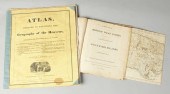
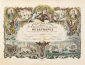
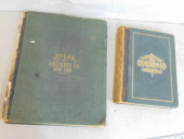
''Atlas Geography of the...
From
marks4antiques.com
- The most updated price guide and makers' marks research online
As a member, you have access to a team of experts
and assistance is always available to you for free
An example from the millions of items in our Price Guide:
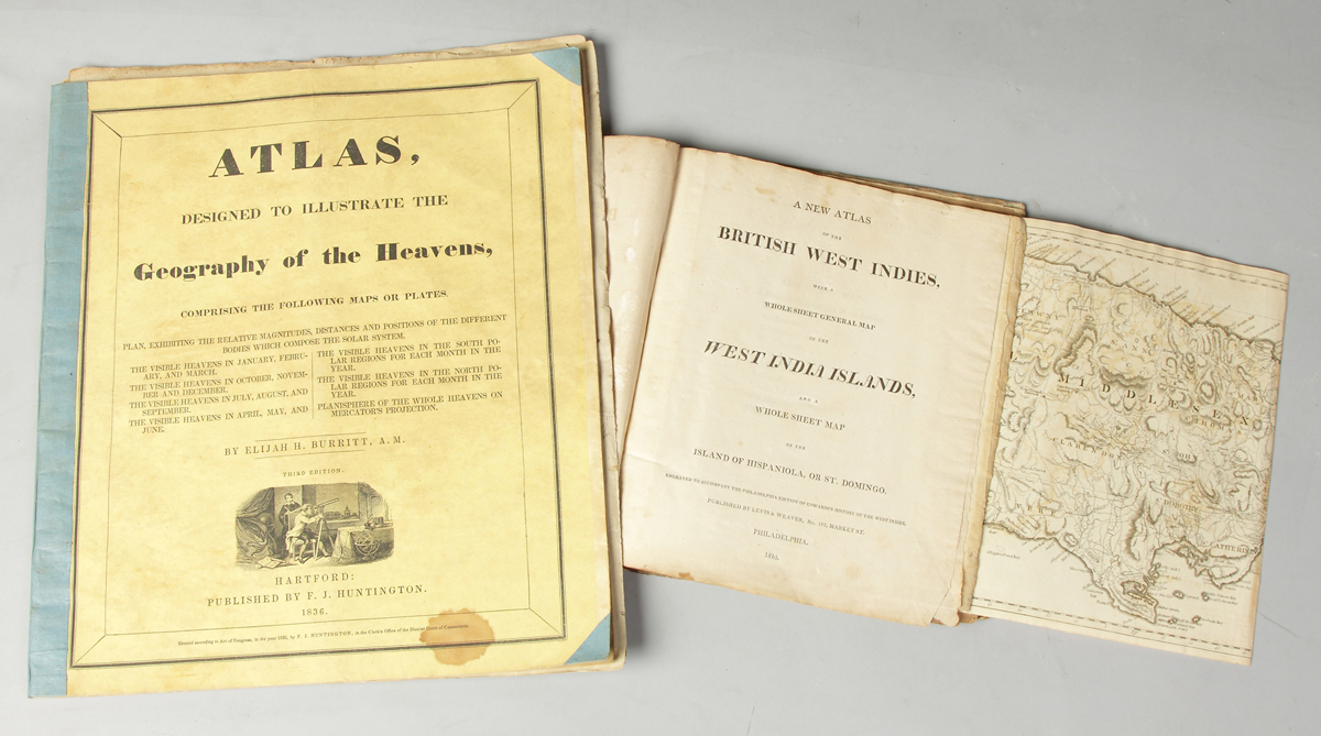
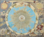
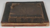
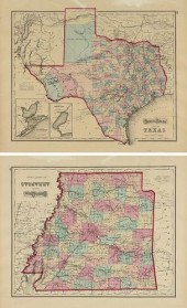
''Atlas Geography of the Heavens'' & ''British West Indies'' 1810 ''Atlas designed to illustrate the Geography of the Heavens comprising maps and...
This is an example from our
values4antiques price guide
We do not buy or sell any items
See more price guides
Check our other research services:
IDENTIFY WORLDWIDE MAKERS' MARKS & HALLMARKS
marks4ceramics:
Porcelain, Pottery, Chinaware, Figurines, Dolls, Vases...
marks4silver
:
Silver, Jewelry, Pewter, Silverplate, Copper & Bronze...
Explore other items from our
Antiques & Collectibles Price Guide
-
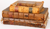
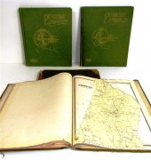
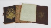
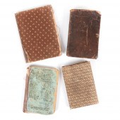 FOUR ANTIQUE SCHOOL BOOKS: PETER'S BURRO
[more like this]
FOUR ANTIQUE SCHOOL BOOKS: PETER'S BURRO
[more like this]
-
 5 KENTUCKY AND TENNESSEE MAPS1st item: "
[more like this]
5 KENTUCKY AND TENNESSEE MAPS1st item: "
[more like this]
-
 ''Atlas Geography of the Heavens'' & ''B
[more like this]
''Atlas Geography of the Heavens'' & ''B
[more like this]
-
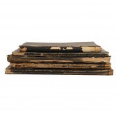
 6PC ASSORTED ANTIQUE 1870'S ATLASES Unit
[more like this]
6PC ASSORTED ANTIQUE 1870'S ATLASES Unit
[more like this]
-
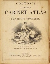
 ATLAS, DESIGNED TO ILLUSTRATE THE GEOGRA
[more like this]
ATLAS, DESIGNED TO ILLUSTRATE THE GEOGRA
[more like this]
-
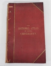 THE NATIONAL ATLAS OF GENERAL GEOGRAPHY
[more like this]
THE NATIONAL ATLAS OF GENERAL GEOGRAPHY
[more like this]
-
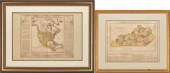 2 FRAMED HISTORICAL MAPS, NORTH AMERICA
[more like this]
2 FRAMED HISTORICAL MAPS, NORTH AMERICA
[more like this]
-
 ANTIQUE 19TH CENTURY US GEOGRAPHY ATLAS
[more like this]
ANTIQUE 19TH CENTURY US GEOGRAPHY ATLAS
[more like this]
-
 (ATLAS FRONTISPIECES) A group of four ti
[more like this]
(ATLAS FRONTISPIECES) A group of four ti
[more like this]
-
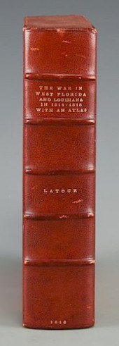 LATOUR WAR IN WEST FLORIDA LA 1814-1815,
[more like this]
LATOUR WAR IN WEST FLORIDA LA 1814-1815,
[more like this]
-
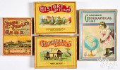 FOUR GEOGRAPHY AND HISTORY GAMES, EARLY
[more like this]
FOUR GEOGRAPHY AND HISTORY GAMES, EARLY
[more like this]
-
 FOUR BOOKS ON ENGLISH HISTORY AND GEOGRA
[more like this]
FOUR BOOKS ON ENGLISH HISTORY AND GEOGRA
[more like this]
-
 AN ANTIQUE MAP, "SYSTEMA SOLARE ET PLANE
[more like this]
AN ANTIQUE MAP, "SYSTEMA SOLARE ET PLANE
[more like this]
-
 3 KY & TN MAPS: VANCE, TANNER, JOHNSON1s
[more like this]
3 KY & TN MAPS: VANCE, TANNER, JOHNSON1s
[more like this]
-
 JOHN WALKER'S SCARCE LATE-18TH-CENTURY A
[more like this]
JOHN WALKER'S SCARCE LATE-18TH-CENTURY A
[more like this]
-
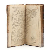
 4 vols. (Philadelphia Property Atlases)
[more like this]
4 vols. (Philadelphia Property Atlases)
[more like this]
-
 4 vols. (Pennsylvania Property Atlases
[more like this]
4 vols. (Pennsylvania Property Atlases
[more like this]
-
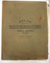
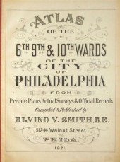 4 vols. Philadelphia Ward Atlases. Elvi
[more like this]
4 vols. Philadelphia Ward Atlases. Elvi
[more like this]
-
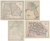
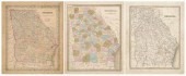 Three 19th century maps of Georgia: &quo
[more like this]
Three 19th century maps of Georgia: &quo
[more like this]
-
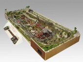 COMPLETE SET UP OF N GAUGE TRAINS & TOWN
[more like this]
COMPLETE SET UP OF N GAUGE TRAINS & TOWN
[more like this]
-
 ''Atlas of Hampden County Massachusetts
[more like this]
''Atlas of Hampden County Massachusetts
[more like this]
-
 Three atlas maps featuring Rhode Island:
[more like this]
Three atlas maps featuring Rhode Island:
[more like this]
-
 Atlas and Cyclopedia of Butler County Oh
[more like this]
Atlas and Cyclopedia of Butler County Oh
[more like this]
-
 4PC CRAM & RAND MCNALLY WORLD ATLASES ,1
[more like this]
4PC CRAM & RAND MCNALLY WORLD ATLASES ,1
[more like this]
-
 TIFFANY & CO. ATLAS 18K WHITE GOLD AND D
[more like this]
TIFFANY & CO. ATLAS 18K WHITE GOLD AND D
[more like this]
-
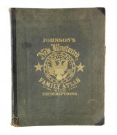 BOOK: JOHNSON'S NEW ILLUSTRATED FAMILY A
[more like this]
BOOK: JOHNSON'S NEW ILLUSTRATED FAMILY A
[more like this]
-
 TIFFANY & CO. ATLAS 18K WHITE GOLD AND D
[more like this]
TIFFANY & CO. ATLAS 18K WHITE GOLD AND D
[more like this]
-
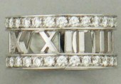
 TIFFANY & CO ATLAS ROMAN NUMERAL NECKLAC
[more like this]
TIFFANY & CO ATLAS ROMAN NUMERAL NECKLAC
[more like this]
-
 AN ANTIQUE TWO SIDED MAP, "GRAY'S ATLAS
[more like this]
AN ANTIQUE TWO SIDED MAP, "GRAY'S ATLAS
[more like this]
-
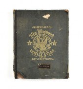 A CIVIL WAR ERA ATLAS, "JOHNSON'S NEW IL
[more like this]
A CIVIL WAR ERA ATLAS, "JOHNSON'S NEW IL
[more like this]
-
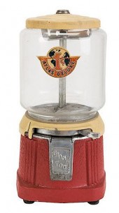 ATLAS MFG. AND SALES CO. 1 CENT ATLAS DE
[more like this]
ATLAS MFG. AND SALES CO. 1 CENT ATLAS DE
[more like this]
-
 IMPORTANT ANTIQUE ATLAS DU VOYAGE DE LA
[more like this]
IMPORTANT ANTIQUE ATLAS DU VOYAGE DE LA
[more like this]
-
 2 BOOKS. ATLAS OF COLUMBIA COUNTY & HIST
[more like this]
2 BOOKS. ATLAS OF COLUMBIA COUNTY & HIST
[more like this]
-
 2 vols. American 19th-Century Atlases:
[more like this]
2 vols. American 19th-Century Atlases:
[more like this]
-
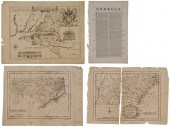
 Four 19th century maps, Southeast: "
[more like this]
Four 19th century maps, Southeast: "
[more like this]
-
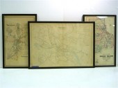
 Three Maps of the Southeastern United St
[more like this]
Three Maps of the Southeastern United St
[more like this]
This list is limited to only a few results.
Many more items are available to our members in our
Price Guide!
Ideal research tools for Collectors, Personal Property Appraisers, Antiques & Collectibles
Dealers, Auction Houses, Museums, eBayers or
other online
sellers (Rubylane, Etsy etc) and curious minds interested in appraising & identifying collectibles

EASY. FAST. ACCURATE.
Research at its best

Our research tools include:


