Pricing Guides & Dictionary of Makers Marks for Antiques & Collectibles
Appraise and find values for
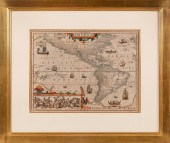
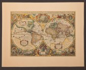
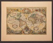
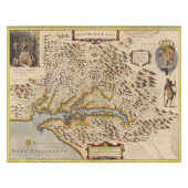
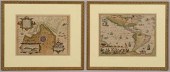
Jodocus Hondius colorful maps of...
From
marks4antiques.com
- The most updated price guide and makers' marks research online
As a member, you have access to a team of experts
and assistance is always available to you for free
An example from the millions of items in our Price Guide:
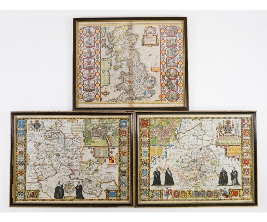
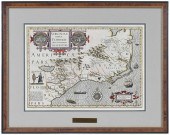
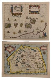
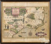
Jodocus Hondius colorful maps of Cambridge, Oxfordshire and Britain. All approximately: 20.5" x 15.25" ss / 17" x 22" oa Condition: Losses to frames,...
This is an example from our
values4antiques price guide
We do not buy or sell any items
See more price guides
Check our other research services:
IDENTIFY WORLDWIDE MAKERS' MARKS & HALLMARKS
marks4ceramics:
Porcelain, Pottery, Chinaware, Figurines, Dolls, Vases...
marks4silver
:
Silver, Jewelry, Pewter, Silverplate, Copper & Bronze...
Explore other items from our
Antiques & Collectibles Price Guide
-
 GERRIT HONDIUS, MASSACHUSETTS, NEW YORK
[more like this]
GERRIT HONDIUS, MASSACHUSETTS, NEW YORK
[more like this]
-
 A Very Large Collection of Maps, 19th/e
[more like this]
A Very Large Collection of Maps, 19th/e
[more like this]
-
 17th Century Hondius World Map "Nova Tot
[more like this]
17th Century Hondius World Map "Nova Tot
[more like this]
-
 JANSSON AND HONDIUS - TWO MAPS OF THE AM
[more like this]
JANSSON AND HONDIUS - TWO MAPS OF THE AM
[more like this]
-
 JODOCUS HONDIUS (BELGIUM, 1563-1612), "S
[more like this]
JODOCUS HONDIUS (BELGIUM, 1563-1612), "S
[more like this]
-
 JODOCUS HONDIUS (DUTCH, 1563 - 1612), "N
[more like this]
JODOCUS HONDIUS (DUTCH, 1563 - 1612), "N
[more like this]
-
 JODOCUS HONDIUS (DUTCH 1563-1612), COLOR
[more like this]
JODOCUS HONDIUS (DUTCH 1563-1612), COLOR
[more like this]
-
 A framed 17th century map of Tartary by
[more like this]
A framed 17th century map of Tartary by
[more like this]
-
 AFTER HENRICUS HONDIUS II (DUTCH, 1597-1
[more like this]
AFTER HENRICUS HONDIUS II (DUTCH, 1597-1
[more like this]
-
 HENRICUS HONDIUS II (DUTCH, 1597-1651)He
[more like this]
HENRICUS HONDIUS II (DUTCH, 1597-1651)He
[more like this]
-
 HONDIUS AND BLAEU - TWO FRENCH REGIONAL
[more like this]
HONDIUS AND BLAEU - TWO FRENCH REGIONAL
[more like this]
-
 Rare Mercator-Hondius map of the Southea
[more like this]
Rare Mercator-Hondius map of the Southea
[more like this]
-
 JODOCUS HONDIUS - MAP OF VIRGINIA AND TH
[more like this]
JODOCUS HONDIUS - MAP OF VIRGINIA AND TH
[more like this]
-
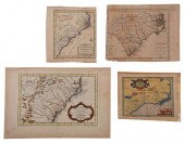 FOUR 17TH AND 18TH CENTURY MAPS OF THE S
[more like this]
FOUR 17TH AND 18TH CENTURY MAPS OF THE S
[more like this]
-
 ORTELIUS AND HONDIUS - TWO MAPS, FLORIDA
[more like this]
ORTELIUS AND HONDIUS - TWO MAPS, FLORIDA
[more like this]
-
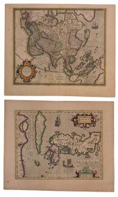 MERCATOR AND HONDIUS - TWO MAPS OF ASIAG
[more like this]
MERCATOR AND HONDIUS - TWO MAPS OF ASIAG
[more like this]
-
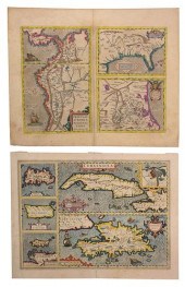
 HONDIUS AND BLAEU - TWO MAPS OF SOUTHEAS
[more like this]
HONDIUS AND BLAEU - TWO MAPS OF SOUTHEAS
[more like this]
-
 17th century map, Virginia, "Nova V
[more like this]
17th century map, Virginia, "Nova V
[more like this]
-
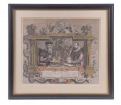 MERCATOR/HONDIUS PORTRAIT PRINT BY COLET
[more like this]
MERCATOR/HONDIUS PORTRAIT PRINT BY COLET
[more like this]
-
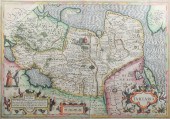
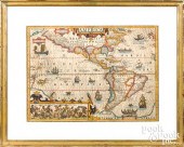 JODOCUS HONDIUS COLOR ENGRAVED MAP OF AM
[more like this]
JODOCUS HONDIUS COLOR ENGRAVED MAP OF AM
[more like this]
-
 JODOCUS HONDIUS COLOR ENGRAVED MAPJodocu
[more like this]
JODOCUS HONDIUS COLOR ENGRAVED MAPJodocu
[more like this]
-
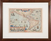 JODOCUS HONDIUS (1563-1612) MAPJodocus H
[more like this]
JODOCUS HONDIUS (1563-1612) MAPJodocus H
[more like this]
-
 TWO 17TH CENTURY MAPS OF THE STRAIGHT OF
[more like this]
TWO 17TH CENTURY MAPS OF THE STRAIGHT OF
[more like this]
-
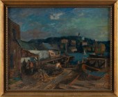
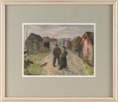
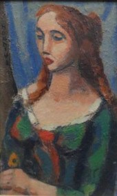 HONDIUS Gerrit. Oil on Board of a Woman.
[more like this]
HONDIUS Gerrit. Oil on Board of a Woman.
[more like this]
-
 GERRIT HONDIUS (NEW YORK, 1891-1970), HA
[more like this]
GERRIT HONDIUS (NEW YORK, 1891-1970), HA
[more like this]
-
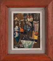 GERRIT HONDIUS (NEW YORK, 1891-1970), BU
[more like this]
GERRIT HONDIUS (NEW YORK, 1891-1970), BU
[more like this]
-
 GERRIT HONDIUS (NEW YORK, 1891-1970), FI
[more like this]
GERRIT HONDIUS (NEW YORK, 1891-1970), FI
[more like this]
-
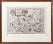
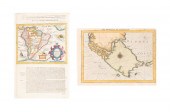
 HENRICUS HONDIUS'S MAP OF THE CHESAPEAKE
[more like this]
HENRICUS HONDIUS'S MAP OF THE CHESAPEAKE
[more like this]
-
 TWO MERCATOR / HONDIUS MAPS2 (Gerard) Me
[more like this]
TWO MERCATOR / HONDIUS MAPS2 (Gerard) Me
[more like this]
-
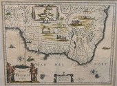
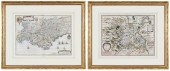
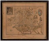
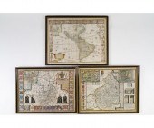
 Jodocus Hondius colorful maps of Cambrid
[more like this]
Jodocus Hondius colorful maps of Cambrid
[more like this]
-
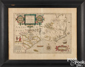
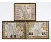
 Three Jodocus Hondius colorful maps of B
[more like this]
Three Jodocus Hondius colorful maps of B
[more like this]
-
 4 vols. (Pennsylvania Property Atlases
[more like this]
4 vols. (Pennsylvania Property Atlases
[more like this]
-
 1 vol. (Philadelphia Atlas.) Smedley, S
[more like this]
1 vol. (Philadelphia Atlas.) Smedley, S
[more like this]
-
 DU HALDE, Jean-Baptiste, (French, 1674-1
[more like this]
DU HALDE, Jean-Baptiste, (French, 1674-1
[more like this]
-
 MITCHELL. A NEW UNIVERSAL ATLAS CONTAINI
[more like this]
MITCHELL. A NEW UNIVERSAL ATLAS CONTAINI
[more like this]
-
 2 FRAMED 18TH C. FADEN MAPS - GREECE & D
[more like this]
2 FRAMED 18TH C. FADEN MAPS - GREECE & D
[more like this]
This list is limited to only a few results.
Many more items are available to our members in our
Price Guide!
Ideal research tools for Collectors, Personal Property Appraisers, Antiques & Collectibles
Dealers, Auction Houses, Museums, eBayers or
other online
sellers (Rubylane, Etsy etc) and curious minds interested in appraising & identifying collectibles

EASY. FAST. ACCURATE.
Research at its best

Our research tools include:


