Pricing Guides & Dictionary of Makers Marks for Antiques & Collectibles
Appraise and find values for
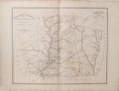
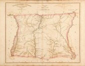
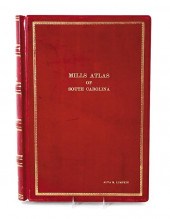
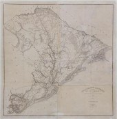
Maps from Robert Mills' 1825...
From
marks4antiques.com
- The most updated price guide and makers' marks research online
As a member, you have access to a team of experts
and assistance is always available to you for free
An example from the millions of items in our Price Guide:
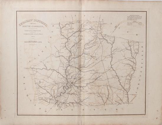
Maps from Robert Mills' 1825 Atlas of South Carolina Mills Robert. ATLAS OF THE STATE OF SOUTH CAROLINA. Baltimore: John. D. Troy 1825. With 24 uncolored...
This is an example from our
values4antiques price guide
We do not buy or sell any items
See more price guides
Check our other research services:
IDENTIFY WORLDWIDE MAKERS' MARKS & HALLMARKS
marks4ceramics:
Porcelain, Pottery, Chinaware, Figurines, Dolls, Vases...
marks4silver
:
Silver, Jewelry, Pewter, Silverplate, Copper & Bronze...
Explore other items from our
Antiques & Collectibles Price Guide
-
 A Very Large Collection of Maps, 19th/e
[more like this]
A Very Large Collection of Maps, 19th/e
[more like this]
-
 Maps from Robert Mills' 1825 Atlas of So
[more like this]
Maps from Robert Mills' 1825 Atlas of So
[more like this]
-
 Reprinted Atlases of the State of South
[more like this]
Reprinted Atlases of the State of South
[more like this]
-
 Robert Mills maps from South Carolina At
[more like this]
Robert Mills maps from South Carolina At
[more like this]
-
 Rare book: Robert Mills' 1825 Atlas of S
[more like this]
Rare book: Robert Mills' 1825 Atlas of S
[more like this]
-
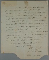 ROBERT MILLS ALS TO MR. PROFFIT, MARCH 2
[more like this]
ROBERT MILLS ALS TO MR. PROFFIT, MARCH 2
[more like this]
-
 HENRY MOUZON - MAP OF NORTH AND SOUTH CA
[more like this]
HENRY MOUZON - MAP OF NORTH AND SOUTH CA
[more like this]
-
 TEN BOOKS/MAGAZINES RELATING TO ROBERT W
[more like this]
TEN BOOKS/MAGAZINES RELATING TO ROBERT W
[more like this]
-
 4 vols. (Pennsylvania Property Atlases
[more like this]
4 vols. (Pennsylvania Property Atlases
[more like this]
-
 1 vol. (Philadelphia Atlas.) Smedley, S
[more like this]
1 vol. (Philadelphia Atlas.) Smedley, S
[more like this]
-
 DU HALDE, Jean-Baptiste, (French, 1674-1
[more like this]
DU HALDE, Jean-Baptiste, (French, 1674-1
[more like this]
-
 MITCHELL. A NEW UNIVERSAL ATLAS CONTAINI
[more like this]
MITCHELL. A NEW UNIVERSAL ATLAS CONTAINI
[more like this]
-
 2 FRAMED 18TH C. FADEN MAPS - GREECE & D
[more like this]
2 FRAMED 18TH C. FADEN MAPS - GREECE & D
[more like this]
-
 AN ANTIQUE MAP, "CARTE DES VARIATIONS DE
[more like this]
AN ANTIQUE MAP, "CARTE DES VARIATIONS DE
[more like this]
-
 16 SARTORIAL AND SOCIETY HARDCOVER VOLUM
[more like this]
16 SARTORIAL AND SOCIETY HARDCOVER VOLUM
[more like this]
-
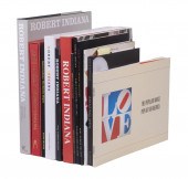 (10) BOOKS & MAGAZINE ON ARTIST ROBERT I
[more like this]
(10) BOOKS & MAGAZINE ON ARTIST ROBERT I
[more like this]
-
 RIX MILLS REMEMBERED: SIXTH GRADE SPELLD
[more like this]
RIX MILLS REMEMBERED: SIXTH GRADE SPELLD
[more like this]
-
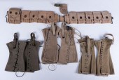 U.S. MILITARY CONTRIVANCES, EIGHT (8)Mil
[more like this]
U.S. MILITARY CONTRIVANCES, EIGHT (8)Mil
[more like this]
-
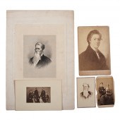 Breckinridge Family Archive Approx. 165
[more like this]
Breckinridge Family Archive Approx. 165
[more like this]
-
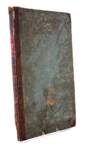 Rare book: Robert Mills' 1838 Atlas of S
[more like this]
Rare book: Robert Mills' 1838 Atlas of S
[more like this]
-
 MILLS ATLAS OF SOUTH CAROLINA 1938 REPRI
[more like this]
MILLS ATLAS OF SOUTH CAROLINA 1938 REPRI
[more like this]
-
 Robert Mills' 1825 map of Charleston fro
[more like this]
Robert Mills' 1825 map of Charleston fro
[more like this]
-
 A Large Collection of Maps of America,
[more like this]
A Large Collection of Maps of America,
[more like this]
-
 2 vols. (Philadelphia Property Atlases.
[more like this]
2 vols. (Philadelphia Property Atlases.
[more like this]
-
 7 vols. Cartography: Brown, Lloyd A. Th
[more like this]
7 vols. Cartography: Brown, Lloyd A. Th
[more like this]
-
 7 vols. Cartography - American Subjects
[more like this]
7 vols. Cartography - American Subjects
[more like this]
-
 1782 Thomas Kitchen atlas, A General Atl
[more like this]
1782 Thomas Kitchen atlas, A General Atl
[more like this]
-
 Military Maps Illustrating the Operation
[more like this]
Military Maps Illustrating the Operation
[more like this]
-
 THE LIFE OF GEORGE WASHINGTON, BY JOHN M
[more like this]
THE LIFE OF GEORGE WASHINGTON, BY JOHN M
[more like this]
-
 MAPS: JOHN SPEED (ENGLAND, 1552-1629), T
[more like this]
MAPS: JOHN SPEED (ENGLAND, 1552-1629), T
[more like this]
-
 6 MISSISSIPPI AND TENNESSEE RIVER MAPSSi
[more like this]
6 MISSISSIPPI AND TENNESSEE RIVER MAPSSi
[more like this]
-
 8 TENNESSEE MILITARY & SURVEY MAPSAssort
[more like this]
8 TENNESSEE MILITARY & SURVEY MAPSAssort
[more like this]
-
 5 CIVIL WAR RELATED BOOKS1st item: Hopki
[more like this]
5 CIVIL WAR RELATED BOOKS1st item: Hopki
[more like this]
-
 5 CIVIL WAR MAPSLot of five Civil War ma
[more like this]
5 CIVIL WAR MAPSLot of five Civil War ma
[more like this]
-
 MAPS: JOHN MARSHALL "THE LIFE OF GEORGE
[more like this]
MAPS: JOHN MARSHALL "THE LIFE OF GEORGE
[more like this]
-
 (5) TEXAS MAPS, 1850'S<br>(lot of 5
[more like this]
(5) TEXAS MAPS, 1850'S<br>(lot of 5
[more like this]
This list is limited to only a few results.
Many more items are available to our members in our
Price Guide!
Ideal research tools for Collectors, Personal Property Appraisers, Antiques & Collectibles
Dealers, Auction Houses, Museums, eBayers or
other online
sellers (Rubylane, Etsy etc) and curious minds interested in appraising & identifying collectibles

EASY. FAST. ACCURATE.
Research at its best

Our research tools include:


