Pricing Guides & Dictionary of Makers Marks for Antiques & Collectibles
Appraise and find values for
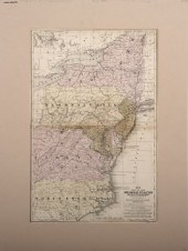
Mitchell maps of Europe Africa...
From
marks4antiques.com
- The most updated price guide and makers' marks research online
As a member, you have access to a team of experts
and assistance is always available to you for free
An example from the millions of items in our Price Guide:
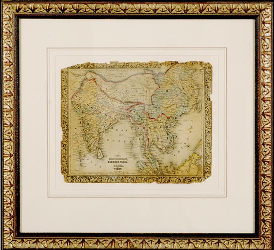
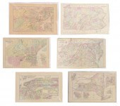
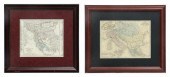
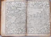
Mitchell maps of Europe Africa and Asia circa 1860 MAP OF EUROPE; HINDOOSTAN; AFRICA; and RUSSIA & EUROPE MAP OF AFRICA hand-colored atlas leaves framed...
This is an example from our
values4antiques price guide
We do not buy or sell any items
See more price guides
Check our other research services:
IDENTIFY WORLDWIDE MAKERS' MARKS & HALLMARKS
marks4ceramics:
Porcelain, Pottery, Chinaware, Figurines, Dolls, Vases...
marks4silver
:
Silver, Jewelry, Pewter, Silverplate, Copper & Bronze...
Explore other items from our
Antiques & Collectibles Price Guide
-
 A Very Large Collection of Maps, 19th/e
[more like this]
A Very Large Collection of Maps, 19th/e
[more like this]
-
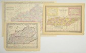
 5 KENTUCKY AND TENNESSEE MAPS1st item: "
[more like this]
5 KENTUCKY AND TENNESSEE MAPS1st item: "
[more like this]
-
 MITCHELL. A NEW UNIVERSAL ATLAS CONTAINI
[more like this]
MITCHELL. A NEW UNIVERSAL ATLAS CONTAINI
[more like this]
-
 Mitchell maps of Europe Africa and Asia
[more like this]
Mitchell maps of Europe Africa and Asia
[more like this]
-
 1939 MAPS OF CONFLICT IN EUROPE, NORTHER
[more like this]
1939 MAPS OF CONFLICT IN EUROPE, NORTHER
[more like this]
-
 LRG GRP: BOOKS ON AFRICA AND AFRICAN ART
[more like this]
LRG GRP: BOOKS ON AFRICA AND AFRICAN ART
[more like this]
-
![[AFRICA] - [HUNTING] - [TRAVEL](/images/africa-hunting-travel--3d05aa-medium.jpg) [AFRICA] - [HUNTING] - [TRAVEL] - [SAFAR
[more like this]
[AFRICA] - [HUNTING] - [TRAVEL] - [SAFAR
[more like this]
-
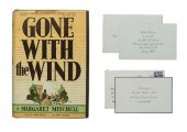 Inscribed copy "Gone With The Wind", fir
[more like this]
Inscribed copy "Gone With The Wind", fir
[more like this]
-
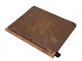 MITCHELL ATLAS, 1867[Mitchell Atlas], Mi
[more like this]
MITCHELL ATLAS, 1867[Mitchell Atlas], Mi
[more like this]
-
 3 MAPS TOTAL , 1 OF TENNESSEE, 2 OF KENT
[more like this]
3 MAPS TOTAL , 1 OF TENNESSEE, 2 OF KENT
[more like this]
-
 (6) MITCHELL & BRADLEY ATLAS MAPS NEW YO
[more like this]
(6) MITCHELL & BRADLEY ATLAS MAPS NEW YO
[more like this]
-
 (5) TEXAS MAPS, 1850'S<br>(lot of 5
[more like this]
(5) TEXAS MAPS, 1850'S<br>(lot of 5
[more like this]
-
 A Large Collection of Maps from Around t
[more like this]
A Large Collection of Maps from Around t
[more like this]
-
 2) STIELER & MITCHELL MAPS EUROPE, TURKE
[more like this]
2) STIELER & MITCHELL MAPS EUROPE, TURKE
[more like this]
-
 4 vols. (Pennsylvania Property Atlases
[more like this]
4 vols. (Pennsylvania Property Atlases
[more like this]
-
 1 vol. (Philadelphia Atlas.) Smedley, S
[more like this]
1 vol. (Philadelphia Atlas.) Smedley, S
[more like this]
-
 DU HALDE, Jean-Baptiste, (French, 1674-1
[more like this]
DU HALDE, Jean-Baptiste, (French, 1674-1
[more like this]
-
 2 FRAMED 18TH C. FADEN MAPS - GREECE & D
[more like this]
2 FRAMED 18TH C. FADEN MAPS - GREECE & D
[more like this]
-
 HENRY MOUZON - MAP OF NORTH AND SOUTH CA
[more like this]
HENRY MOUZON - MAP OF NORTH AND SOUTH CA
[more like this]
-
 AN ANTIQUE MAP, "CARTE DES VARIATIONS DE
[more like this]
AN ANTIQUE MAP, "CARTE DES VARIATIONS DE
[more like this]
-
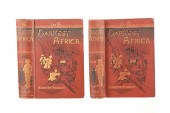 RARE 1890 1ST ED. VOL. I & II "IN DARKES
[more like this]
RARE 1890 1ST ED. VOL. I & II "IN DARKES
[more like this]
-
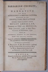 BOOKS ON TRAVELS AND EXPLORATION OF MORO
[more like this]
BOOKS ON TRAVELS AND EXPLORATION OF MORO
[more like this]
-
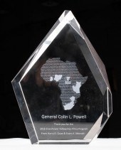 GLASS '2016 EISENHOWER FELLOWSHIP AFRICA
[more like this]
GLASS '2016 EISENHOWER FELLOWSHIP AFRICA
[more like this]
-
 SEBASTIAN MUNSTER. COSMOGRAPHIAE UNIVERS
[more like this]
SEBASTIAN MUNSTER. COSMOGRAPHIAE UNIVERS
[more like this]
-
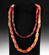 18TH C. GERMAN NECKLACES CARNELIAN & GLA
[more like this]
18TH C. GERMAN NECKLACES CARNELIAN & GLA
[more like this]
-
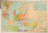 LARGE FOLD-OUT MAP EUROPE 1922"Europe in
[more like this]
LARGE FOLD-OUT MAP EUROPE 1922"Europe in
[more like this]
-
 GEORGE BERTRAND MITCHELL (AMERICAN, 1874
[more like this]
GEORGE BERTRAND MITCHELL (AMERICAN, 1874
[more like this]
-
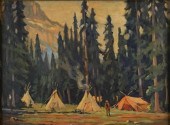
 GLEN MITCHELL (AMERICAN, 1894-1972) GYPS
[more like this]
GLEN MITCHELL (AMERICAN, 1894-1972) GYPS
[more like this]
-
 MAP AND ATLAS LOT, 3 PCS INCL. MELISH DI
[more like this]
MAP AND ATLAS LOT, 3 PCS INCL. MELISH DI
[more like this]
-
 A Large Collection of Maps of Various Re
[more like this]
A Large Collection of Maps of Various Re
[more like this]
-
 A Large Collection of Maps of America,
[more like this]
A Large Collection of Maps of America,
[more like this]
-
 2 vols. (Philadelphia Property Atlases.
[more like this]
2 vols. (Philadelphia Property Atlases.
[more like this]
-
 7 vols. Cartography: Brown, Lloyd A. Th
[more like this]
7 vols. Cartography: Brown, Lloyd A. Th
[more like this]
-
 7 vols. Cartography - American Subjects
[more like this]
7 vols. Cartography - American Subjects
[more like this]
-
 1782 Thomas Kitchen atlas, A General Atl
[more like this]
1782 Thomas Kitchen atlas, A General Atl
[more like this]
-
 Military Maps Illustrating the Operation
[more like this]
Military Maps Illustrating the Operation
[more like this]
This list is limited to only a few results.
Many more items are available to our members in our
Price Guide!
Ideal research tools for Collectors, Personal Property Appraisers, Antiques & Collectibles
Dealers, Auction Houses, Museums, eBayers or
other online
sellers (Rubylane, Etsy etc) and curious minds interested in appraising & identifying collectibles

EASY. FAST. ACCURATE.
Research at its best

Our research tools include:


