Pricing Guides & Dictionary of Makers Marks for Antiques & Collectibles
Appraise and find values for
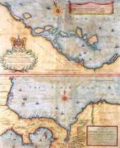
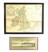
THREE MAPS OF SCOTLAND, ENGLAND,...
From
marks4antiques.com
- The most updated price guide and makers' marks research online
As a member, you have access to a team of experts
and assistance is always available to you for free
An example from the millions of items in our Price Guide:
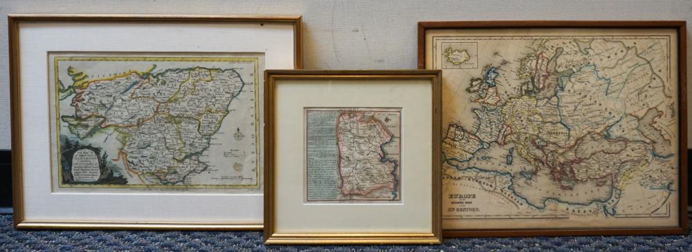
THREE MAPS OF SCOTLAND, ENGLAND, AND EUROPE, FRAME OF LARGEST: 13 X 17 IN. (33.02 X 43.18 CM.)Three Maps of Scotland, England, and Europe,, Dimensions:...
This is an example from our
values4antiques price guide
We do not buy or sell any items
See more price guides
Check our other research services:
IDENTIFY WORLDWIDE MAKERS' MARKS & HALLMARKS
marks4ceramics:
Porcelain, Pottery, Chinaware, Figurines, Dolls, Vases...
marks4silver
:
Silver, Jewelry, Pewter, Silverplate, Copper & Bronze...
Explore other items from our
Antiques & Collectibles Price Guide
-
 A Very Large Collection of Maps, 19th/e
[more like this]
A Very Large Collection of Maps, 19th/e
[more like this]
-
 JAPANESE KUTANI LIDDED VASE ?? ?????of b
[more like this]
JAPANESE KUTANI LIDDED VASE ?? ?????of b
[more like this]
-
 MUGHAL STYLE PALE CELADON JADE HANDLED B
[more like this]
MUGHAL STYLE PALE CELADON JADE HANDLED B
[more like this]
-
 MUGHAL-STYLE WHITE JADE 'CHRYSANTHEMUM'
[more like this]
MUGHAL-STYLE WHITE JADE 'CHRYSANTHEMUM'
[more like this]
-
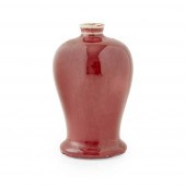 OX-BLOOD-GLAZED LANGYAO MEIPING VASE
QIN
[more like this]
OX-BLOOD-GLAZED LANGYAO MEIPING VASE
QIN
[more like this]
-
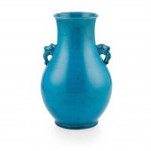 TURQUOISE-GLAZED HANDLED VASE
QING DYNAS
[more like this]
TURQUOISE-GLAZED HANDLED VASE
QING DYNAS
[more like this]
-
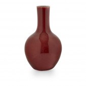 SANG-DE-BOEUF BOTTLE VASE
QING DYNASTY,
[more like this]
SANG-DE-BOEUF BOTTLE VASE
QING DYNASTY,
[more like this]
-
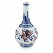 BLUE AND WHITE AND UNDERGLAZED-RED BOTTL
[more like this]
BLUE AND WHITE AND UNDERGLAZED-RED BOTTL
[more like this]
-
 PAIR OF FAMILLE ROSE 'COVERT EIGHT IMMOR
[more like this]
PAIR OF FAMILLE ROSE 'COVERT EIGHT IMMOR
[more like this]
-
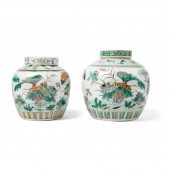 TWO FAMILLE VERTE GINGER JARS AND COVERS
[more like this]
TWO FAMILLE VERTE GINGER JARS AND COVERS
[more like this]
-
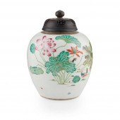 FAMILLE ROSE 'LOTUS POND AND MANDARIN DU
[more like this]
FAMILLE ROSE 'LOTUS POND AND MANDARIN DU
[more like this]
-
 SPINACH GREEN JADE WITH AGATE INSET OPIU
[more like this]
SPINACH GREEN JADE WITH AGATE INSET OPIU
[more like this]
-
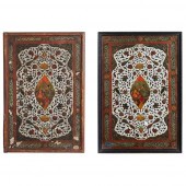 TWO QAJAR LACQUERED LEATHER PAPIER MACHE
[more like this]
TWO QAJAR LACQUERED LEATHER PAPIER MACHE
[more like this]
-
 MITCHELL. A NEW UNIVERSAL ATLAS CONTAINI
[more like this]
MITCHELL. A NEW UNIVERSAL ATLAS CONTAINI
[more like this]
-
 4 vols. (Pennsylvania Property Atlases
[more like this]
4 vols. (Pennsylvania Property Atlases
[more like this]
-
 1 vol. (Philadelphia Atlas.) Smedley, S
[more like this]
1 vol. (Philadelphia Atlas.) Smedley, S
[more like this]
-
 DU HALDE, Jean-Baptiste, (French, 1674-1
[more like this]
DU HALDE, Jean-Baptiste, (French, 1674-1
[more like this]
-
 2 FRAMED 18TH C. FADEN MAPS - GREECE & D
[more like this]
2 FRAMED 18TH C. FADEN MAPS - GREECE & D
[more like this]
-
 HENRY MOUZON - MAP OF NORTH AND SOUTH CA
[more like this]
HENRY MOUZON - MAP OF NORTH AND SOUTH CA
[more like this]
-
 AN ANTIQUE MAP, "CARTE DES VARIATIONS DE
[more like this]
AN ANTIQUE MAP, "CARTE DES VARIATIONS DE
[more like this]
-
 SCOTLAND, AND HISTORY
A COLLECTION, INCL
[more like this]
SCOTLAND, AND HISTORY
A COLLECTION, INCL
[more like this]
-
 MAPS: JOHN SPEED (ENGLAND, 1552-1629), T
[more like this]
MAPS: JOHN SPEED (ENGLAND, 1552-1629), T
[more like this]
-
 BRITANNIA, VOL. I & II CAMDEN 1722Camden
[more like this]
BRITANNIA, VOL. I & II CAMDEN 1722Camden
[more like this]
-
 WILLIAM HACKE AND ROBERT MORDEN, 17TH C.
[more like this]
WILLIAM HACKE AND ROBERT MORDEN, 17TH C.
[more like this]
-
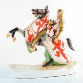 MICHAEL SUTTY PORCELAIN FIGURE OF ROBERT
[more like this]
MICHAEL SUTTY PORCELAIN FIGURE OF ROBERT
[more like this]
-
 SCOTLAND, GLASGOW AND DUMBARTONSHIRE, A
[more like this]
SCOTLAND, GLASGOW AND DUMBARTONSHIRE, A
[more like this]
-
 MAPS: TWO MAPS: GUILLAUME DELISLE (FRENC
[more like this]
MAPS: TWO MAPS: GUILLAUME DELISLE (FRENC
[more like this]
-
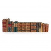
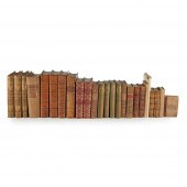
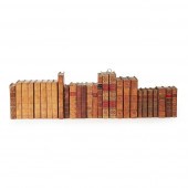 LEATHER BINDINGS
INCLUDING BARTHELEMY, J
[more like this]
LEATHER BINDINGS
INCLUDING BARTHELEMY, J
[more like this]
-
 THREE MAPS OF SCOTLAND, ENGLAND, AND EUR
[more like this]
THREE MAPS OF SCOTLAND, ENGLAND, AND EUR
[more like this]
-
 5 CIVIL WAR RELATED BOOKS1st item: Hopki
[more like this]
5 CIVIL WAR RELATED BOOKS1st item: Hopki
[more like this]
-
 A Large Collection of Maps of America,
[more like this]
A Large Collection of Maps of America,
[more like this]
-
 2 vols. (Philadelphia Property Atlases.
[more like this]
2 vols. (Philadelphia Property Atlases.
[more like this]
-
 7 vols. Cartography: Brown, Lloyd A. Th
[more like this]
7 vols. Cartography: Brown, Lloyd A. Th
[more like this]
-
 7 vols. Cartography - American Subjects
[more like this]
7 vols. Cartography - American Subjects
[more like this]
-
 1782 Thomas Kitchen atlas, A General Atl
[more like this]
1782 Thomas Kitchen atlas, A General Atl
[more like this]
-
 Military Maps Illustrating the Operation
[more like this]
Military Maps Illustrating the Operation
[more like this]
This list is limited to only a few results.
Many more items are available to our members in our
Price Guide!
Ideal research tools for Collectors, Personal Property Appraisers, Antiques & Collectibles
Dealers, Auction Houses, Museums, eBayers or
other online
sellers (Rubylane, Etsy etc) and curious minds interested in appraising & identifying collectibles

EASY. FAST. ACCURATE.
Research at its best

Our research tools include:


