Pricing Guides & Dictionary of Makers Marks for Antiques & Collectibles
Appraise and find values for
(TOPICAL) LIFE SAVING, SHIPS, MAPS,...
From
marks4antiques.com
- The most updated price guide and makers' marks research online
As a member, you have access to a team of experts
and assistance is always available to you for free
An example from the millions of items in our Price Guide:
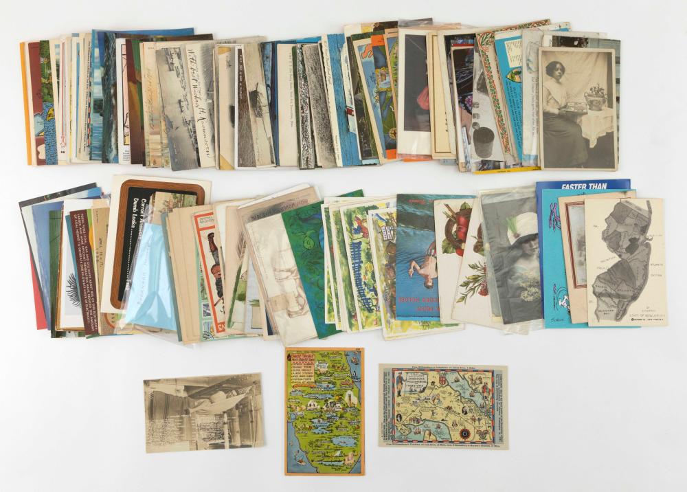
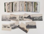
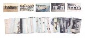
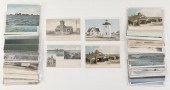
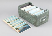
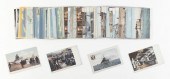
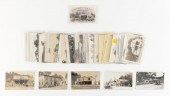
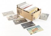
(TOPICAL) LIFE SAVING, SHIPS, MAPS, ETC.: 205 POSTCARDS EARLY TO LATE-20TH CENTURY(TOPICAL) LIFE SAVING, SHIPS, MAPS, ETC.: 205 POSTCARDS, Early to...
This is an example from our
values4antiques price guide
We do not buy or sell any items
See more price guides
Check our other research services:
IDENTIFY WORLDWIDE MAKERS' MARKS & HALLMARKS
marks4ceramics:
Porcelain, Pottery, Chinaware, Figurines, Dolls, Vases...
marks4silver
:
Silver, Jewelry, Pewter, Silverplate, Copper & Bronze...
Explore other items from our
Antiques & Collectibles Price Guide
-
 (TOPICAL) CAPE COD - LIFE SAVING: 40 POS
[more like this]
(TOPICAL) CAPE COD - LIFE SAVING: 40 POS
[more like this]
-
 (TOPICAL) LIFE SAVING: 41 POSTCARDS EARL
[more like this]
(TOPICAL) LIFE SAVING: 41 POSTCARDS EARL
[more like this]
-
 (TOPICAL) LIFE SAVING, SHIPS, MAPS, ETC.
[more like this]
(TOPICAL) LIFE SAVING, SHIPS, MAPS, ETC.
[more like this]
-
 (TOPICAL) CAPE COD LIFE SAVING AND LIGHT
[more like this]
(TOPICAL) CAPE COD LIFE SAVING AND LIGHT
[more like this]
-
 A Very Large Collection of Maps, 19th/e
[more like this]
A Very Large Collection of Maps, 19th/e
[more like this]
-
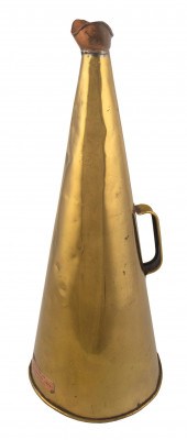 COPPER AND BRASS LIFE SAVING SERVICE HOR
[more like this]
COPPER AND BRASS LIFE SAVING SERVICE HOR
[more like this]
-
 PHOTOGRAPH OF A LIFE-SAVING TEAM 20TH CE
[more like this]
PHOTOGRAPH OF A LIFE-SAVING TEAM 20TH CE
[more like this]
-
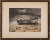
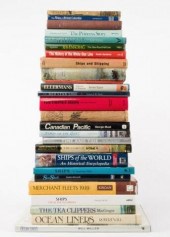 MARINE & OCEAN LINERS BOOKSA group of tw
[more like this]
MARINE & OCEAN LINERS BOOKSA group of tw
[more like this]
-
 (VIEW - MA, TOPICAL & MISCELLANEOUS): BO
[more like this]
(VIEW - MA, TOPICAL & MISCELLANEOUS): BO
[more like this]
-
 AN ANTIQUE MAP, "CARTE DES VARIATIONS DE
[more like this]
AN ANTIQUE MAP, "CARTE DES VARIATIONS DE
[more like this]
-
 (TOPICAL) SHIPS (19) AND BATTLESHIPS (39
[more like this]
(TOPICAL) SHIPS (19) AND BATTLESHIPS (39
[more like this]
-
 HENRY MOUZON - MAP OF NORTH AND SOUTH CA
[more like this]
HENRY MOUZON - MAP OF NORTH AND SOUTH CA
[more like this]
-
 4 vols. (Pennsylvania Property Atlases
[more like this]
4 vols. (Pennsylvania Property Atlases
[more like this]
-
 1 vol. (Philadelphia Atlas.) Smedley, S
[more like this]
1 vol. (Philadelphia Atlas.) Smedley, S
[more like this]
-
 DU HALDE, Jean-Baptiste, (French, 1674-1
[more like this]
DU HALDE, Jean-Baptiste, (French, 1674-1
[more like this]
-
 MITCHELL. A NEW UNIVERSAL ATLAS CONTAINI
[more like this]
MITCHELL. A NEW UNIVERSAL ATLAS CONTAINI
[more like this]
-
 2 FRAMED 18TH C. FADEN MAPS - GREECE & D
[more like this]
2 FRAMED 18TH C. FADEN MAPS - GREECE & D
[more like this]
-
 THE LIFE OF GEORGE WASHINGTON, BY JOHN M
[more like this]
THE LIFE OF GEORGE WASHINGTON, BY JOHN M
[more like this]
-
 MAPS: JOHN MARSHALL "THE LIFE OF GEORGE
[more like this]
MAPS: JOHN MARSHALL "THE LIFE OF GEORGE
[more like this]
-
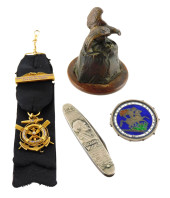 MEMORABILIA, 19TH/20TH C., DETAILS INCLU
[more like this]
MEMORABILIA, 19TH/20TH C., DETAILS INCLU
[more like this]
-
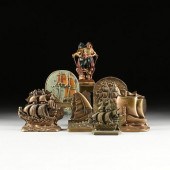 SEVEN PAIRS OF BOOKENDS WITH A NAUTICAL
[more like this]
SEVEN PAIRS OF BOOKENDS WITH A NAUTICAL
[more like this]
-
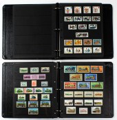 WORLDWIDE TOPICAL STAMP COLLECTION World
[more like this]
WORLDWIDE TOPICAL STAMP COLLECTION World
[more like this]
-
 A Large Collection of Maps of America,
[more like this]
A Large Collection of Maps of America,
[more like this]
-
 2 vols. (Philadelphia Property Atlases.
[more like this]
2 vols. (Philadelphia Property Atlases.
[more like this]
-
 7 vols. Cartography: Brown, Lloyd A. Th
[more like this]
7 vols. Cartography: Brown, Lloyd A. Th
[more like this]
-
 7 vols. Cartography - American Subjects
[more like this]
7 vols. Cartography - American Subjects
[more like this]
-
 1782 Thomas Kitchen atlas, A General Atl
[more like this]
1782 Thomas Kitchen atlas, A General Atl
[more like this]
-
 Military Maps Illustrating the Operation
[more like this]
Military Maps Illustrating the Operation
[more like this]
-
 MAPS: JOHN SPEED (ENGLAND, 1552-1629), T
[more like this]
MAPS: JOHN SPEED (ENGLAND, 1552-1629), T
[more like this]
-
 6 MISSISSIPPI AND TENNESSEE RIVER MAPSSi
[more like this]
6 MISSISSIPPI AND TENNESSEE RIVER MAPSSi
[more like this]
-
 8 TENNESSEE MILITARY & SURVEY MAPSAssort
[more like this]
8 TENNESSEE MILITARY & SURVEY MAPSAssort
[more like this]
-
 5 CIVIL WAR RELATED BOOKS1st item: Hopki
[more like this]
5 CIVIL WAR RELATED BOOKS1st item: Hopki
[more like this]
-
 5 CIVIL WAR MAPSLot of five Civil War ma
[more like this]
5 CIVIL WAR MAPSLot of five Civil War ma
[more like this]
-
 (5) TEXAS MAPS, 1850'S<br>(lot of 5
[more like this]
(5) TEXAS MAPS, 1850'S<br>(lot of 5
[more like this]
-
 (TOPICAL) GAS STATIONS: 38 REAL OR PRINT
[more like this]
(TOPICAL) GAS STATIONS: 38 REAL OR PRINT
[more like this]
-
 (TOPICAL) MISCELLANEOUS: 429 POSTCARDS E
[more like this]
(TOPICAL) MISCELLANEOUS: 429 POSTCARDS E
[more like this]
This list is limited to only a few results.
Many more items are available to our members in our
Price Guide!
Ideal research tools for Collectors, Personal Property Appraisers, Antiques & Collectibles
Dealers, Auction Houses, Museums, eBayers or
other online
sellers (Rubylane, Etsy etc) and curious minds interested in appraising & identifying collectibles

EASY. FAST. ACCURATE.
Research at its best

Our research tools include:


