Pricing Guides & Dictionary of Makers Marks for Antiques & Collectibles
Appraise and find values for
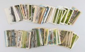
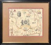
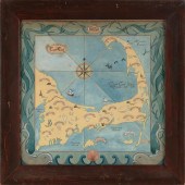
TWO MAPS OF CAPE AND ISLANDS...
From
marks4antiques.com
- The most updated price guide and makers' marks research online
As a member, you have access to a team of experts
and assistance is always available to you for free
An example from the millions of items in our Price Guide:
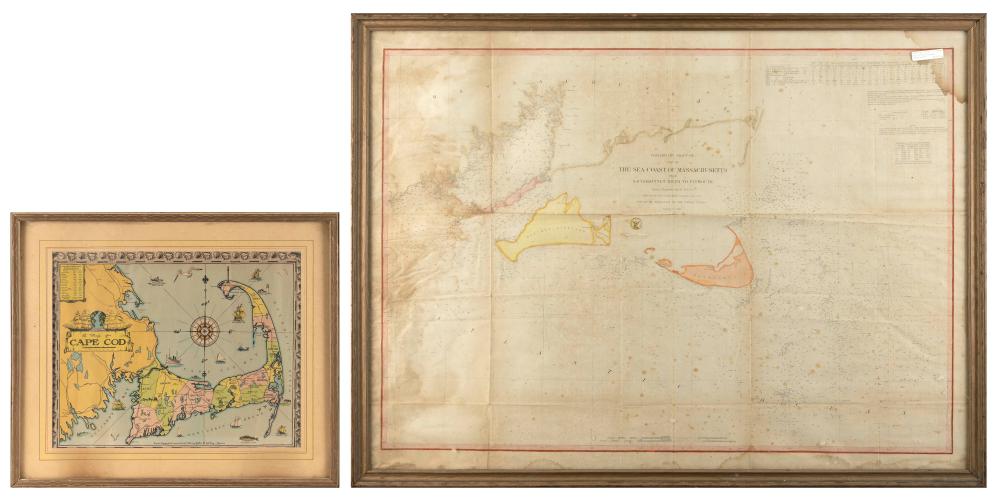
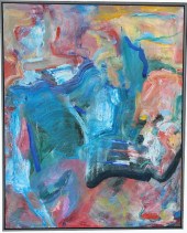
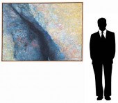
TWO MAPS OF CAPE AND ISLANDS INTEREST FRAMED 26” X 35” AND 21” X 25”.TWO MAPS OF CAPE AND ISLANDS INTEREST, 1) "The Sea Coast of Massachusetts" depicting...
This is an example from our
values4antiques price guide
We do not buy or sell any items
See more price guides
Check our other research services:
IDENTIFY WORLDWIDE MAKERS' MARKS & HALLMARKS
marks4ceramics:
Porcelain, Pottery, Chinaware, Figurines, Dolls, Vases...
marks4silver
:
Silver, Jewelry, Pewter, Silverplate, Copper & Bronze...
Explore other items from our
Antiques & Collectibles Price Guide
-
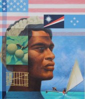
 CHRIS CALLE (B. 1961) "MARSHALL ISLANDS"
[more like this]
CHRIS CALLE (B. 1961) "MARSHALL ISLANDS"
[more like this]
-
 A Very Large Collection of Maps, 19th/e
[more like this]
A Very Large Collection of Maps, 19th/e
[more like this]
-
 CHRIS CALLE (B. 1961) "MICRONESIA"Chris
[more like this]
CHRIS CALLE (B. 1961) "MICRONESIA"Chris
[more like this]
-
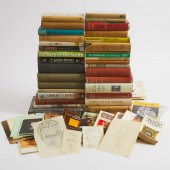 Approximately 32 Volumes by or Relating
[more like this]
Approximately 32 Volumes by or Relating
[more like this]
-
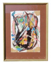
 TWO MAPS OF CAPE AND ISLANDS INTEREST FR
[more like this]
TWO MAPS OF CAPE AND ISLANDS INTEREST FR
[more like this]
-
 CONTINENTAL SCHOOL (CIRCA 1769,), SPANIS
[more like this]
CONTINENTAL SCHOOL (CIRCA 1769,), SPANIS
[more like this]
-
 3 NAUTICAL MAPS INC. SOUTHERN 18611st it
[more like this]
3 NAUTICAL MAPS INC. SOUTHERN 18611st it
[more like this]
-
 (VIEW) CAPE COD & ISLANDS: 203 POSTCARDS
[more like this]
(VIEW) CAPE COD & ISLANDS: 203 POSTCARDS
[more like this]
-
 HOWARD KOSLOW (1924 - 2016) "... FREE AS
[more like this]
HOWARD KOSLOW (1924 - 2016) "... FREE AS
[more like this]
-
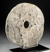 19TH C. CAROLINE ISLANDS YAP LIMESTONE R
[more like this]
19TH C. CAROLINE ISLANDS YAP LIMESTONE R
[more like this]
-
 DU HALDE, Jean-Baptiste, (French, 1674-1
[more like this]
DU HALDE, Jean-Baptiste, (French, 1674-1
[more like this]
-
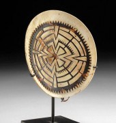 19TH C. SOLOMON ISLANDS SHELL KAPKAP (HE
[more like this]
19TH C. SOLOMON ISLANDS SHELL KAPKAP (HE
[more like this]
-
 AN ANTIQUE MAP, "CARTE DES VARIATIONS DE
[more like this]
AN ANTIQUE MAP, "CARTE DES VARIATIONS DE
[more like this]
-
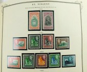 STAMPS: GREAT BRITAIN STAMP ALBUM, STANL
[more like this]
STAMPS: GREAT BRITAIN STAMP ALBUM, STANL
[more like this]
-
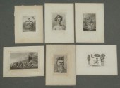 Lot six early Sandwich Island Hawaii eng
[more like this]
Lot six early Sandwich Island Hawaii eng
[more like this]
-
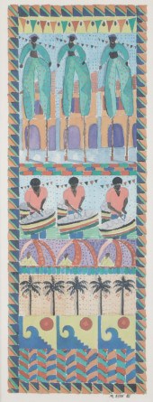 LISA ETRE, U.S. VIRGIN ISLANDS (B. 1955)
[more like this]
LISA ETRE, U.S. VIRGIN ISLANDS (B. 1955)
[more like this]
-
 4 vols. (Pennsylvania Property Atlases
[more like this]
4 vols. (Pennsylvania Property Atlases
[more like this]
-
 1 vol. (Philadelphia Atlas.) Smedley, S
[more like this]
1 vol. (Philadelphia Atlas.) Smedley, S
[more like this]
-
 MITCHELL. A NEW UNIVERSAL ATLAS CONTAINI
[more like this]
MITCHELL. A NEW UNIVERSAL ATLAS CONTAINI
[more like this]
-
 2 FRAMED 18TH C. FADEN MAPS - GREECE & D
[more like this]
2 FRAMED 18TH C. FADEN MAPS - GREECE & D
[more like this]
-
 HENRY MOUZON - MAP OF NORTH AND SOUTH CA
[more like this]
HENRY MOUZON - MAP OF NORTH AND SOUTH CA
[more like this]
-
 BRITANNIA, VOL. I & II CAMDEN 1722Camden
[more like this]
BRITANNIA, VOL. I & II CAMDEN 1722Camden
[more like this]
-
 COULTON WAUGH COLOR LITHOGRAPH "A MAP OF
[more like this]
COULTON WAUGH COLOR LITHOGRAPH "A MAP OF
[more like this]
-
 THOMAS KOETHER (NY, FL B. 1940) "RED PRO
[more like this]
THOMAS KOETHER (NY, FL B. 1940) "RED PRO
[more like this]
-
 THOMAS KOETHER (NY, FL B. 1940) "CREVICE
[more like this]
THOMAS KOETHER (NY, FL B. 1940) "CREVICE
[more like this]
-
 THOMAS KOETHER (NY B 1940) "SOMETHING FE
[more like this]
THOMAS KOETHER (NY B 1940) "SOMETHING FE
[more like this]
-
 JUNE MILLIKEN-MCINERNY (CAPE COD, CONTEM
[more like this]
JUNE MILLIKEN-MCINERNY (CAPE COD, CONTEM
[more like this]
-
 8 TENNESSEE MILITARY & SURVEY MAPSAssort
[more like this]
8 TENNESSEE MILITARY & SURVEY MAPSAssort
[more like this]
-
 A Large Collection of Maps from Around t
[more like this]
A Large Collection of Maps from Around t
[more like this]
-
 WILLIAM WINTERBOTHAM. AN HISTORICAL, GEO
[more like this]
WILLIAM WINTERBOTHAM. AN HISTORICAL, GEO
[more like this]
-
 A Large Collection of Maps of America,
[more like this]
A Large Collection of Maps of America,
[more like this]
-
 5 CIVIL WAR RELATED BOOKS1st item: Hopki
[more like this]
5 CIVIL WAR RELATED BOOKS1st item: Hopki
[more like this]
-
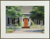
 WATERCOLOR MAP OF THE CAPE AND ISLANDS O
[more like this]
WATERCOLOR MAP OF THE CAPE AND ISLANDS O
[more like this]
-
 6 MISSISSIPPI AND TENNESSEE RIVER MAPSSi
[more like this]
6 MISSISSIPPI AND TENNESSEE RIVER MAPSSi
[more like this]
-
 Military Maps Illustrating the Operation
[more like this]
Military Maps Illustrating the Operation
[more like this]
-
 2 vols. (Philadelphia Property Atlases.
[more like this]
2 vols. (Philadelphia Property Atlases.
[more like this]
This list is limited to only a few results.
Many more items are available to our members in our
Price Guide!
Ideal research tools for Collectors, Personal Property Appraisers, Antiques & Collectibles
Dealers, Auction Houses, Museums, eBayers or
other online
sellers (Rubylane, Etsy etc) and curious minds interested in appraising & identifying collectibles

EASY. FAST. ACCURATE.
Research at its best

Our research tools include:


