Pricing Guides & Dictionary of Makers Marks for Antiques & Collectibles
Appraise and find values for
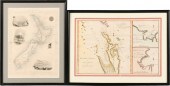
TWO MAPS OF NEW ZEALAND FRAME: 15...
From
marks4antiques.com
- The most updated price guide and makers' marks research online
As a member, you have access to a team of experts
and assistance is always available to you for free
An example from the millions of items in our Price Guide:
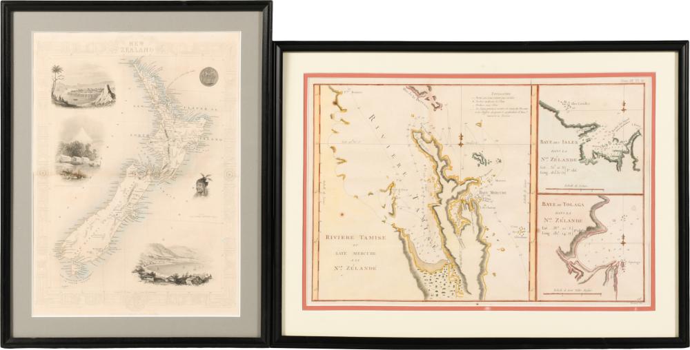
TWO MAPS OF NEW ZEALAND FRAME: 15 1/2 X 21 1/4 X 21 1/4 IN. (39.4 X 54 X 54 CM.), FRAME: 17 1/2 X 13 3/4 X 13 3/4 IN. (44.5 X 34.9 X 34.9 CM.)TWO MAPS OF...
This is an example from our
values4antiques price guide
We do not buy or sell any items
See more price guides
Check our other research services:
IDENTIFY WORLDWIDE MAKERS' MARKS & HALLMARKS
marks4ceramics:
Porcelain, Pottery, Chinaware, Figurines, Dolls, Vases...
marks4silver
:
Silver, Jewelry, Pewter, Silverplate, Copper & Bronze...
Explore other items from our
Antiques & Collectibles Price Guide
-
 COLLECTION OF NEW ZEALAND, AUSTRALIAN AN
[more like this]
COLLECTION OF NEW ZEALAND, AUSTRALIAN AN
[more like this]
-
 A Very Large Collection of Maps, 19th/e
[more like this]
A Very Large Collection of Maps, 19th/e
[more like this]
-
 [EXPLORATION -- AUSTRALIA & NEW ZEALAND]
[more like this]
[EXPLORATION -- AUSTRALIA & NEW ZEALAND]
[more like this]
-
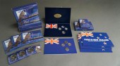
 COLLECTION OF NEW ZEALAND AND AUSTRALIAN
[more like this]
COLLECTION OF NEW ZEALAND AND AUSTRALIAN
[more like this]
-
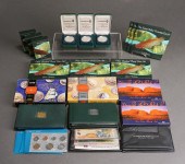
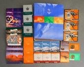
 COLLECTION OF NEW ZEALAND COINSCollectio
[more like this]
COLLECTION OF NEW ZEALAND COINSCollectio
[more like this]
-
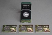 2007 NEW ZEALAND $5 FINE-SILVER FROSTED
[more like this]
2007 NEW ZEALAND $5 FINE-SILVER FROSTED
[more like this]
-
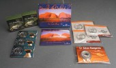
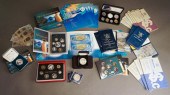
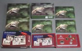 THREE 2007 NEW ZEALAND SIX-COIN PROOF SE
[more like this]
THREE 2007 NEW ZEALAND SIX-COIN PROOF SE
[more like this]
-
 MITCHELL. A NEW UNIVERSAL ATLAS CONTAINI
[more like this]
MITCHELL. A NEW UNIVERSAL ATLAS CONTAINI
[more like this]
-
 A LATE MEXICAN-AMERICAN WAR ERA MAP, "MA
[more like this]
A LATE MEXICAN-AMERICAN WAR ERA MAP, "MA
[more like this]
-
 HENRY MOUZON - MAP OF NORTH AND SOUTH CA
[more like this]
HENRY MOUZON - MAP OF NORTH AND SOUTH CA
[more like this]
-
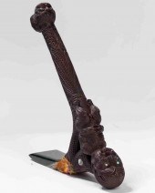 MAORI CARVED WOOD AND NEPHRITE TOKI POUT
[more like this]
MAORI CARVED WOOD AND NEPHRITE TOKI POUT
[more like this]
-
 TWO MAPS OF NEW ZEALAND FRAME: 15 1/2 X
[more like this]
TWO MAPS OF NEW ZEALAND FRAME: 15 1/2 X
[more like this]
-
 2 FRAMED 18TH C. FADEN MAPS - GREECE & D
[more like this]
2 FRAMED 18TH C. FADEN MAPS - GREECE & D
[more like this]
-
 DU HALDE, Jean-Baptiste, (French, 1674-1
[more like this]
DU HALDE, Jean-Baptiste, (French, 1674-1
[more like this]
-
 4 vols. (Pennsylvania Property Atlases
[more like this]
4 vols. (Pennsylvania Property Atlases
[more like this]
-
 1 vol. (Philadelphia Atlas.) Smedley, S
[more like this]
1 vol. (Philadelphia Atlas.) Smedley, S
[more like this]
-
 AN ANTIQUE MAP, "CARTE DES VARIATIONS DE
[more like this]
AN ANTIQUE MAP, "CARTE DES VARIATIONS DE
[more like this]
-
 A Large Collection of Maps from Around t
[more like this]
A Large Collection of Maps from Around t
[more like this]
-
 7 vols. Cartography: Brown, Lloyd A. Th
[more like this]
7 vols. Cartography: Brown, Lloyd A. Th
[more like this]
-
 LRG GRP: BOOKS ON AFRICA AND AFRICAN ART
[more like this]
LRG GRP: BOOKS ON AFRICA AND AFRICAN ART
[more like this]
-
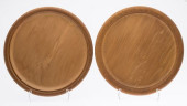 TWO NEW ZEALAND ANCIENT KAURI WOOD TRAYS
[more like this]
TWO NEW ZEALAND ANCIENT KAURI WOOD TRAYS
[more like this]
-
 7 vols. Cartography - American Subjects
[more like this]
7 vols. Cartography - American Subjects
[more like this]
-
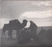
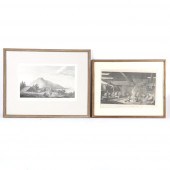 TWO INDIGENOUS TRIBAL SCENE ENGRAVINGS F
[more like this]
TWO INDIGENOUS TRIBAL SCENE ENGRAVINGS F
[more like this]
-
 COLLECTION OF AUSTRALIAN AND NEW ZEALAND
[more like this]
COLLECTION OF AUSTRALIAN AND NEW ZEALAND
[more like this]
-
 COLLECTION OF NEW ZEALAND COINSCollectio
[more like this]
COLLECTION OF NEW ZEALAND COINSCollectio
[more like this]
-
 ELEANOR PARKE CUSTIS (AMERICAN, 1897-198
[more like this]
ELEANOR PARKE CUSTIS (AMERICAN, 1897-198
[more like this]
-
 NEW ZEALAND MYSTIC CIRCLE PHOTOGRAPH.New
[more like this]
NEW ZEALAND MYSTIC CIRCLE PHOTOGRAPH.New
[more like this]
-
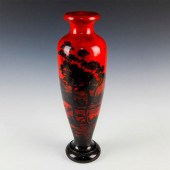 RARE WOODEN SOUTH SEAS VASE, SUNRISEDeep
[more like this]
RARE WOODEN SOUTH SEAS VASE, SUNRISEDeep
[more like this]
-
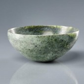 CARVED NEW ZEALAND JADE BOWLA finely car
[more like this]
CARVED NEW ZEALAND JADE BOWLA finely car
[more like this]
-
 8 TENNESSEE MILITARY & SURVEY MAPSAssort
[more like this]
8 TENNESSEE MILITARY & SURVEY MAPSAssort
[more like this]
-
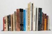
 5 CIVIL WAR RELATED BOOKS1st item: Hopki
[more like this]
5 CIVIL WAR RELATED BOOKS1st item: Hopki
[more like this]
-
 MAPS: JOHN SPEED (ENGLAND, 1552-1629), T
[more like this]
MAPS: JOHN SPEED (ENGLAND, 1552-1629), T
[more like this]
-
 1782 Thomas Kitchen atlas, A General Atl
[more like this]
1782 Thomas Kitchen atlas, A General Atl
[more like this]
-
 (5) TEXAS MAPS, 1850'S<br>(lot of 5
[more like this]
(5) TEXAS MAPS, 1850'S<br>(lot of 5
[more like this]
-
 A Large Collection of Maps of America,
[more like this]
A Large Collection of Maps of America,
[more like this]
-
 2 vols. (Philadelphia Property Atlases.
[more like this]
2 vols. (Philadelphia Property Atlases.
[more like this]
This list is limited to only a few results.
Many more items are available to our members in our
Price Guide!
Ideal research tools for Collectors, Personal Property Appraisers, Antiques & Collectibles
Dealers, Auction Houses, Museums, eBayers or
other online
sellers (Rubylane, Etsy etc) and curious minds interested in appraising & identifying collectibles

EASY. FAST. ACCURATE.
Research at its best

Our research tools include:


