Pricing Guides & Dictionary of Makers Marks for Antiques & Collectibles
Appraise and find values for
Two Overton British maps (Henry...
From
marks4antiques.com
- The most updated price guide and makers' marks research online
As a member, you have access to a team of experts
and assistance is always available to you for free
An example from the millions of items in our Price Guide:
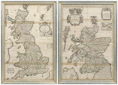
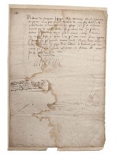
Two Overton British maps (Henry Overton, British, working 1707-1749): one Great Britain, probably 1708 (see attached information), 36-1/8 x 22-1/2 in....
This is an example from our
values4antiques price guide
We do not buy or sell any items
See more price guides
Check our other research services:
IDENTIFY WORLDWIDE MAKERS' MARKS & HALLMARKS
marks4ceramics:
Porcelain, Pottery, Chinaware, Figurines, Dolls, Vases...
marks4silver
:
Silver, Jewelry, Pewter, Silverplate, Copper & Bronze...
Explore other items from our
Antiques & Collectibles Price Guide
-
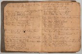
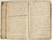
 ARCHIVE OF THE CLAYBROOK - OVERTON FAMIL
[more like this]
ARCHIVE OF THE CLAYBROOK - OVERTON FAMIL
[more like this]
-
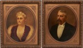
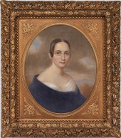 O/C PORTRAIT OF ANN COLEMAN OVERTON BRIN
[more like this]
O/C PORTRAIT OF ANN COLEMAN OVERTON BRIN
[more like this]
-
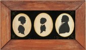 OVERTON FAMILY, CLAIBORNE CO. TN TRIPLE
[more like this]
OVERTON FAMILY, CLAIBORNE CO. TN TRIPLE
[more like this]
-
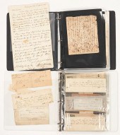
 VA BIRTH/SLAVE RECORD INC. JOHN OVERTONC
[more like this]
VA BIRTH/SLAVE RECORD INC. JOHN OVERTONC
[more like this]
-
 PORTRAITS OF COL. ROBERT BOGARDUS SNOWDE
[more like this]
PORTRAITS OF COL. ROBERT BOGARDUS SNOWDE
[more like this]
-
 1805 TN SUPREME COURT BOOK, JOHN OVERTON
[more like this]
1805 TN SUPREME COURT BOOK, JOHN OVERTON
[more like this]
-
 A Very Large Collection of Maps, 19th/e
[more like this]
A Very Large Collection of Maps, 19th/e
[more like this]
-
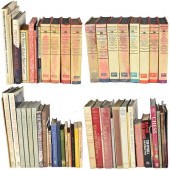 GRP: ASSORTED BOOKS ON EUROPEAN ART HIST
[more like this]
GRP: ASSORTED BOOKS ON EUROPEAN ART HIST
[more like this]
-
 2 FRAMED 18TH C. FADEN MAPS - GREECE & D
[more like this]
2 FRAMED 18TH C. FADEN MAPS - GREECE & D
[more like this]
-
 AN ANTIQUE MAP, "CARTE DES VARIATIONS DE
[more like this]
AN ANTIQUE MAP, "CARTE DES VARIATIONS DE
[more like this]
-
 HENRY MOUZON - MAP OF NORTH AND SOUTH CA
[more like this]
HENRY MOUZON - MAP OF NORTH AND SOUTH CA
[more like this]
-
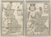 Two Overton British maps (Henry Overton,
[more like this]
Two Overton British maps (Henry Overton,
[more like this]
-
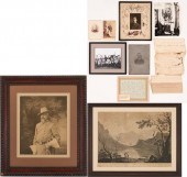 SNOWDEN FAMILY PHOTOS AND SLAVE DOCUMENT
[more like this]
SNOWDEN FAMILY PHOTOS AND SLAVE DOCUMENT
[more like this]
-
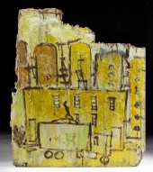 1990S PURVIS YOUNG PAINTING, TRUCK & BDG
[more like this]
1990S PURVIS YOUNG PAINTING, TRUCK & BDG
[more like this]
-
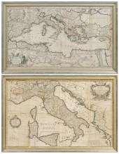 Two Overton maps, Italy, Mediterranean (
[more like this]
Two Overton maps, Italy, Mediterranean (
[more like this]
-
 4 EARLY AMERICAN MAPS: OVERTON, THIERRY,
[more like this]
4 EARLY AMERICAN MAPS: OVERTON, THIERRY,
[more like this]
-
 DU HALDE, Jean-Baptiste, (French, 1674-1
[more like this]
DU HALDE, Jean-Baptiste, (French, 1674-1
[more like this]
-
 4 vols. (Pennsylvania Property Atlases
[more like this]
4 vols. (Pennsylvania Property Atlases
[more like this]
-
 1 vol. (Philadelphia Atlas.) Smedley, S
[more like this]
1 vol. (Philadelphia Atlas.) Smedley, S
[more like this]
-
 MITCHELL. A NEW UNIVERSAL ATLAS CONTAINI
[more like this]
MITCHELL. A NEW UNIVERSAL ATLAS CONTAINI
[more like this]
-
 Catherine de Medici Queen of France ALS
[more like this]
Catherine de Medici Queen of France ALS
[more like this]
-
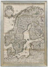 Overton map of Scandinavia (Henry Overto
[more like this]
Overton map of Scandinavia (Henry Overto
[more like this]
-
 +TWO HENRY BONAVENTURE MONNIER (FRENCH,
[more like this]
+TWO HENRY BONAVENTURE MONNIER (FRENCH,
[more like this]
-
 WILLIAM HENRY 1960 WATERCOLOR OF SAILBOA
[more like this]
WILLIAM HENRY 1960 WATERCOLOR OF SAILBOA
[more like this]
-
 A Large Collection of Maps of America,
[more like this]
A Large Collection of Maps of America,
[more like this]
-
 8 TENNESSEE MILITARY & SURVEY MAPSAssort
[more like this]
8 TENNESSEE MILITARY & SURVEY MAPSAssort
[more like this]
-
 5 CIVIL WAR RELATED BOOKS1st item: Hopki
[more like this]
5 CIVIL WAR RELATED BOOKS1st item: Hopki
[more like this]
-
 2 vols. (Philadelphia Property Atlases.
[more like this]
2 vols. (Philadelphia Property Atlases.
[more like this]
-
 7 vols. Cartography: Brown, Lloyd A. Th
[more like this]
7 vols. Cartography: Brown, Lloyd A. Th
[more like this]
-
 7 vols. Cartography - American Subjects
[more like this]
7 vols. Cartography - American Subjects
[more like this]
-
 1782 Thomas Kitchen atlas, A General Atl
[more like this]
1782 Thomas Kitchen atlas, A General Atl
[more like this]
-
 Military Maps Illustrating the Operation
[more like this]
Military Maps Illustrating the Operation
[more like this]
-
 THE LIFE OF GEORGE WASHINGTON, BY JOHN M
[more like this]
THE LIFE OF GEORGE WASHINGTON, BY JOHN M
[more like this]
-
 MAPS: JOHN SPEED (ENGLAND, 1552-1629), T
[more like this]
MAPS: JOHN SPEED (ENGLAND, 1552-1629), T
[more like this]
-
 6 MISSISSIPPI AND TENNESSEE RIVER MAPSSi
[more like this]
6 MISSISSIPPI AND TENNESSEE RIVER MAPSSi
[more like this]
-
 5 CIVIL WAR MAPSLot of five Civil War ma
[more like this]
5 CIVIL WAR MAPSLot of five Civil War ma
[more like this]
This list is limited to only a few results.
Many more items are available to our members in our
Price Guide!
Ideal research tools for Collectors, Personal Property Appraisers, Antiques & Collectibles
Dealers, Auction Houses, Museums, eBayers or
other online
sellers (Rubylane, Etsy etc) and curious minds interested in appraising & identifying collectibles

EASY. FAST. ACCURATE.
Research at its best

Our research tools include:


