Pricing Guides & Dictionary of Makers Marks for Antiques & Collectibles
Appraise and find values for
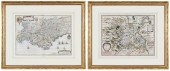
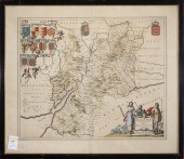
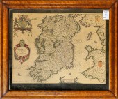
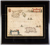
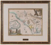
John Blaeu (1596-1673)/Oxonium...
From
marks4antiques.com
- The most updated price guide and makers' marks research online
As a member, you have access to a team of experts
and assistance is always available to you for free
An example from the millions of items in our Price Guide:
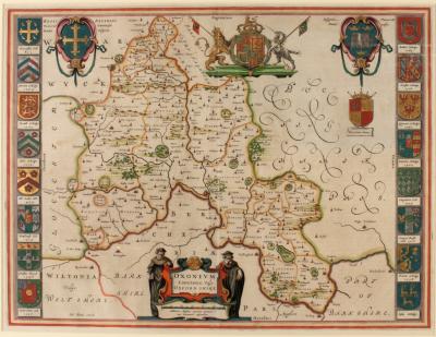
John Blaeu (1596-1673)/Oxonium Comitatus, Vulgo Oxfordshire/text on reverse/coloured engraved map, circa 1645 39cm x 51cm...
This is an example from our
values4antiques price guide
We do not buy or sell any items
See more price guides
Check our other research services:
IDENTIFY WORLDWIDE MAKERS' MARKS & HALLMARKS
marks4ceramics:
Porcelain, Pottery, Chinaware, Figurines, Dolls, Vases...
marks4silver
:
Silver, Jewelry, Pewter, Silverplate, Copper & Bronze...
Explore other items from our
Antiques & Collectibles Price Guide
-
 JOHANNES BLAEU (1596-1673) MAPJohannes B
[more like this]
JOHANNES BLAEU (1596-1673) MAPJohannes B
[more like this]
-
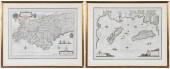
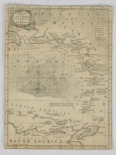
 JAN BLAEU, DUTCH 1596-1673, MAP OF PARAG
[more like this]
JAN BLAEU, DUTCH 1596-1673, MAP OF PARAG
[more like this]
-
 JOAN BLAEU (DUTCH, 1596 - 1673), "TABULA
[more like this]
JOAN BLAEU (DUTCH, 1596 - 1673), "TABULA
[more like this]
-
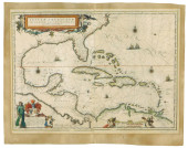 MAP: BLAEU, JOAN (1596-1673), "INSULAE A
[more like this]
MAP: BLAEU, JOAN (1596-1673), "INSULAE A
[more like this]
-
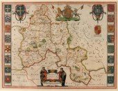 John Blaeu (1596-1673)/Oxonium Comitatus
[more like this]
John Blaeu (1596-1673)/Oxonium Comitatus
[more like this]
-
 BLAEU - TWO FRAMED FRENCH REGIONAL MAPSW
[more like this]
BLAEU - TWO FRAMED FRENCH REGIONAL MAPSW
[more like this]
-
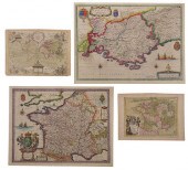
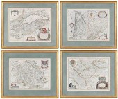 BLAEU - FOUR FRENCH REGIONAL MAPSWillem
[more like this]
BLAEU - FOUR FRENCH REGIONAL MAPSWillem
[more like this]
-
 HONDIUS AND BLAEU - TWO FRENCH REGIONAL
[more like this]
HONDIUS AND BLAEU - TWO FRENCH REGIONAL
[more like this]
-
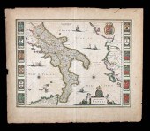 17TH C. DUTCH MAP - REGNO DI NAPOLI - BY
[more like this]
17TH C. DUTCH MAP - REGNO DI NAPOLI - BY
[more like this]
-
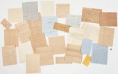
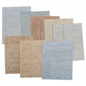 Letters Between the Sturges Brothers Mos
[more like this]
Letters Between the Sturges Brothers Mos
[more like this]
-
 JOAN BLAEU (NETHERLANDS, 1596-1673) MAP
[more like this]
JOAN BLAEU (NETHERLANDS, 1596-1673) MAP
[more like this]
-
 WILLEM AND JOAN BLAEU MAPWillem and Joan
[more like this]
WILLEM AND JOAN BLAEU MAPWillem and Joan
[more like this]
-
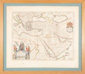
 BLAEU - TURCICUM IMPERIUM, MAPCornelis (
[more like this]
BLAEU - TURCICUM IMPERIUM, MAPCornelis (
[more like this]
-
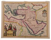
 PRINT, JOAN BLAEU Joan Blaeu (Dutch, 159
[more like this]
PRINT, JOAN BLAEU Joan Blaeu (Dutch, 159
[more like this]
-
 MAP, JOHANNES BLAEU Johannes Blaeu (Dutc
[more like this]
MAP, JOHANNES BLAEU Johannes Blaeu (Dutc
[more like this]
-
 MAP, JOHANNES BLAEU Johannes Blaeu (Dutc
[more like this]
MAP, JOHANNES BLAEU Johannes Blaeu (Dutc
[more like this]
-
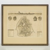
 JOAN BLAEU, DUTCH 1599-1673, HEREFORDIA
[more like this]
JOAN BLAEU, DUTCH 1599-1673, HEREFORDIA
[more like this]
-
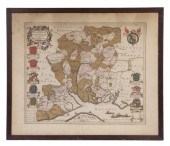
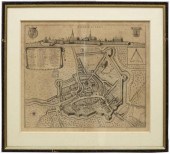
 JOAN BLAEU, DUTCH 1599-1673, GELRE, HAND
[more like this]
JOAN BLAEU, DUTCH 1599-1673, GELRE, HAND
[more like this]
-
 Archive of Documents Associated with the
[more like this]
Archive of Documents Associated with the
[more like this]
-
 John Speed (British 1552-1629)/Rutlandsh
[more like this]
John Speed (British 1552-1629)/Rutlandsh
[more like this]
-
 CIVIL WAR ARCHIVE, INCL. GEN. BATE ON DE
[more like this]
CIVIL WAR ARCHIVE, INCL. GEN. BATE ON DE
[more like this]
-
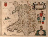 Jansson Blaeu (1596-1673), Wallia Princi
[more like this]
Jansson Blaeu (1596-1673), Wallia Princi
[more like this]
-
 Three Flemish Topographical City Maps: F
[more like this]
Three Flemish Topographical City Maps: F
[more like this]
-
 (2) FRAMED ANTIQUE ETCHINGS MAPS OF ARME
[more like this]
(2) FRAMED ANTIQUE ETCHINGS MAPS OF ARME
[more like this]
-
 SARNIA INSULA VULGO GARNSEY ET INSULA CE
[more like this]
SARNIA INSULA VULGO GARNSEY ET INSULA CE
[more like this]
-
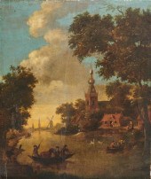 KLAES NICOLAES MOLENAER, (CA. 1630-1676)
[more like this]
KLAES NICOLAES MOLENAER, (CA. 1630-1676)
[more like this]
-
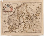 Maps of Scandanavia by Joan Blaeu Anders
[more like this]
Maps of Scandanavia by Joan Blaeu Anders
[more like this]
-
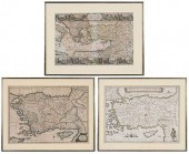 BLAEU, MORTIER, VISSCHER - THREE MAPS OF
[more like this]
BLAEU, MORTIER, VISSCHER - THREE MAPS OF
[more like this]
-
 BLAEU, LE ROUGE - THREE MAPS OF FRANCE,
[more like this]
BLAEU, LE ROUGE - THREE MAPS OF FRANCE,
[more like this]
-
 GRP: 5 MAPS OF BRAZIL BLAEU BELLIN KITCH
[more like this]
GRP: 5 MAPS OF BRAZIL BLAEU BELLIN KITCH
[more like this]
-
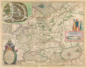 MAP: BLAEU, WILLEM & JOAN. "TABULA RUSSI
[more like this]
MAP: BLAEU, WILLEM & JOAN. "TABULA RUSSI
[more like this]
-
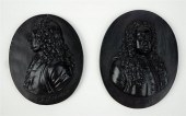 TWO WEDGWOOD BLACK BASALT PORTRAIT MEDAL
[more like this]
TWO WEDGWOOD BLACK BASALT PORTRAIT MEDAL
[more like this]
-
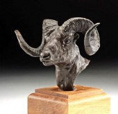 JOHN SCOTT BRONZE - "DREAM RAM" (1995)Jo
[more like this]
JOHN SCOTT BRONZE - "DREAM RAM" (1995)Jo
[more like this]
-
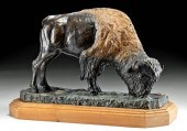 JOHN SCOTT BRONZE - "GREAT SPIRITS CATTL
[more like this]
JOHN SCOTT BRONZE - "GREAT SPIRITS CATTL
[more like this]
-
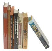 (7) BOOKS, JOHN GRAVES (TEXAS) SOME FIRS
[more like this]
(7) BOOKS, JOHN GRAVES (TEXAS) SOME FIRS
[more like this]
-
 JOHN OGILBY - "LORDS PROPRIETORS" MAP OF
[more like this]
JOHN OGILBY - "LORDS PROPRIETORS" MAP OF
[more like this]
This list is limited to only a few results.
Many more items are available to our members in our
Price Guide!
Ideal research tools for Collectors, Personal Property Appraisers, Antiques & Collectibles
Dealers, Auction Houses, Museums, eBayers or
other online
sellers (Rubylane, Etsy etc) and curious minds interested in appraising & identifying collectibles

EASY. FAST. ACCURATE.
Research at its best

Our research tools include:


