Pricing Guides & Dictionary of Makers Marks for Antiques & Collectibles
Appraise and find values for
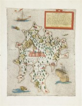
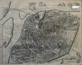
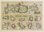
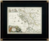
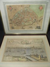
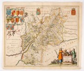
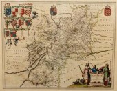
SARNIA INSULA VULGO GARNSEY ET...
From
marks4antiques.com
- The most updated price guide and makers' marks research online
As a member, you have access to a team of experts
and assistance is always available to you for free
An example from the millions of items in our Price Guide:
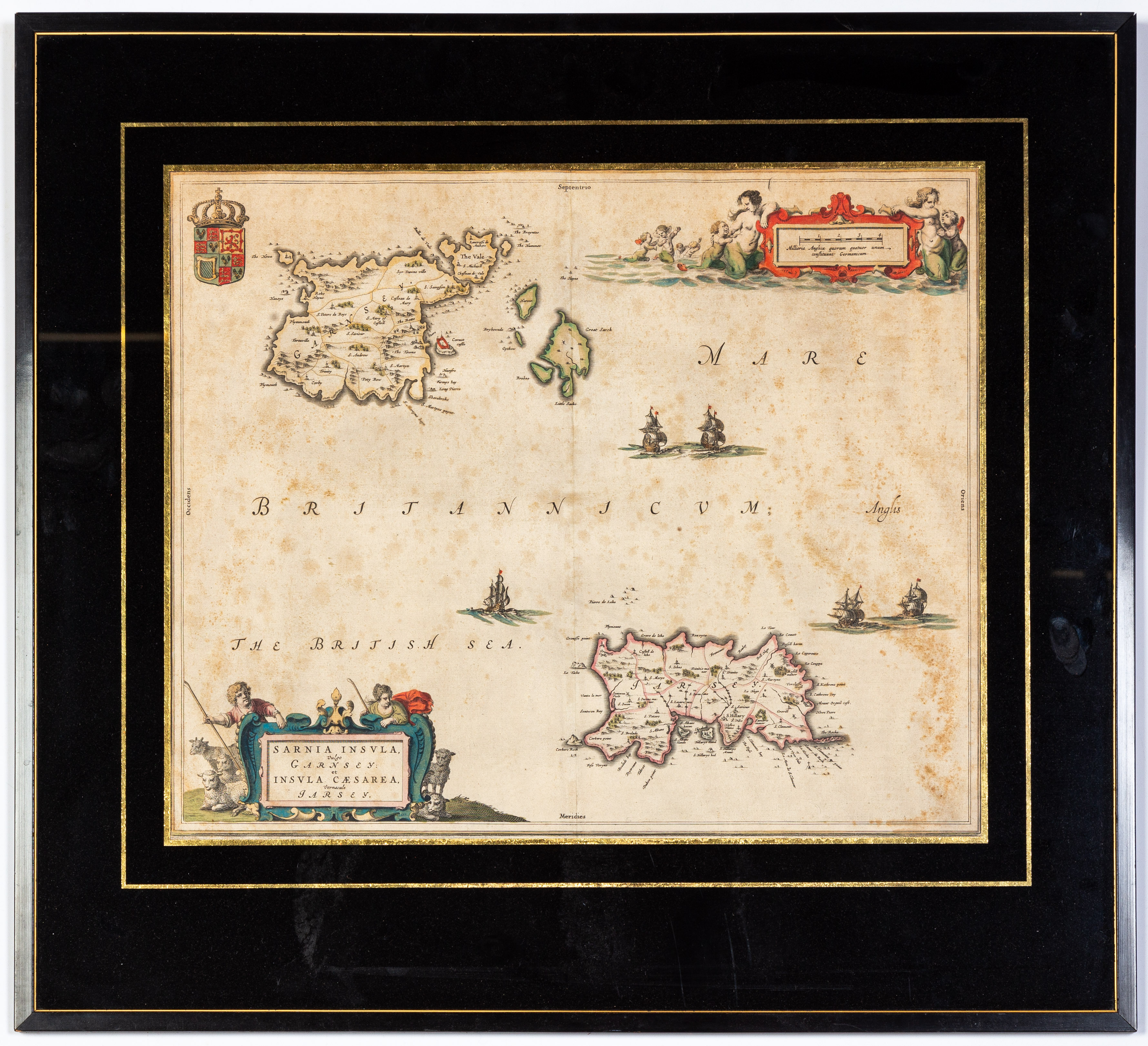
SARNIA INSULA VULGO GARNSEY ET INSULA CESAREA VERNACULE JARSEY, MAP Hand-colored on velum. Author: Blaeu, Joan, 1596-1673. Date: 1665...
This is an example from our
values4antiques price guide
We do not buy or sell any items
See more price guides
Check our other research services:
IDENTIFY WORLDWIDE MAKERS' MARKS & HALLMARKS
marks4ceramics:
Porcelain, Pottery, Chinaware, Figurines, Dolls, Vases...
marks4silver
:
Silver, Jewelry, Pewter, Silverplate, Copper & Bronze...
Explore other items from our
Antiques & Collectibles Price Guide
-
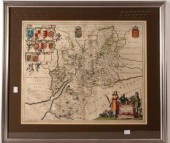
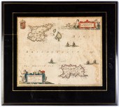 SARNIA INSULA VULGO GARNSEY ET INSULA CE
[more like this]
SARNIA INSULA VULGO GARNSEY ET INSULA CE
[more like this]
-
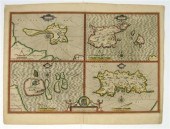
 ORTELIUS AND HONDIUS - TWO MAPS, FLORIDA
[more like this]
ORTELIUS AND HONDIUS - TWO MAPS, FLORIDA
[more like this]
-
 NINE PIECES OF ONTARIO HOTEL WARELot of
[more like this]
NINE PIECES OF ONTARIO HOTEL WARELot of
[more like this]
-
 * (MAP) BERTELLI FERRANDO A pair of engr
[more like this]
* (MAP) BERTELLI FERRANDO A pair of engr
[more like this]
-
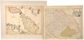
 AN ANTIQUE MALTA MAP, "INSULA MALTA ACCU
[more like this]
AN ANTIQUE MALTA MAP, "INSULA MALTA ACCU
[more like this]
-
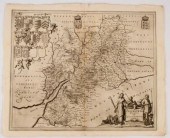
 BLAEU, JOHANNES. INSULA GADITANA VULGO I
[more like this]
BLAEU, JOHANNES. INSULA GADITANA VULGO I
[more like this]
-
 JOAN BLAEU, CARTOGRAPHER, HIBERNIA REGNU
[more like this]
JOAN BLAEU, CARTOGRAPHER, HIBERNIA REGNU
[more like this]
-
 PIERRE MORTIER, CARTOGRAPHER, AVENIO VUL
[more like this]
PIERRE MORTIER, CARTOGRAPHER, AVENIO VUL
[more like this]
-
 1 piece. Hand-Colored Engraved Map. Spe
[more like this]
1 piece. Hand-Colored Engraved Map. Spe
[more like this]
-
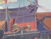
 BROOKLYN DOCKS PAINTING 1915 POSSIBLY EL
[more like this]
BROOKLYN DOCKS PAINTING 1915 POSSIBLY EL
[more like this]
-
 BROOKLYN DOCKS PAINTING 1915 POSSIBLY EL
[more like this]
BROOKLYN DOCKS PAINTING 1915 POSSIBLY EL
[more like this]
-
 (MAP) BLAEU WILLEM Rugia Insula ac Ducat
[more like this]
(MAP) BLAEU WILLEM Rugia Insula ac Ducat
[more like this]
-
 *(MAP) ORTELIUS ABRAHAM Candia Insula -
[more like this]
*(MAP) ORTELIUS ABRAHAM Candia Insula -
[more like this]
-
![[MAPS]. A group of maps, compr](/images/maps-a-group-of-maps--34adfc-medium.jpg) [MAPS]. A group of maps, comprising:
De
[more like this]
[MAPS]. A group of maps, comprising:
De
[more like this]
-
 MAP, JOHANNES BLAEU Johannes Blaeu (Dutc
[more like this]
MAP, JOHANNES BLAEU Johannes Blaeu (Dutc
[more like this]
-
 Braun & Hogenberg, LYMPURCH, Limburgum O
[more like this]
Braun & Hogenberg, LYMPURCH, Limburgum O
[more like this]
-
 1 piece. Hand-Colored Engraved Map. Ble
[more like this]
1 piece. Hand-Colored Engraved Map. Ble
[more like this]
-
 17th century map of Epirus, Albania, &qu
[more like this]
17th century map of Epirus, Albania, &qu
[more like this]
-
 Two Antique Maps The lot consisting of:
[more like this]
Two Antique Maps The lot consisting of:
[more like this]
-
 FERRARI Giovanni Battista (Italian 1584-
[more like this]
FERRARI Giovanni Battista (Italian 1584-
[more like this]
-
 (MAP) A group of five matted maps compri
[more like this]
(MAP) A group of five matted maps compri
[more like this]
-
 Two early Dutch hand colored map engravi
[more like this]
Two early Dutch hand colored map engravi
[more like this]
-
 JOAN BLAEU (NETHERLANDS, 1596-1673) MAP
[more like this]
JOAN BLAEU (NETHERLANDS, 1596-1673) MAP
[more like this]
-
 17TH CENTURY BLAEU MAP OF RUSSIA Russiae
[more like this]
17TH CENTURY BLAEU MAP OF RUSSIA Russiae
[more like this]
-
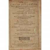 DAVIES, JOHN
ANTIQUAE LINGUAE BRITANNICA
[more like this]
DAVIES, JOHN
ANTIQUAE LINGUAE BRITANNICA
[more like this]
-
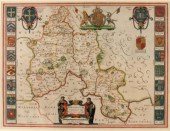
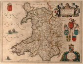 Jansson Blaeu (1596-1673), Wallia Princi
[more like this]
Jansson Blaeu (1596-1673), Wallia Princi
[more like this]
-
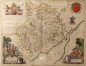
 Johannes Blaeu/Devonia vulgo Devon-Shire
[more like this]
Johannes Blaeu/Devonia vulgo Devon-Shire
[more like this]
-
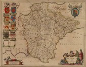
 Johannes Blaeu/Monumethensis Comitatus V
[more like this]
Johannes Blaeu/Monumethensis Comitatus V
[more like this]
-
 Jan Jansson (1588-1664)/Oxonium Comitatu
[more like this]
Jan Jansson (1588-1664)/Oxonium Comitatu
[more like this]
-
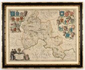
 Johannes Blaeu (1650-1712)/Glocestria Du
[more like this]
Johannes Blaeu (1650-1712)/Glocestria Du
[more like this]
-
 Johannes Blaeu (1650-1712)/Glocestria Du
[more like this]
Johannes Blaeu (1650-1712)/Glocestria Du
[more like this]
-
 John Blaeu (1596-1673)/Oxonium Comitatus
[more like this]
John Blaeu (1596-1673)/Oxonium Comitatus
[more like this]
-
 Johannes Blaeu (1650-1712)/Glocestria Du
[more like this]
Johannes Blaeu (1650-1712)/Glocestria Du
[more like this]
-
 Johannes Blaeu (1650-1712)/Glocestria Du
[more like this]
Johannes Blaeu (1650-1712)/Glocestria Du
[more like this]
-
 J. DE HONDT, COLOR MAP OF STRAITS OF MAG
[more like this]
J. DE HONDT, COLOR MAP OF STRAITS OF MAG
[more like this]
-
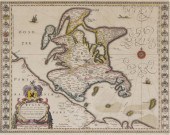
 GROUP OF 5 HAND COLORED MAPS OF THE AMER
[more like this]
GROUP OF 5 HAND COLORED MAPS OF THE AMER
[more like this]
This list is limited to only a few results.
Many more items are available to our members in our
Price Guide!
Ideal research tools for Collectors, Personal Property Appraisers, Antiques & Collectibles
Dealers, Auction Houses, Museums, eBayers or
other online
sellers (Rubylane, Etsy etc) and curious minds interested in appraising & identifying collectibles

EASY. FAST. ACCURATE.
Research at its best

Our research tools include:


