Pricing Guides & Dictionary of Makers Marks for Antiques & Collectibles
Appraise and find values for
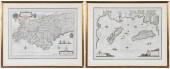
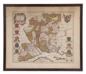
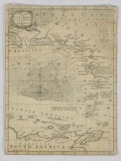
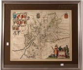
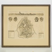
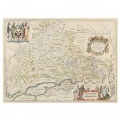
Johannes Blaeu/Devonia vulgo...
From
marks4antiques.com
- The most updated price guide and makers' marks research online
As a member, you have access to a team of experts
and assistance is always available to you for free
An example from the millions of items in our Price Guide:
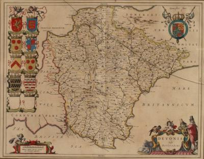
Johannes Blaeu/Devonia vulgo Devon-Shire/Amsterdam, circa 1645/engraved map with contemporary hand colouring, decorative cartouche and mileage scale,...
This is an example from our
values4antiques price guide
We do not buy or sell any items
See more price guides
Check our other research services:
IDENTIFY WORLDWIDE MAKERS' MARKS & HALLMARKS
marks4ceramics:
Porcelain, Pottery, Chinaware, Figurines, Dolls, Vases...
marks4silver
:
Silver, Jewelry, Pewter, Silverplate, Copper & Bronze...
Explore other items from our
Antiques & Collectibles Price Guide
-
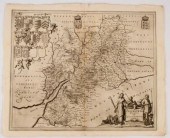
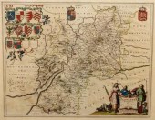
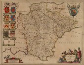 Johannes Blaeu/Devonia vulgo Devon-Shire
[more like this]
Johannes Blaeu/Devonia vulgo Devon-Shire
[more like this]
-
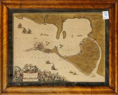
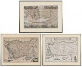
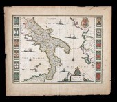 17TH C. DUTCH MAP - REGNO DI NAPOLI - BY
[more like this]
17TH C. DUTCH MAP - REGNO DI NAPOLI - BY
[more like this]
-
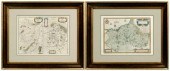
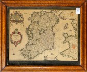
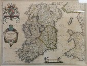 JOAN BLAEU, CARTOGRAPHER, HIBERNIA REGNU
[more like this]
JOAN BLAEU, CARTOGRAPHER, HIBERNIA REGNU
[more like this]
-
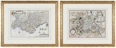
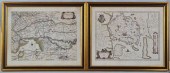
 BLAEU - TWO FRAMED FRENCH REGIONAL MAPSW
[more like this]
BLAEU - TWO FRAMED FRENCH REGIONAL MAPSW
[more like this]
-
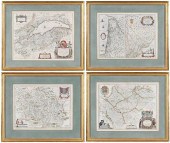
 Three 17th century European maps: two Fr
[more like this]
Three 17th century European maps: two Fr
[more like this]
-
 MAP, JOHANNES BLAEU Johannes Blaeu (Dutc
[more like this]
MAP, JOHANNES BLAEU Johannes Blaeu (Dutc
[more like this]
-
 MAP, JOHANNES BLAEU Johannes Blaeu (Dutc
[more like this]
MAP, JOHANNES BLAEU Johannes Blaeu (Dutc
[more like this]
-
 JOAN BLAEU (NETHERLANDS, 1596-1673) MAP
[more like this]
JOAN BLAEU (NETHERLANDS, 1596-1673) MAP
[more like this]
-
 BLAEU - TWO MAPS OF SOUTH AMERICAWillem
[more like this]
BLAEU - TWO MAPS OF SOUTH AMERICAWillem
[more like this]
-
 PRINT, JOAN BLAEU Joan Blaeu (Dutch, 159
[more like this]
PRINT, JOAN BLAEU Joan Blaeu (Dutch, 159
[more like this]
-
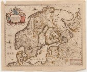 Maps of Scandanavia by Joan Blaeu Anders
[more like this]
Maps of Scandanavia by Joan Blaeu Anders
[more like this]
-
 BLAEU, MORTIER, VISSCHER - THREE MAPS OF
[more like this]
BLAEU, MORTIER, VISSCHER - THREE MAPS OF
[more like this]
-
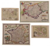
 BLAEU - FOUR FRENCH REGIONAL MAPSWillem
[more like this]
BLAEU - FOUR FRENCH REGIONAL MAPSWillem
[more like this]
-
 HONDIUS AND BLAEU - TWO FRENCH REGIONAL
[more like this]
HONDIUS AND BLAEU - TWO FRENCH REGIONAL
[more like this]
-
 BLAEU, LE ROUGE - THREE MAPS OF FRANCE,
[more like this]
BLAEU, LE ROUGE - THREE MAPS OF FRANCE,
[more like this]
-
 GRP: 5 MAPS OF BRAZIL BLAEU BELLIN KITCH
[more like this]
GRP: 5 MAPS OF BRAZIL BLAEU BELLIN KITCH
[more like this]
-
 MAP: BLAEU, WILLEM & JOAN. "TABULA RUSSI
[more like this]
MAP: BLAEU, WILLEM & JOAN. "TABULA RUSSI
[more like this]
-
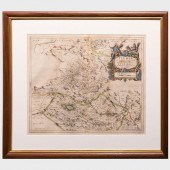
 Johannes Blaeu/Monumethensis Comitatus V
[more like this]
Johannes Blaeu/Monumethensis Comitatus V
[more like this]
-
 Johannes Blaeu (1650-1712)/Glocestria Du
[more like this]
Johannes Blaeu (1650-1712)/Glocestria Du
[more like this]
-
 Johannes Blaeu (1650-1712)/Glocestria Du
[more like this]
Johannes Blaeu (1650-1712)/Glocestria Du
[more like this]
-
 Johannes Blaeu (1650-1712)/Glocestria Du
[more like this]
Johannes Blaeu (1650-1712)/Glocestria Du
[more like this]
-
 Johannes Blaeu (1650-1712)/Glocestria Du
[more like this]
Johannes Blaeu (1650-1712)/Glocestria Du
[more like this]
-
 BLAEU, JOHANNES. INSULA GADITANA VULGO I
[more like this]
BLAEU, JOHANNES. INSULA GADITANA VULGO I
[more like this]
-
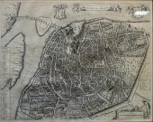
 Three Flemish Topographical City Maps: F
[more like this]
Three Flemish Topographical City Maps: F
[more like this]
-
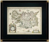 17th century map of Iceland, "Tabul
[more like this]
17th century map of Iceland, "Tabul
[more like this]
-
 JOHANNES BLAEU (1596-1673) MAPJohannes B
[more like this]
JOHANNES BLAEU (1596-1673) MAPJohannes B
[more like this]
-
 DOMINIO FIORENTINO & JOHANNES BLAEU 1646
[more like this]
DOMINIO FIORENTINO & JOHANNES BLAEU 1646
[more like this]
-
 PIERRE MORTIER, CARTOGRAPHER, AVENIO VUL
[more like this]
PIERRE MORTIER, CARTOGRAPHER, AVENIO VUL
[more like this]
-
 17TH CENTURY BLAEU MAP OF RUSSIA Russiae
[more like this]
17TH CENTURY BLAEU MAP OF RUSSIA Russiae
[more like this]
-
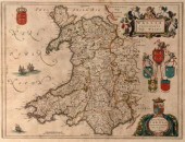 Jansson Blaeu (1596-1673), Wallia Princi
[more like this]
Jansson Blaeu (1596-1673), Wallia Princi
[more like this]
-
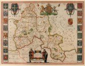 John Blaeu (1596-1673)/Oxonium Comitatus
[more like this]
John Blaeu (1596-1673)/Oxonium Comitatus
[more like this]
-
 TWO FRAMED MAPS, ZUD HOLLAND & FIONIAinc
[more like this]
TWO FRAMED MAPS, ZUD HOLLAND & FIONIAinc
[more like this]
-
 JOAN BLAEU (1599-1673): TEVIOTIA VULGO T
[more like this]
JOAN BLAEU (1599-1673): TEVIOTIA VULGO T
[more like this]
-
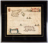 SARNIA INSULA VULGO GARNSEY ET INSULA CE
[more like this]
SARNIA INSULA VULGO GARNSEY ET INSULA CE
[more like this]
-
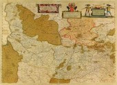 MAP: "PICARDIA VERA ET INFERIOR" BY JOHA
[more like this]
MAP: "PICARDIA VERA ET INFERIOR" BY JOHA
[more like this]
-
 21 BAROQUE ENGRAVINGS OF ARMOR (CUSTODIS
[more like this]
21 BAROQUE ENGRAVINGS OF ARMOR (CUSTODIS
[more like this]
This list is limited to only a few results.
Many more items are available to our members in our
Price Guide!
Ideal research tools for Collectors, Personal Property Appraisers, Antiques & Collectibles
Dealers, Auction Houses, Museums, eBayers or
other online
sellers (Rubylane, Etsy etc) and curious minds interested in appraising & identifying collectibles

EASY. FAST. ACCURATE.
Research at its best

Our research tools include:


