Pricing Guides & Dictionary of Makers Marks for Antiques & Collectibles
Appraise and find values for
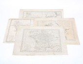
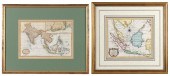
Two West Indies Maps framed one...
From
marks4antiques.com
- The most updated price guide and makers' marks research online
As a member, you have access to a team of experts
and assistance is always available to you for free
An example from the millions of items in our Price Guide:
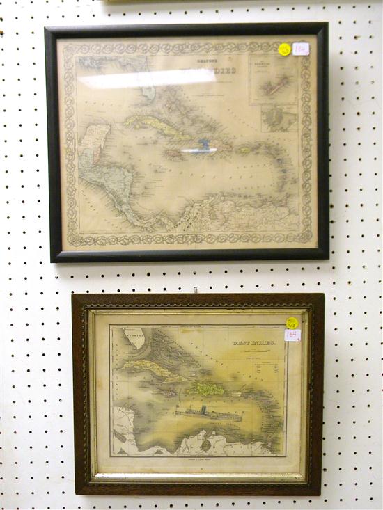
Two West Indies Maps framed one published by ''A. Finley Philadelphia'' handcolored original graphite vignette by previous owner slight toning and...
This is an example from our
values4antiques price guide
We do not buy or sell any items
See more price guides
Check our other research services:
IDENTIFY WORLDWIDE MAKERS' MARKS & HALLMARKS
marks4ceramics:
Porcelain, Pottery, Chinaware, Figurines, Dolls, Vases...
marks4silver
:
Silver, Jewelry, Pewter, Silverplate, Copper & Bronze...
Explore other items from our
Antiques & Collectibles Price Guide
-
 A Very Large Collection of Maps, 19th/e
[more like this]
A Very Large Collection of Maps, 19th/e
[more like this]
-
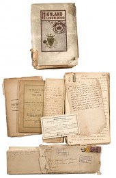
 Joseph Hubert Diss Debar Sketchbook Jose
[more like this]
Joseph Hubert Diss Debar Sketchbook Jose
[more like this]
-
 World cruise line ephemera to include 19
[more like this]
World cruise line ephemera to include 19
[more like this]
-
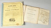
 ATLAS TO EDWARDS WEST INDIES HISTORY OF
[more like this]
ATLAS TO EDWARDS WEST INDIES HISTORY OF
[more like this]
-
 WILLIAM WINTERBOTHAM. AN HISTORICAL, GEO
[more like this]
WILLIAM WINTERBOTHAM. AN HISTORICAL, GEO
[more like this]
-
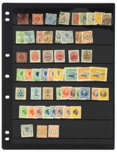 DANISH WEST INDIES STAMP GROUP 1855-1917
[more like this]
DANISH WEST INDIES STAMP GROUP 1855-1917
[more like this]
-
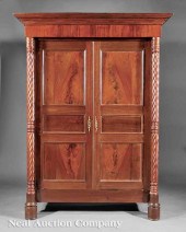
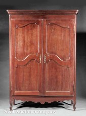 A West Indies Carved Courbaril Armoire i
[more like this]
A West Indies Carved Courbaril Armoire i
[more like this]
-
 4 vols. (Pennsylvania Property Atlases
[more like this]
4 vols. (Pennsylvania Property Atlases
[more like this]
-
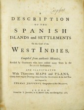 1 vol. Jefferys, Thomas. A Description
[more like this]
1 vol. Jefferys, Thomas. A Description
[more like this]
-
 (5) TEXAS MAPS, 1850'S<br>(lot of 5
[more like this]
(5) TEXAS MAPS, 1850'S<br>(lot of 5
[more like this]
-
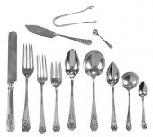 WHITING MADAM JUMEL STERLING FLATWARE, 3
[more like this]
WHITING MADAM JUMEL STERLING FLATWARE, 3
[more like this]
-
 A Large Collection of Maps from Around t
[more like this]
A Large Collection of Maps from Around t
[more like this]
-
 DU HALDE, Jean-Baptiste, (French, 1674-1
[more like this]
DU HALDE, Jean-Baptiste, (French, 1674-1
[more like this]
-
 4 TN & KY MAPS, 3 FRAMED1st item: "Tenne
[more like this]
4 TN & KY MAPS, 3 FRAMED1st item: "Tenne
[more like this]
-
 2 FRAMED 18TH C. FADEN MAPS - GREECE & D
[more like this]
2 FRAMED 18TH C. FADEN MAPS - GREECE & D
[more like this]
-
 AN ANTIQUE MAP, "CARTE DES VARIATIONS DE
[more like this]
AN ANTIQUE MAP, "CARTE DES VARIATIONS DE
[more like this]
-
 ''Atlas Geography of the Heavens'' & ''B
[more like this]
''Atlas Geography of the Heavens'' & ''B
[more like this]
-
 1 vol. (Philadelphia Atlas.) Smedley, S
[more like this]
1 vol. (Philadelphia Atlas.) Smedley, S
[more like this]
-
 MITCHELL. A NEW UNIVERSAL ATLAS CONTAINI
[more like this]
MITCHELL. A NEW UNIVERSAL ATLAS CONTAINI
[more like this]
-
 HENRY MOUZON - MAP OF NORTH AND SOUTH CA
[more like this]
HENRY MOUZON - MAP OF NORTH AND SOUTH CA
[more like this]
-
 Ben E. Green Politician & Colonel Unpubl
[more like this]
Ben E. Green Politician & Colonel Unpubl
[more like this]
-
 Four 18th century maps dated 1782 & 1783
[more like this]
Four 18th century maps dated 1782 & 1783
[more like this]
-
 Seven 18th & 19th century maps related t
[more like this]
Seven 18th & 19th century maps related t
[more like this]
-
 GUTHRIE, A NEW SYSTEM OF MODERN GEOGRAPH
[more like this]
GUTHRIE, A NEW SYSTEM OF MODERN GEOGRAPH
[more like this]
-
 5 KENTUCKY AND TENNESSEE MAPS1st item: "
[more like this]
5 KENTUCKY AND TENNESSEE MAPS1st item: "
[more like this]
-
 A Rare French West Indies Carved Mahogan
[more like this]
A Rare French West Indies Carved Mahogan
[more like this]
-
 5 CIVIL WAR MAPSLot of five Civil War ma
[more like this]
5 CIVIL WAR MAPSLot of five Civil War ma
[more like this]
-
 A LATE MEXICAN-AMERICAN WAR ERA MAP, "MA
[more like this]
A LATE MEXICAN-AMERICAN WAR ERA MAP, "MA
[more like this]
-
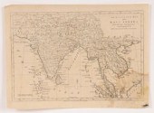
 TWO HAND-COLORED MAPS OF THE EAST INDIES
[more like this]
TWO HAND-COLORED MAPS OF THE EAST INDIES
[more like this]
-
 MAPS: JOHN SPEED (ENGLAND, 1552-1629), T
[more like this]
MAPS: JOHN SPEED (ENGLAND, 1552-1629), T
[more like this]
-
 A Large Collection of Maps of America,
[more like this]
A Large Collection of Maps of America,
[more like this]
-
 5 CIVIL WAR RELATED BOOKS1st item: Hopki
[more like this]
5 CIVIL WAR RELATED BOOKS1st item: Hopki
[more like this]
-
 6 MISSISSIPPI AND TENNESSEE RIVER MAPSSi
[more like this]
6 MISSISSIPPI AND TENNESSEE RIVER MAPSSi
[more like this]
-
 8 TENNESSEE MILITARY & SURVEY MAPSAssort
[more like this]
8 TENNESSEE MILITARY & SURVEY MAPSAssort
[more like this]
-
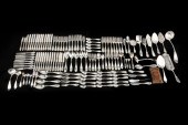 135PCS ASSEMBLED AMERICAN SILVER "OLIVE"
[more like this]
135PCS ASSEMBLED AMERICAN SILVER "OLIVE"
[more like this]
-
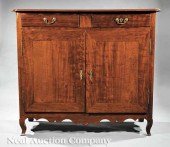 A West Indies Carved Mahogany Buffet 19t
[more like this]
A West Indies Carved Mahogany Buffet 19t
[more like this]
This list is limited to only a few results.
Many more items are available to our members in our
Price Guide!
Ideal research tools for Collectors, Personal Property Appraisers, Antiques & Collectibles
Dealers, Auction Houses, Museums, eBayers or
other online
sellers (Rubylane, Etsy etc) and curious minds interested in appraising & identifying collectibles

EASY. FAST. ACCURATE.
Research at its best

Our research tools include:


